Property Record
1998 State Road 44, New Smyrna Beach, FL 32168
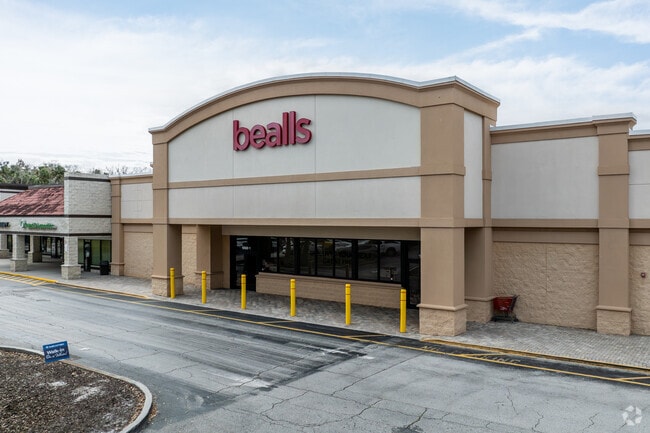
This Property Is For Sale
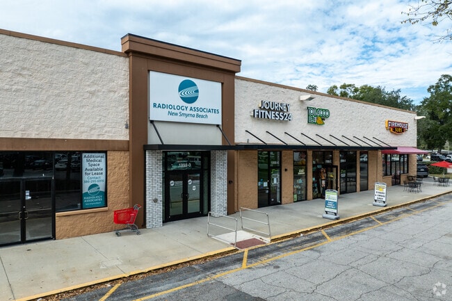
Current Lease Availabilities
NEARBY LISTINGS FOR SALE OR LEASE
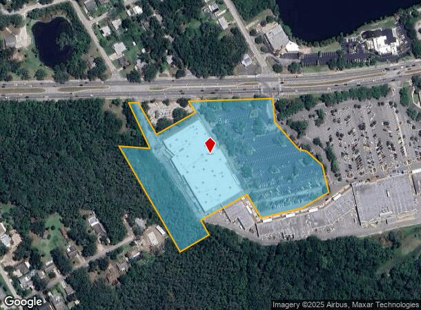
Property Detail
1998 State Road 44
Deltona-Daytona Beach-Ormond Beach, FL
Turnbull Creek
7343-06-00-0720
IRREG PARCEL IN LOTS 56 71 72 & 73 LYING S OF ST RD 40 TURNBULL CREEK NAPIER & HULL GRANT EXC 100% SUBSURFACE RIGHTS PER OR 2909 PG 0364 PER OR 5039 PG 2928 PER OR 6342 PG 2253 PER OR 6748 PG 3484
Regionalshoppingcenterormallwithanchorstore
Volusia
AE
Florida
12127C0540J
56
2025
10.15 AC
2026
South Beach Cities
082902
Deltona/Daytona Beach
91,759 SF
DEMOGRAPHICS near 1998 State Road 44
1 Mile
3 Mile
5 Mile
2024 Total Population
3,844
25,244
57,097
2029 Population
4,283
28,278
64,551
Pop Growth 2024-2029
+ 11.42%
+ 12.02%
+ 13.05%
Average Age
45
48
50
2024 Total Households
1,677
11,433
26,638
HH Growth 2024-2029
+ 11.57%
+ 12.24%
+ 13.45%
Median Household Inc
$57,652
$57,304
$60,303
Avg Household Size
2.10
2.10
2.10
2024 Avg HH Vehicles
2.00
2.00
2.00
Median Home Value
$234,523
$264,298
$279,085
Median Year Built
1990
1985
1985
Nearby Places
Map Layers
Map Styles
 Street
 Aerial
- Restaurants
- Banks
- Shops
- Fitness
- Groceries
PUBLIC TRANSPORTATION
AIRPORT
Daytona Beach International
DRIVE
WALK
Distance
Daytona Beach International
25 min
17.1 mi
Orlando Sanford International
DRIVE
WALK
Distance
Orlando Sanford International
45 min
30.9 mi
Nearby Properties
Address
Land Use
TOTAL SIZE
Lot Size
Zoning
Address
Land Use
TOTAL SIZE
Lot Size
Zoning
360,394 SF
65.63 AC
01R4
Address
Land Use
TOTAL SIZE
Lot Size
Zoning
317,281 SF
21.97 AC
RR
Address
Land Use
TOTAL SIZE
Lot Size
Zoning
177,619 SF
6.91 AC
10R2
Address
Land Use
TOTAL SIZE
Lot Size
Zoning
260,126 SF
2 AC
10R3
Address
Land Use
TOTAL SIZE
Lot Size
Zoning
108,577 SF
20 AC
10R2
Address
Land Use
TOTAL SIZE
Lot Size
Zoning
209,027 SF
29.13 AC
10R2A
Address
Land Use
TOTAL SIZE
Lot Size
Zoning
150,044 SF
19.80 AC
R4
Address
Land Use
TOTAL SIZE
Lot Size
Zoning
162,622 SF
20.33 AC
B62
Address
Land Use
TOTAL SIZE
Lot Size
Zoning
23,142 SF
7.98 AC
R
Address
Land Use
TOTAL SIZE
Lot Size
Zoning
91,509 SF
4.06 AC
I1
Address
Land Use
TOTAL SIZE
Lot Size
Zoning
7,345 SF
0.43 AC
MH1
Address
Land Use
TOTAL SIZE
Lot Size
Zoning
87,154 SF
1.08 AC
10R5
Address
Land Use
TOTAL SIZE
Lot Size
Zoning
110,926 SF
7.02 AC
Address
Land Use
TOTAL SIZE
Lot Size
Zoning
51,507 SF
10.61 AC
B3C
Address
Land Use
TOTAL SIZE
Lot Size
Zoning
43,852 SF
8.81 AC
RR
Address
Land Use
TOTAL SIZE
Lot Size
Zoning
111,686 SF
10.03 AC
10B5
Address
Land Use
TOTAL SIZE
Lot Size
Zoning
47,434 SF
11.41 AC
10R3
Address
Land Use
TOTAL SIZE
Lot Size
Zoning
74,609 SF
12.67 AC
10B3
Address
Land Use
TOTAL SIZE
Lot Size
Zoning
119,537 SF
12.06 AC
PUD
Address
Land Use
TOTAL SIZE
Lot Size
Zoning
55,587 SF
85.39 AC
R4
Address
Land Use
TOTAL SIZE
Lot Size
Zoning
65.13 AC
Address
Land Use
TOTAL SIZE
Lot Size
Zoning
115,028 SF
16.51 AC
R4
Address
Land Use
TOTAL SIZE
Lot Size
Zoning
229,941 SF
0.57 AC
10R2A
Address
Land Use
TOTAL SIZE
Lot Size
Zoning
44,239 SF
2.31 AC
10B1
Address
Land Use
TOTAL SIZE
Lot Size
Zoning
98,105 SF
8.03 AC
07B3
Address
Land Use
TOTAL SIZE
Lot Size
Zoning
108,762 SF
11.60 AC
RA
Address
Land Use
TOTAL SIZE
Lot Size
Zoning
32,198 SF
1.88 AC
A3C2
Address
Land Use
TOTAL SIZE
Lot Size
Zoning
70,088 SF
0.30 AC
10R5
Address
Land Use
TOTAL SIZE
Lot Size
Zoning
41,310 SF
1.57 AC
10B1
The World's #1 Commercial Real Estate Marketplace
Connect with us
© 2026 CoStar Group
The information above has been obtained from sources believed reliable. While we do not doubt its accuracy we have not verified it and make no guarantee, warranty or representation about it. It is your responsibility to independently confirm its accuracy and completeness. Any projections, opinions, assumptions, or estimates used are for example only and do not represent the current or future performance of the property. The value of this transaction to you depends on tax and other factors which should be evaluated by your tax, financial, and legal advisors. You and your advisors should conduct a careful, independent investigation of the property to determine to your satisfaction the suitability of the property for your needs.