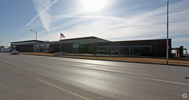
Property Record
1999 Iron St, Kansas City, MO 64116


NEARBY LISTINGS FOR SALE OR LEASE
Property Detail
1999 Iron St
17-610-00-18-002.00
BEG SE COR INTERS IRON ST & ARMOUR RD, NE651.8, SLY182.1, E18.1, S501, W345, S50, W124.88, SELY397.23, W TO EL IRON ST, N ALNG ROW TO POB
Taxexempt
Clay
ARE
Missouri
29095C0139G
10.97 AC
2024
City of North KC
2025
Kansas City
022100
Kansas City, MO-KS
DEMOGRAPHICS near 1999 Iron St
1 Mile
3 Mile
5 Mile
2024 Total Population
5,163
56,240
199,943
2029 Population
5,441
58,226
205,591
Pop Growth 2024-2029
+ 5.38%
+ 3.53%
+ 2.82%
Average Age
43
37
37
2024 Total Households
2,968
26,717
82,868
HH Growth 2024-2029
+ 5.36%
+ 3.64%
+ 3.07%
Median Household Inc
$41,415
$51,893
$51,152
Avg Household Size
1.70
2.00
2.30
2024 Avg HH Vehicles
1.00
1.00
2.00
Median Home Value
$194,702
$176,486
$157,051
Median Year Built
1977
1966
1962
Nearby Places
Map Layers
Map Styles
 Street
 Aerial
- Restaurants
- Banks
- Shops
- Fitness
- Groceries
PUBLIC TRANSPORTATION
COMMUTER RAIL
DRIVE
WALK
Distance
12 min
5.5 mi
AIRPORT
Kansas City International
DRIVE
WALK
Distance
Kansas City International
26 min
16.9 mi
Nearby Properties
Address
Land Use
TOTAL SIZE
Lot Size
Zoning
Address
Land Use
TOTAL SIZE
Lot Size
Zoning
Address
Land Use
TOTAL SIZE
Lot Size
Zoning
8.29 AC
Address
Land Use
TOTAL SIZE
Lot Size
Zoning
846,143 SF
51.25 AC
Address
Land Use
TOTAL SIZE
Lot Size
Zoning
63,748 SF
3.92 AC
Address
Land Use
TOTAL SIZE
Lot Size
Zoning
215,920 SF
38.28 AC
Address
Land Use
TOTAL SIZE
Lot Size
Zoning
115,627 SF
1.56 AC
Address
Land Use
TOTAL SIZE
Lot Size
Zoning
261,570 SF
1.82 AC
Address
Land Use
TOTAL SIZE
Lot Size
Zoning
Address
Land Use
TOTAL SIZE
Lot Size
Zoning
87,294 SF
0.70 AC
Address
Land Use
TOTAL SIZE
Lot Size
Zoning
4,012,734 SF
574.30 AC
KM3
Address
Land Use
TOTAL SIZE
Lot Size
Zoning
384,543 SF
5.40 AC
Address
Land Use
TOTAL SIZE
Lot Size
Zoning
342,989 SF
1.84 AC
Address
Land Use
TOTAL SIZE
Lot Size
Zoning
Address
Land Use
TOTAL SIZE
Lot Size
Zoning
296,548 SF
5.09 AC
Address
Land Use
TOTAL SIZE
Lot Size
Zoning
276,233 SF
Address
Land Use
TOTAL SIZE
Lot Size
Zoning
116,228 SF
0.79 AC
Address
Land Use
TOTAL SIZE
Lot Size
Zoning
5,044 SF
100.08 AC
Address
Land Use
TOTAL SIZE
Lot Size
Zoning
243,839 SF
47.82 AC
Address
Land Use
TOTAL SIZE
Lot Size
Zoning
Address
Land Use
TOTAL SIZE
Lot Size
Zoning
229,473 SF
2.38 AC
Address
Land Use
TOTAL SIZE
Lot Size
Zoning
187,460 SF
1.46 AC
Address
Land Use
TOTAL SIZE
Lot Size
Zoning
71,420 SF
0.26 AC
Address
Land Use
TOTAL SIZE
Lot Size
Zoning
Address
Land Use
TOTAL SIZE
Lot Size
Zoning
295,300 SF
1.50 AC
Address
Land Use
TOTAL SIZE
Lot Size
Zoning
Address
Land Use
TOTAL SIZE
Lot Size
Zoning
46.94 AC
Address
Land Use
TOTAL SIZE
Lot Size
Zoning
73,500 SF
2.25 AC
Address
Land Use
TOTAL SIZE
Lot Size
Zoning
15.16 AC
Address
Land Use
TOTAL SIZE
Lot Size
Zoning
125,911 SF
0.75 AC
The World's #1 Commercial Real Estate Marketplace
Connect with us
© 2026 CoStar Group
The information above has been obtained from sources believed reliable. While we do not doubt its accuracy we have not verified it and make no guarantee, warranty or representation about it. It is your responsibility to independently confirm its accuracy and completeness. Any projections, opinions, assumptions, or estimates used are for example only and do not represent the current or future performance of the property. The value of this transaction to you depends on tax and other factors which should be evaluated by your tax, financial, and legal advisors. You and your advisors should conduct a careful, independent investigation of the property to determine to your satisfaction the suitability of the property for your needs.