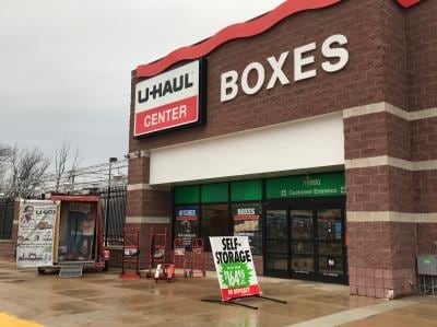
Property Record
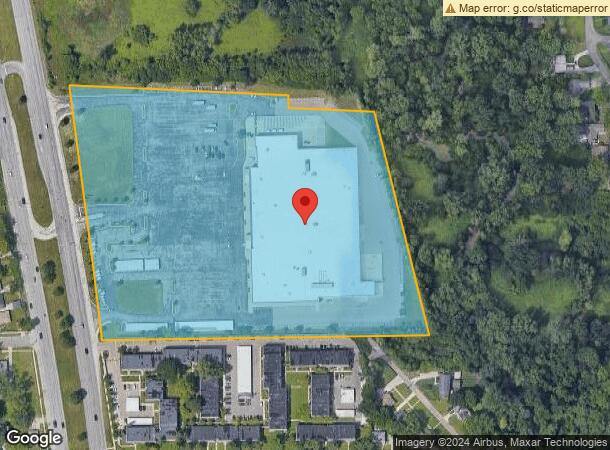
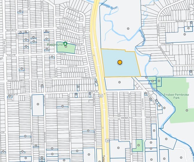
19990 Telegraph Rd, Detroit, MI 48219
NEARBY LISTINGS FOR SALE OR LEASE
Property Detail
19990 Telegraph Rd
Detroit-Warren-Dearborn, MI
Thomas Hitchmans
22-01-903-70-02L
S W EIGHT MILE PT OF NW 1/4 SEC 4 AND NE 1/4 SEC 5 T 1 S R 10 E ALSO PT OF LOTS 87,88 AND 89 THOMAS HITCHMANS SUB L30 P50 PLATS W C R ALL DESC AS BEG AT W 1/4 COR SD SEC 4 TH N 87D 59M 56S W ALG E-W 1/4 LINE SD SEC 5 41.87 FT TO E LINE TELEGRAPH RD 2
Supermarket
Wayne
A
Michigan
26163C0067E
87-88
2025
11.66 AC
2025
Detroit W of Woodward
541700
Detroit
143,941 SF
DEMOGRAPHICS near 19990 Telegraph Rd
1 Mile
3 Mile
5 Mile
2024 Total Population
13,731
101,506
285,052
2029 Population
13,313
99,152
278,411
Pop Growth 2024-2029
(3.04%)
(2.32%)
(2.33%)
Average Age
40
40
41
2024 Total Households
6,136
41,944
118,822
HH Growth 2024-2029
(3.24%)
(2.39%)
(2.34%)
Median Household Inc
$38,641
$48,678
$53,812
Avg Household Size
2.20
2.30
2.30
2024 Avg HH Vehicles
1.00
2.00
2.00
Median Home Value
$88,625
$115,358
$148,169
Median Year Built
1956
1955
1957
Nearby Places
Map Layers
Map Styles
 Street
 Aerial
- Restaurants
- Banks
- Shops
- Fitness
- Groceries
PUBLIC TRANSPORTATION
AIRPORT
Detroit Metro Wayne County
DRIVE
WALK
Distance
Detroit Metro Wayne County
37 min
20.3 mi
Windsor International
DRIVE
WALK
Distance
Windsor International
46 min
28.0 mi
Freight Ports
Port of Toledo
DRIVE
WALK
Distance
Port of Toledo
89 min
72.2 mi
Nearby Properties
Address
Land Use
TOTAL SIZE
Lot Size
Zoning
Address
Land Use
TOTAL SIZE
Lot Size
Zoning
383,602 SF
36.60 AC
I-1
Address
Land Use
TOTAL SIZE
Lot Size
Zoning
301,269 SF
25.47 AC
OS
Address
Land Use
TOTAL SIZE
Lot Size
Zoning
210 SF
20.52 AC
R-2
Address
Land Use
TOTAL SIZE
Lot Size
Zoning
397,200 SF
14.07 AC
RMU
Address
Land Use
TOTAL SIZE
Lot Size
Zoning
209,000 SF
11.21 AC
ERO
Address
Land Use
TOTAL SIZE
Lot Size
Zoning
174 SF
14.17 AC
RM
Address
Land Use
TOTAL SIZE
Lot Size
Zoning
204 SF
11.31 AC
RM
Address
Land Use
TOTAL SIZE
Lot Size
Zoning
202,736 SF
20 AC
PD
Address
Land Use
TOTAL SIZE
Lot Size
Zoning
97,082 SF
67.47 AC
TV-R
Address
Land Use
TOTAL SIZE
Lot Size
Zoning
Address
Land Use
TOTAL SIZE
Lot Size
Zoning
143,700 SF
3.27 AC
PD
Address
Land Use
TOTAL SIZE
Lot Size
Zoning
307,002 SF
14.61 AC
RC
Address
Land Use
TOTAL SIZE
Lot Size
Zoning
158,092 SF
11.75 AC
B-3
Address
Land Use
TOTAL SIZE
Lot Size
Zoning
129 SF
15.16 AC
RM
Address
Land Use
TOTAL SIZE
Lot Size
Zoning
230,048 SF
11.06 AC
RC
Address
Land Use
TOTAL SIZE
Lot Size
Zoning
152 SF
7.32 AC
RM
Address
Land Use
TOTAL SIZE
Lot Size
Zoning
83,514 SF
5.66 AC
OS
Address
Land Use
TOTAL SIZE
Lot Size
Zoning
131,781 SF
8.74 AC
RM
Address
Land Use
TOTAL SIZE
Lot Size
Zoning
120 SF
8.41 AC
RM
Address
Land Use
TOTAL SIZE
Lot Size
Zoning
88,024 SF
12.87 AC
RC
Address
Land Use
TOTAL SIZE
Lot Size
Zoning
16.05 AC
I-1
Address
Land Use
TOTAL SIZE
Lot Size
Zoning
257,372 SF
3.40 AC
RMU
Address
Land Use
TOTAL SIZE
Lot Size
Zoning
115,270 SF
7.07 AC
AI
Address
Land Use
TOTAL SIZE
Lot Size
Zoning
104,567 SF
2.14 AC
PD
Address
Land Use
TOTAL SIZE
Lot Size
Zoning
96 SF
5.46 AC
RM
Address
Land Use
TOTAL SIZE
Lot Size
Zoning
60,508 SF
12.76 AC
R-2
Address
Land Use
TOTAL SIZE
Lot Size
Zoning
104 SF
8.93 AC
RM
Address
Land Use
TOTAL SIZE
Lot Size
Zoning
90,314 SF
8.41 AC
B-2
Address
Land Use
TOTAL SIZE
Lot Size
Zoning
18.17 AC
I-L
The World's #1 Commercial Real Estate Marketplace
Connect with us
© 2025 CoStar Group
The information above has been obtained from sources believed reliable. While we do not doubt its accuracy we have not verified it and make no guarantee, warranty or representation about it. It is your responsibility to independently confirm its accuracy and completeness. Any projections, opinions, assumptions, or estimates used are for example only and do not represent the current or future performance of the property. The value of this transaction to you depends on tax and other factors which should be evaluated by your tax, financial, and legal advisors. You and your advisors should conduct a careful, independent investigation of the property to determine to your satisfaction the suitability of the property for your needs.