Property Record
1B Commons Dr, Londonderry, NH 03053
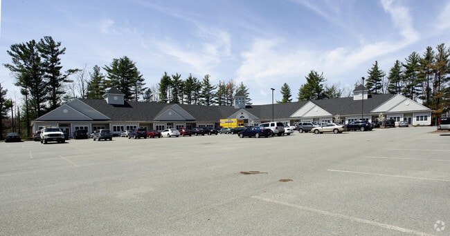
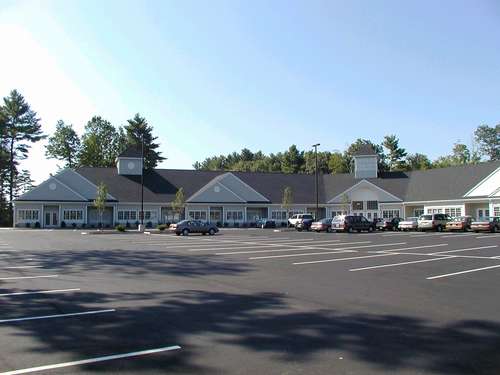
Property Detail
1B Commons Dr
LOND-000010-000000-000001C-000009B
Rockingham
Officecondo
New Hampshire
C-III
1c-15
B and X Area of moderate flood hazard, usually the area between the limits of the 100-year and 500-year floods.
0.02 AC
2025
Rockingham
2025
Boston
003701
Boston-Cambridge-Newton, MA-NH
978 SF
NEARBY LISTINGS FOR SALE OR LEASE
DEMOGRAPHICS near 1B Commons Dr
1 mile
3 mile
5 mile
2025 Total Population
3,217
33,490
63,325
2030 Population
3,313
33,801
63,919
Pop Growth 2025-2030
+ 2.98%
+ 0.93%
+ 0.94%
Average Age
44
42
42
2025 Total Households
1,336
13,317
23,854
HH Growth 2025-2030
+ 2.92%
+ 0.80%
+ 0.82%
Median Household Inc
$100,942
$98,695
$119,415
Avg Household Size
2.30
2.50
2.60
2025 Avg HH Vehicles
2.00
2.00
2.00
Median Home Value
$418,338
$438,619
$484,373
Median Year Built
1984
1980
1982
Nearby Places
Map Layers
Map Styles
 Street
 Aerial
Transit
 Traffic
 Biking
Places
Listings with unknown addresses are not visible on the map
- Restaurants
- Banks
- Shops
- Fitness
- Groceries
PUBLIC TRANSPORTATION
AIRPORT
Manchester Boston Regional
Drive
Walk
Distance
Manchester Boston Regional
22 min
9.0 mi
Freight Ports
Port of Boston
Drive
Walk
Distance
Port of Boston
69 min
46.2 mi
SALE & LEASE HISTORY
LISTING DATE
SALE/LEASE

Oct 27, 2017
For Lease
Oct 27, 2017
For Sale
The World's #1 Commercial Real Estate Marketplace
Connect with us
© 2026 CoStar Group
The information above has been obtained from sources believed reliable. While we do not doubt its accuracy we have not verified it and make no guarantee, warranty or representation about it. It is your responsibility to independently confirm its accuracy and completeness. Any projections, opinions, assumptions, or estimates used are for example only and do not represent the current or future performance of the property. The value of this transaction to you depends on tax and other factors which should be evaluated by your tax, financial, and legal advisors. You and your advisors should conduct a careful, independent investigation of the property to determine to your satisfaction the suitability of the property for your needs.