Property Record
1E Avenue, Somerton, AZ 85350


Save to a Folder
{{folder.Name}}
{{folder.ListingIds.length}} Properties
{{folder.ListingIds.length}} Property
Create a New Folder
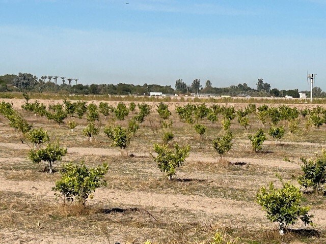
Property Detail
1E Avenue
212-09-003
SECTION: 09 TOWNSHIP: 10S RANGE: 23W SE4 EXC RD R/W & EXC A CANAL R/W
Orchard
YUMA
AG
Arizona
C and X Area of minimal flood hazard, usually depicted on FIRMs as above the 500-year flood level.
150.47 AC
2025
Yuma & El Centro
2026
Other Market Areas
011501
Yuma, AZ
NEARBY LISTINGS FOR SALE OR LEASE
-
-
No Photo
-
View all Somerton listings for sale on LoopNet.com
DEMOGRAPHICS near 1E Avenue
1 mile
3 mile
5 mile
2025 Total Population
790
4,286
10,317
2030 Population
826
4,496
10,862
Pop Growth 2025-2030
+ 4.56%
+ 4.90%
+ 5.28%
Average Age
38
38
38
2025 Total Households
122
943
2,617
HH Growth 2025-2030
+ 4.10%
+ 5.09%
+ 6.11%
Median Household Inc
$84,134
$74,999
$82,006
Avg Household Size
3.50
3.30
3.30
2025 Avg HH Vehicles
3.00
3.00
3.00
Median Home Value
$274,999
$252,571
$285,498
Median Year Built
1994
1991
1995
Nearby Places
Map Layers
Map Styles
 Street
 Aerial
Layers
 Traffic
 Biking
Places
Listings with unknown addresses are not visible on the map
- Restaurants
- Banks
- Shops
- Fitness
- Groceries
PUBLIC TRANSPORTATION
AIRPORT
Yuma International
Drive
Walk
Distance
Yuma International
22 min
9.0 mi
Freight Ports
Port of San Diego
Drive
Walk
Distance
Port of San Diego
215 min
184.4 mi
SALE & LEASE HISTORY
LISTING DATE
SALE/LEASE

Nov 03, 2022
For Sale
Nearby Properties
Address
Land Use
TOTAL SIZE
Lot Size
Zoning
Address
Land Use
TOTAL SIZE
Lot Size
Zoning
56,100 SF
9.46 AC
AG-10
Address
Land Use
TOTAL SIZE
Lot Size
Zoning
37,000 SF
19.88 AC
RA-10
Address
Land Use
TOTAL SIZE
Lot Size
Zoning
13,669 SF
2.08 AC
SR-2
Address
Land Use
TOTAL SIZE
Lot Size
Zoning
10,420 SF
2.28 AC
C-2
Address
Land Use
TOTAL SIZE
Lot Size
Zoning
48,238 SF
5.90 AC
RA-10
Address
Land Use
TOTAL SIZE
Lot Size
Zoning
66,545 SF
14.85 AC
RA-10
Address
Land Use
TOTAL SIZE
Lot Size
Zoning
9,243 SF
4.75 AC
HI
Address
Land Use
TOTAL SIZE
Lot Size
Zoning
37,528 SF
37.43 AC
RA-10
Address
Land Use
TOTAL SIZE
Lot Size
Zoning
6,000 SF
1.88 AC
C-2
Address
Land Use
TOTAL SIZE
Lot Size
Zoning
52,723 SF
16.62 AC
HI
Address
Land Use
TOTAL SIZE
Lot Size
Zoning
14,330 SF
5.07 AC
AG-5
Address
Land Use
TOTAL SIZE
Lot Size
Zoning
20,115 SF
120 AC
HI
Address
Land Use
TOTAL SIZE
Lot Size
Zoning
15,169 SF
6.43 AC
RA-10
Address
Land Use
TOTAL SIZE
Lot Size
Zoning
5,914 SF
4.15 AC
RA-10
Address
Land Use
TOTAL SIZE
Lot Size
Zoning
5,000 SF
1.40 AC
C-1
Address
Land Use
TOTAL SIZE
Lot Size
Zoning
10,472 SF
13.50 AC
RA-10
Address
Land Use
TOTAL SIZE
Lot Size
Zoning
4,555 SF
2 AC
SSB-2
Address
Land Use
TOTAL SIZE
Lot Size
Zoning
12,800 SF
5.26 AC
HI
Address
Land Use
TOTAL SIZE
Lot Size
Zoning
720 SF
638.79 AC
RA-10
Address
Land Use
TOTAL SIZE
Lot Size
Zoning
70 AC
LI
Address
Land Use
TOTAL SIZE
Lot Size
Zoning
4,861 SF
5.08 AC
RA-10
Address
Land Use
TOTAL SIZE
Lot Size
Zoning
4,954 SF
2.07 AC
SSB-2
Address
Land Use
TOTAL SIZE
Lot Size
Zoning
8,700 SF
146.52 AC
AG
Address
Land Use
TOTAL SIZE
Lot Size
Zoning
4,543 SF
2.85 AC
RA-10
Address
Land Use
TOTAL SIZE
Lot Size
Zoning
4,198 SF
9.50 AC
SSB-2
Address
Land Use
TOTAL SIZE
Lot Size
Zoning
4,926 SF
1.71 AC
SR-2
Address
Land Use
TOTAL SIZE
Lot Size
Zoning
4,693 SF
2.34 AC
SR-2
Address
Land Use
TOTAL SIZE
Lot Size
Zoning
5,000 SF
1.14 AC
C-1
Address
Land Use
TOTAL SIZE
Lot Size
Zoning
1,194 SF
160 AC
AG
The World's #1 Commercial Real Estate Marketplace
Connect with us
© 2026 CoStar Group
The information above has been obtained from sources believed reliable. While we do not doubt its accuracy we have not verified it and make no guarantee, warranty or representation about it. It is your responsibility to independently confirm its accuracy and completeness. Any projections, opinions, assumptions, or estimates used are for example only and do not represent the current or future performance of the property. The value of this transaction to you depends on tax and other factors which should be evaluated by your tax, financial, and legal advisors. You and your advisors should conduct a careful, independent investigation of the property to determine to your satisfaction the suitability of the property for your needs.