Property Record
1St St, Somers, WI 53171
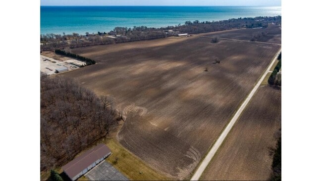


Property Detail
1St St
Kenosha, WI
1412-H-1 PT NW 1/4 SEC 5 T 2 R 23 COM 280.5 FT S OF NW COR 1/4 TH S 654.5 FT TH E 713.54 FT +- TH N 449.67 FT TH W 515.3 FT +
83-4-223-052-0530
KENOSHA
Agriculturalland
Wisconsin
B and X Area of moderate flood hazard, usually the area between the limits of the 100-year and 500-year floods.
530
2025
8.29 AC
2025
Kenosha East
000601
Chicago
NEARBY LISTINGS FOR SALE OR LEASE
DEMOGRAPHICS near 1St St
1 mile
3 mile
5 mile
2025 Total Population
1,380
32,947
104,593
2030 Population
1,379
33,007
105,056
Pop Growth 2025-2030
(0.07%)
+ 0.18%
+ 0.44%
Average Age
44
41
40
2025 Total Households
579
13,779
42,664
HH Growth 2025-2030
(0.17%)
+ 0.12%
+ 0.46%
Median Household Inc
$104,687
$69,255
$63,957
Avg Household Size
2.40
2.30
2.30
2025 Avg HH Vehicles
2.00
2.00
2.00
Median Home Value
$346,354
$213,183
$196,451
Median Year Built
1977
1969
1964
Nearby Places
Map Layers
Map Styles
 Street
 Aerial
Layers
 Traffic
 Biking
Places
Listings with unknown addresses are not visible on the map
- Restaurants
- Banks
- Shops
- Fitness
- Groceries
PUBLIC TRANSPORTATION
COMMUTER RAIL
Kenosha Station (Union Pacific North Line - Northeast Illinois Regional Commuter Railroad (Metra))
Drive
Walk
Distance
Kenosha Station (Union Pacific North Line - Northeast Illinois Regional Commuter Railroad (Metra))
13 min
6.5 mi
Sturtevant Amtrak Station (Hiawatha Service - Amtrak)
Drive
Walk
Distance
Sturtevant Amtrak Station (Hiawatha Service - Amtrak)
18 min
8.8 mi
AIRPORT
General Mitchell International
Drive
Walk
Distance
General Mitchell International
39 min
28.0 mi
Freight Ports
Port Milwaukee
Drive
Walk
Distance
Port Milwaukee
43 min
31.9 mi
SALE & LEASE HISTORY
LISTING DATE
SALE/LEASE

Nov 13, 2024
For Sale
Feb 10, 2020
For Sale
Feb 01, 2018
For Sale
Nearby Properties
Address
Land Use
TOTAL SIZE
Lot Size
Zoning
Address
Land Use
TOTAL SIZE
Lot Size
Zoning
22.34 AC
Address
Land Use
TOTAL SIZE
Lot Size
Zoning
21,072 SF
24.33 AC
RM2
Address
Land Use
TOTAL SIZE
Lot Size
Zoning
26,500 SF
17.79 AC
RM2
Address
Land Use
TOTAL SIZE
Lot Size
Zoning
33.40 AC
I2
Address
Land Use
TOTAL SIZE
Lot Size
Zoning
98.81 AC
Address
Land Use
TOTAL SIZE
Lot Size
Zoning
15,084 SF
34.20 AC
Address
Land Use
TOTAL SIZE
Lot Size
Zoning
9,860 SF
14.55 AC
RM2
Address
Land Use
TOTAL SIZE
Lot Size
Zoning
22.72 AC
Address
Land Use
TOTAL SIZE
Lot Size
Zoning
12,420 SF
6.58 AC
RM2
Address
Land Use
TOTAL SIZE
Lot Size
Zoning
11.56 AC
Address
Land Use
TOTAL SIZE
Lot Size
Zoning
102,312 SF
9.92 AC
B2
Address
Land Use
TOTAL SIZE
Lot Size
Zoning
105,550 SF
13.43 AC
Address
Land Use
TOTAL SIZE
Lot Size
Zoning
30.06 AC
Address
Land Use
TOTAL SIZE
Lot Size
Zoning
26,162 SF
3.58 AC
RM2
Address
Land Use
TOTAL SIZE
Lot Size
Zoning
8.17 AC
Address
Land Use
TOTAL SIZE
Lot Size
Zoning
Address
Land Use
TOTAL SIZE
Lot Size
Zoning
16,222 SF
2.44 AC
RM2
Address
Land Use
TOTAL SIZE
Lot Size
Zoning
Address
Land Use
TOTAL SIZE
Lot Size
Zoning
26,500 SF
2.81 AC
RM2
Address
Land Use
TOTAL SIZE
Lot Size
Zoning
21.66 AC
I2
Address
Land Use
TOTAL SIZE
Lot Size
Zoning
10.12 AC
Address
Land Use
TOTAL SIZE
Lot Size
Zoning
13,224 SF
8.88 AC
Address
Land Use
TOTAL SIZE
Lot Size
Zoning
5.24 AC
Address
Land Use
TOTAL SIZE
Lot Size
Zoning
Address
Land Use
TOTAL SIZE
Lot Size
Zoning
19.15 AC
Address
Land Use
TOTAL SIZE
Lot Size
Zoning
9,832 SF
2.65 AC
R4
Address
Land Use
TOTAL SIZE
Lot Size
Zoning
14.94 AC
Address
Land Use
TOTAL SIZE
Lot Size
Zoning
Address
Land Use
TOTAL SIZE
Lot Size
Zoning
10,496 SF
2.17 AC
GFP
Address
Land Use
TOTAL SIZE
Lot Size
Zoning
12,623 SF
3.54 AC
B2
The World's #1 Commercial Real Estate Marketplace
Connect with us
© 2026 CoStar Group
The information above has been obtained from sources believed reliable. While we do not doubt its accuracy we have not verified it and make no guarantee, warranty or representation about it. It is your responsibility to independently confirm its accuracy and completeness. Any projections, opinions, assumptions, or estimates used are for example only and do not represent the current or future performance of the property. The value of this transaction to you depends on tax and other factors which should be evaluated by your tax, financial, and legal advisors. You and your advisors should conduct a careful, independent investigation of the property to determine to your satisfaction the suitability of the property for your needs.