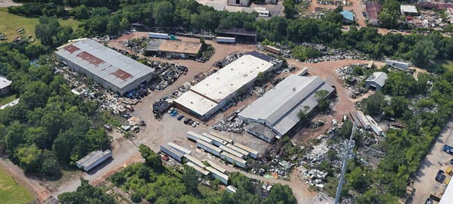
Property Record
2 17Th St W, Birmingham, AL 35208

NEARBY LISTINGS FOR SALE OR LEASE
Property Detail
2 17Th St W
Birmingham-Hoover, AL
Bham Humane Soc Re 29-4-3
29-00-04-3-006-002.002
LOT 2-A OF A RESUR OF LOT 2 OF BHAM HUMANE SOCIETY & RAINES LUMBER CO SURVEY 160/21
Industrialgeneral
Jefferson
X
Alabama
01073C0551G
2-a,2
2023
8.40 AC
2024
Bessemer
003900
Birmingham
41,802 SF
DEMOGRAPHICS near 2 17Th St W
1 Mile
3 Mile
5 Mile
2024 Total Population
12,250
73,670
164,775
2029 Population
12,641
74,439
165,090
Pop Growth 2024-2029
+ 3.19%
+ 1.04%
+ 0.19%
Average Age
43
41
39
2024 Total Households
5,269
32,583
71,970
HH Growth 2024-2029
+ 3.26%
+ 1.10%
+ 0.25%
Median Household Inc
$28,333
$33,775
$40,300
Avg Household Size
2.10
2.10
2.10
2024 Avg HH Vehicles
1.00
1.00
1.00
Median Home Value
$69,417
$74,643
$118,456
Median Year Built
1961
1961
1965
Nearby Places
Map Layers
Map Styles
 Street
 Aerial
- Restaurants
- Banks
- Shops
- Fitness
- Groceries
PUBLIC TRANSPORTATION
COMMUTER RAIL
DRIVE
WALK
Distance
8 min
4.1 mi
AIRPORT
Birmingham-Shuttlesworth International
DRIVE
WALK
Distance
Birmingham-Shuttlesworth International
16 min
9.2 mi
SALE & LEASE HISTORY
LISTING DATE
SALE/LEASE

Oct 23, 2024
For Sale
Jun 25, 2024
For Lease
Apr 12, 2019
For Sale
Nearby Properties
Address
Land Use
TOTAL SIZE
Lot Size
Zoning
Address
Land Use
TOTAL SIZE
Lot Size
Zoning
203,878 SF
12.58 AC
B6
Address
Land Use
TOTAL SIZE
Lot Size
Zoning
230,441 SF
10.22 AC
M1
Address
Land Use
TOTAL SIZE
Lot Size
Zoning
344,150 SF
42 AC
R5
Address
Land Use
TOTAL SIZE
Lot Size
Zoning
416,477 SF
80 AC
R5
Address
Land Use
TOTAL SIZE
Lot Size
Zoning
109,819 SF
2.91 AC
M2
Address
Land Use
TOTAL SIZE
Lot Size
Zoning
311,982 SF
30 AC
R6
Address
Land Use
TOTAL SIZE
Lot Size
Zoning
159,822 SF
1.30 AC
M1
Address
Land Use
TOTAL SIZE
Lot Size
Zoning
180,412 SF
14.89 AC
R6
Address
Land Use
TOTAL SIZE
Lot Size
Zoning
1.77 AC
QO&I
Address
Land Use
TOTAL SIZE
Lot Size
Zoning
66,238 SF
0.63 AC
M1
Address
Land Use
TOTAL SIZE
Lot Size
Zoning
267,289 SF
18.40 AC
L1
Address
Land Use
TOTAL SIZE
Lot Size
Zoning
84,900 SF
0.87 AC
M1
Address
Land Use
TOTAL SIZE
Lot Size
Zoning
93,258 SF
4.98 AC
R5
Address
Land Use
TOTAL SIZE
Lot Size
Zoning
56,392 SF
3.92 AC
M1
Address
Land Use
TOTAL SIZE
Lot Size
Zoning
146,358 SF
13.70 AC
R6
Address
Land Use
TOTAL SIZE
Lot Size
Zoning
127,240 SF
3.50 AC
R4
Address
Land Use
TOTAL SIZE
Lot Size
Zoning
36,870 SF
2.51 AC
M1-M
Address
Land Use
TOTAL SIZE
Lot Size
Zoning
200,650 SF
19.48 AC
R4
Address
Land Use
TOTAL SIZE
Lot Size
Zoning
49,220 SF
2.76 AC
M1
Address
Land Use
TOTAL SIZE
Lot Size
Zoning
198,732 SF
11.60 AC
L1
Address
Land Use
TOTAL SIZE
Lot Size
Zoning
48,276 SF
11.70 AC
M2
Address
Land Use
TOTAL SIZE
Lot Size
Zoning
100,583 SF
7.98 AC
M1
Address
Land Use
TOTAL SIZE
Lot Size
Zoning
131,208 SF
0.81 AC
M1
Address
Land Use
TOTAL SIZE
Lot Size
Zoning
106,366 SF
8.70 AC
R3
Address
Land Use
TOTAL SIZE
Lot Size
Zoning
98,932 SF
11 AC
R5
Address
Land Use
TOTAL SIZE
Lot Size
Zoning
68,046 SF
6 AC
B6
Address
Land Use
TOTAL SIZE
Lot Size
Zoning
83,583 SF
10.61 AC
R5
Address
Land Use
TOTAL SIZE
Lot Size
Zoning
64.50 AC
R5/C
Address
Land Use
TOTAL SIZE
Lot Size
Zoning
250,918 SF
10 AC
B-2
Address
Land Use
TOTAL SIZE
Lot Size
Zoning
65,299 SF
2 AC
B2
The World's #1 Commercial Real Estate Marketplace
Connect with us
© 2025 CoStar Group
The information above has been obtained from sources believed reliable. While we do not doubt its accuracy we have not verified it and make no guarantee, warranty or representation about it. It is your responsibility to independently confirm its accuracy and completeness. Any projections, opinions, assumptions, or estimates used are for example only and do not represent the current or future performance of the property. The value of this transaction to you depends on tax and other factors which should be evaluated by your tax, financial, and legal advisors. You and your advisors should conduct a careful, independent investigation of the property to determine to your satisfaction the suitability of the property for your needs.