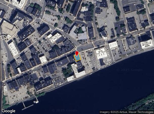
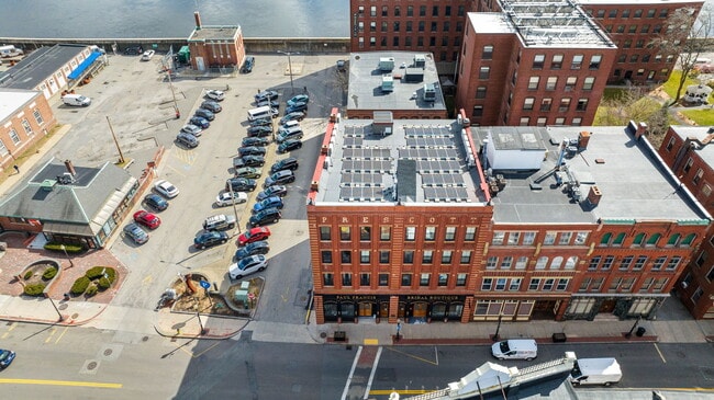
Property Record
2 Washington St, Haverhill, MA 01832
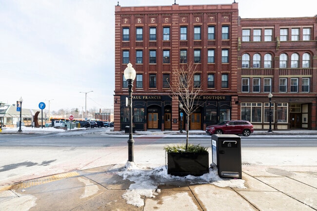
This Property Is For Sale
NEARBY LISTINGS FOR SALE OR LEASE
Property Detail
2 Washington St
HAVE-000308-000001-000002
Essex
Commercialofficeresidentialmixeduse
Massachusetts
X
2
25009C0089H
0.09 AC
0
Downtown Haverhill
2025
Boston
260100
Boston-Cambridge-Newton, MA-NH
15,161 SF
DEMOGRAPHICS near 2 Washington St
1 Mile
3 Mile
5 Mile
2024 Total Population
27,515
64,851
108,728
2029 Population
26,960
64,050
108,081
Pop Growth 2024-2029
(2.02%)
(1.24%)
(0.60%)
Average Age
38
40
41
2024 Total Households
10,992
25,585
41,786
HH Growth 2024-2029
(1.93%)
(1.30%)
(0.71%)
Median Household Inc
$55,741
$75,696
$87,339
Avg Household Size
2.40
2.50
2.50
2024 Avg HH Vehicles
1.00
2.00
2.00
Median Home Value
$365,521
$385,664
$418,266
Median Year Built
1947
1962
1970
Nearby Places
Map Layers
Map Styles
 Street
 Aerial
- Restaurants
- Banks
- Shops
- Fitness
- Groceries
PUBLIC TRANSPORTATION
TRANSIT/SUBWAY
Haverhill (Haverhill Line - Massachusetts Bay Transportation Authority Commuter Rail (Purple Line))
DRIVE
WALK
Distance
Haverhill (Haverhill Line - Massachusetts Bay Transportation Authority Commuter Rail (Purple Line))
1 min
5 min
0.3 mi
Bradford (Haverhill Line - Massachusetts Bay Transportation Authority Commuter Rail (Purple Line))
DRIVE
WALK
Distance
Bradford (Haverhill Line - Massachusetts Bay Transportation Authority Commuter Rail (Purple Line))
2 min
14 min
0.7 mi
COMMUTER RAIL
Haverhill (Haverhill Line - Massachusetts Bay Transportation Authority Commuter Rail (Purple Line))
DRIVE
WALK
Distance
Haverhill (Haverhill Line - Massachusetts Bay Transportation Authority Commuter Rail (Purple Line))
1 min
4 min
0.2 mi
Bradford (Haverhill Line - Massachusetts Bay Transportation Authority Commuter Rail (Purple Line))
DRIVE
WALK
Distance
Bradford (Haverhill Line - Massachusetts Bay Transportation Authority Commuter Rail (Purple Line))
2 min
13 min
0.7 mi
AIRPORT
Portsmouth International at Pease
DRIVE
WALK
Distance
Portsmouth International at Pease
41 min
29.7 mi
Manchester Boston Regional
DRIVE
WALK
Distance
Manchester Boston Regional
47 min
31.2 mi
General Edward Lawrence Logan International
DRIVE
WALK
Distance
General Edward Lawrence Logan International
51 min
38.3 mi
Nearby Properties
Address
Land Use
TOTAL SIZE
Lot Size
Zoning
Address
Land Use
TOTAL SIZE
Lot Size
Zoning
30.72 AC
Address
Land Use
TOTAL SIZE
Lot Size
Zoning
109.09 AC
Address
Land Use
TOTAL SIZE
Lot Size
Zoning
32.32 AC
Address
Land Use
TOTAL SIZE
Lot Size
Zoning
232,420 SF
4.58 AC
Address
Land Use
TOTAL SIZE
Lot Size
Zoning
358,890 SF
5.72 AC
Address
Land Use
TOTAL SIZE
Lot Size
Zoning
Address
Land Use
TOTAL SIZE
Lot Size
Zoning
195,120 SF
9.05 AC
Address
Land Use
TOTAL SIZE
Lot Size
Zoning
226,309 SF
19.33 AC
R3
Address
Land Use
TOTAL SIZE
Lot Size
Zoning
187,600 SF
19.31 AC
Address
Land Use
TOTAL SIZE
Lot Size
Zoning
173,788 SF
16.30 AC
Address
Land Use
TOTAL SIZE
Lot Size
Zoning
21.91 AC
Address
Land Use
TOTAL SIZE
Lot Size
Zoning
19.90 AC
Address
Land Use
TOTAL SIZE
Lot Size
Zoning
121,231 SF
1.11 AC
Address
Land Use
TOTAL SIZE
Lot Size
Zoning
200,081 SF
1.95 AC
Address
Land Use
TOTAL SIZE
Lot Size
Zoning
72,019 SF
10.74 AC
Address
Land Use
TOTAL SIZE
Lot Size
Zoning
21,752 SF
5.28 AC
Address
Land Use
TOTAL SIZE
Lot Size
Zoning
26.60 AC
Address
Land Use
TOTAL SIZE
Lot Size
Zoning
17.95 AC
Address
Land Use
TOTAL SIZE
Lot Size
Zoning
201,526 SF
24 AC
Address
Land Use
TOTAL SIZE
Lot Size
Zoning
159,058 SF
7.46 AC
Address
Land Use
TOTAL SIZE
Lot Size
Zoning
5.82 AC
Address
Land Use
TOTAL SIZE
Lot Size
Zoning
106,323 SF
2.05 AC
Address
Land Use
TOTAL SIZE
Lot Size
Zoning
142,845 SF
20.99 AC
Address
Land Use
TOTAL SIZE
Lot Size
Zoning
69,094 SF
0.54 AC
Address
Land Use
TOTAL SIZE
Lot Size
Zoning
119,956 SF
9.54 AC
Address
Land Use
TOTAL SIZE
Lot Size
Zoning
88,943 SF
2.43 AC
Address
Land Use
TOTAL SIZE
Lot Size
Zoning
202,022 SF
13.29 AC
Address
Land Use
TOTAL SIZE
Lot Size
Zoning
126,618 SF
17.47 AC
Address
Land Use
TOTAL SIZE
Lot Size
Zoning
63,461 SF
7.61 AC
Address
Land Use
TOTAL SIZE
Lot Size
Zoning
80.58 AC
The World's #1 Commercial Real Estate Marketplace
Connect with us
© 2025 CoStar Group
The information above has been obtained from sources believed reliable. While we do not doubt its accuracy we have not verified it and make no guarantee, warranty or representation about it. It is your responsibility to independently confirm its accuracy and completeness. Any projections, opinions, assumptions, or estimates used are for example only and do not represent the current or future performance of the property. The value of this transaction to you depends on tax and other factors which should be evaluated by your tax, financial, and legal advisors. You and your advisors should conduct a careful, independent investigation of the property to determine to your satisfaction the suitability of the property for your needs.