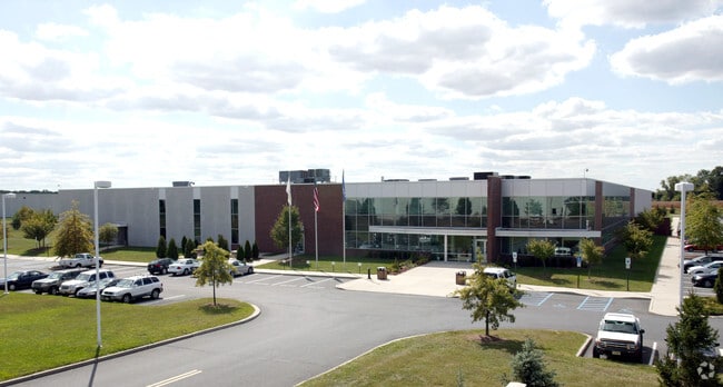
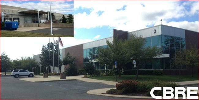
Property Record
2 Applegate Dr, Robbinsville, NJ 08691


Property Detail
2 Applegate Dr
Trenton-Princeton, NJ
MC LEAN ENG, 134244 SF
12-00041-0000-00019-02
Mercer
Warehouse
New Jersey
PCD
19.2
B and X Area of moderate flood hazard, usually the area between the limits of the 100-year and 500-year floods.
12.98 AC
2024
Trenton/295
2025
Northern New Jersey
004309
NEARBY LISTINGS FOR SALE OR LEASE
-
-
-
-
No Photo
-
-
-
View all Robbinsville listings for lease on LoopNet.com
DEMOGRAPHICS near 2 Applegate Dr
1 mile
3 mile
5 mile
2025 Total Population
887
16,107
56,045
2030 Population
910
16,498
57,606
Pop Growth 2025-2030
+ 2.59%
+ 2.43%
+ 2.79%
Average Age
41
42
43
2025 Total Households
275
5,671
20,566
HH Growth 2025-2030
+ 2.55%
+ 2.42%
+ 2.88%
Median Household Inc
$230,000
$164,222
$134,203
Avg Household Size
3.20
2.80
2.70
2025 Avg HH Vehicles
3.00
2.00
2.00
Median Home Value
$717,105
$646,400
$470,056
Median Year Built
1977
1993
1982
Nearby Places
Map Layers
Map Styles
 Street
 Aerial
Layers
 Traffic
 Biking
Places
Listings with unknown addresses are not visible on the map
- Restaurants
- Banks
- Shops
- Fitness
- Groceries
PUBLIC TRANSPORTATION
COMMUTER RAIL
Hamilton (Northeast Corridor Line - NJ Transit Commuter Rail (NJ Transit))
Drive
Walk
Distance
Hamilton (Northeast Corridor Line - NJ Transit Commuter Rail (NJ Transit))
18 min
9.0 mi
AIRPORT
Trenton Mercer
Drive
Walk
Distance
Trenton Mercer
28 min
17.6 mi
Freight Ports
Port of Philadelphia
Drive
Walk
Distance
Port of Philadelphia
52 min
37.2 mi
SALE & LEASE HISTORY
LISTING DATE
SALE/LEASE

Sep 24, 2016
For Lease
Sep 23, 2016
For Sale
Nearby Properties
Address
Land Use
TOTAL SIZE
Lot Size
Zoning
Address
Land Use
TOTAL SIZE
Lot Size
Zoning
31.05 AC
Address
Land Use
TOTAL SIZE
Lot Size
Zoning
55.71 AC
PCD
Address
Land Use
TOTAL SIZE
Lot Size
Zoning
64.43 AC
PCD
Address
Land Use
TOTAL SIZE
Lot Size
Zoning
65.18 AC
PCD
Address
Land Use
TOTAL SIZE
Lot Size
Zoning
47.91 AC
PCD
Address
Land Use
TOTAL SIZE
Lot Size
Zoning
79.71 AC
PCD
Address
Land Use
TOTAL SIZE
Lot Size
Zoning
60.18 AC
PCD
Address
Land Use
TOTAL SIZE
Lot Size
Zoning
266,000 SF
56.90 AC
RD
Address
Land Use
TOTAL SIZE
Lot Size
Zoning
134,000 SF
117.90 AC
AR
Address
Land Use
TOTAL SIZE
Lot Size
Zoning
37.90 AC
PCD
Address
Land Use
TOTAL SIZE
Lot Size
Zoning
64,184 SF
8.53 AC
MF0
Address
Land Use
TOTAL SIZE
Lot Size
Zoning
104.44 AC
PCD
Address
Land Use
TOTAL SIZE
Lot Size
Zoning
22.91 AC
PCD
Address
Land Use
TOTAL SIZE
Lot Size
Zoning
30.70 AC
PCD
Address
Land Use
TOTAL SIZE
Lot Size
Zoning
38.78 AC
PCD
Address
Land Use
TOTAL SIZE
Lot Size
Zoning
46.35 AC
PCD
Address
Land Use
TOTAL SIZE
Lot Size
Zoning
141,175 SF
17.06 AC
RD
Address
Land Use
TOTAL SIZE
Lot Size
Zoning
11.16 AC
PCD
Address
Land Use
TOTAL SIZE
Lot Size
Zoning
22.73 AC
PCD
Address
Land Use
TOTAL SIZE
Lot Size
Zoning
10 AC
PCD
Address
Land Use
TOTAL SIZE
Lot Size
Zoning
79.71 AC
PCD
Address
Land Use
TOTAL SIZE
Lot Size
Zoning
136,664 SF
14.16 AC
RD
Address
Land Use
TOTAL SIZE
Lot Size
Zoning
21.51 AC
PCD
Address
Land Use
TOTAL SIZE
Lot Size
Zoning
23.18 AC
PCD
Address
Land Use
TOTAL SIZE
Lot Size
Zoning
15,488 SF
34.01 AC
PEC
Address
Land Use
TOTAL SIZE
Lot Size
Zoning
110,161 SF
12.52 AC
RD
Address
Land Use
TOTAL SIZE
Lot Size
Zoning
5.46 AC
RD
Address
Land Use
TOTAL SIZE
Lot Size
Zoning
7.51 AC
PCD
Address
Land Use
TOTAL SIZE
Lot Size
Zoning
27,230 SF
6.39 AC
Address
Land Use
TOTAL SIZE
Lot Size
Zoning
7.61 AC
RD
The World's #1 Commercial Real Estate Marketplace
Connect with us
© 2026 CoStar Group
The information above has been obtained from sources believed reliable. While we do not doubt its accuracy we have not verified it and make no guarantee, warranty or representation about it. It is your responsibility to independently confirm its accuracy and completeness. Any projections, opinions, assumptions, or estimates used are for example only and do not represent the current or future performance of the property. The value of this transaction to you depends on tax and other factors which should be evaluated by your tax, financial, and legal advisors. You and your advisors should conduct a careful, independent investigation of the property to determine to your satisfaction the suitability of the property for your needs.