Property Record
2 Beach Rd, Winthrop, MA 02152

Save to a Folder
{{folder.Name}}
{{folder.ListingIds.length}} Properties
{{folder.ListingIds.length}} Property
Create a New Folder
Property Detail
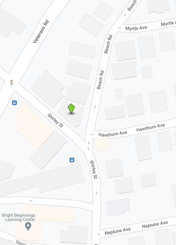
2 Beach Rd
WINT-000057-000000-000002
Suffolk
Apartment
Massachusetts
AE The base floodplain where base flood elevations are provided. AE Zones are now used on new format FIRMs instead of A1-A30 Zones.
2
2025
0.06 AC
2025
Winthrop Beach
180101
Boston
5,505 SF
Boston-Cambridge-Newton, MA-NH
NEARBY LISTINGS FOR SALE OR LEASE
DEMOGRAPHICS near 2 Beach Rd
1 mile
3 mile
5 mile
2025 Total Population
15,272
81,727
317,260
2030 Population
15,171
82,359
323,816
Pop Growth 2025-2030
(0.66%)
+ 0.77%
+ 2.07%
Average Age
45
40
39
2025 Total Households
6,537
30,193
130,451
HH Growth 2025-2030
(0.60%)
+ 1.00%
+ 2.52%
Median Household Inc
$100,168
$88,020
$107,500
Avg Household Size
2.30
2.60
2.30
2025 Avg HH Vehicles
1.00
1.00
1.00
Median Home Value
$647,649
$619,900
$724,086
Median Year Built
1947
1948
1954
Nearby Places
Map Layers
Map Styles
 Street
 Aerial
Layers
 Traffic
 Biking
Places
Listings with unknown addresses are not visible on the map
- Restaurants
- Banks
- Shops
- Fitness
- Groceries
PUBLIC TRANSPORTATION
COMMUTER RAIL
Drive
Walk
Distance
11 min
5.4 mi
Drive
Walk
Distance
12 min
5.9 mi
AIRPORT
General Edward Lawrence Logan International
Drive
Walk
Distance
General Edward Lawrence Logan International
10 min
4.9 mi
Nearby Properties
Address
Land Use
TOTAL SIZE
Lot Size
Zoning
Address
Land Use
TOTAL SIZE
Lot Size
Zoning
171,791 SF
166.88 AC
E
Address
Land Use
TOTAL SIZE
Lot Size
Zoning
247,013 SF
1.13 AC
RC2
Address
Land Use
TOTAL SIZE
Lot Size
Zoning
164,959 SF
96.81 AC
E
Address
Land Use
TOTAL SIZE
Lot Size
Zoning
211,294 SF
1.66 AC
RC2
Address
Land Use
TOTAL SIZE
Lot Size
Zoning
226,431 SF
4.31 AC
HB
Address
Land Use
TOTAL SIZE
Lot Size
Zoning
1.65 AC
RC2
Address
Land Use
TOTAL SIZE
Lot Size
Zoning
422,028 SF
16.10 AC
RB
Address
Land Use
TOTAL SIZE
Lot Size
Zoning
232,943 SF
3.87 AC
Address
Land Use
TOTAL SIZE
Lot Size
Zoning
154.16 AC
E
Address
Land Use
TOTAL SIZE
Lot Size
Zoning
172,043 SF
1.13 AC
RC1
Address
Land Use
TOTAL SIZE
Lot Size
Zoning
5,668 SF
20.05 AC
A
Address
Land Use
TOTAL SIZE
Lot Size
Zoning
391,884 SF
108.79 AC
C
Address
Land Use
TOTAL SIZE
Lot Size
Zoning
738 SF
20.71 AC
PORT
Address
Land Use
TOTAL SIZE
Lot Size
Zoning
449,900 SF
3.38 AC
I
Address
Land Use
TOTAL SIZE
Lot Size
Zoning
14.79 AC
INDUST
Address
Land Use
TOTAL SIZE
Lot Size
Zoning
214,895 SF
3.30 AC
A
Address
Land Use
TOTAL SIZE
Lot Size
Zoning
192,881 SF
6.08 AC
C
Address
Land Use
TOTAL SIZE
Lot Size
Zoning
224,868 SF
9.08 AC
I
Address
Land Use
TOTAL SIZE
Lot Size
Zoning
192,031 SF
8.34 AC
Address
Land Use
TOTAL SIZE
Lot Size
Zoning
130,120 SF
0.83 AC
RC2
Address
Land Use
TOTAL SIZE
Lot Size
Zoning
115,045 SF
6.90 AC
C
Address
Land Use
TOTAL SIZE
Lot Size
Zoning
181,959 SF
1.38 AC
RC2
Address
Land Use
TOTAL SIZE
Lot Size
Zoning
81.22 AC
E
Address
Land Use
TOTAL SIZE
Lot Size
Zoning
1.66 AC
PDD1
Address
Land Use
TOTAL SIZE
Lot Size
Zoning
117,516 SF
1.68 AC
R2
Address
Land Use
TOTAL SIZE
Lot Size
Zoning
6.19 AC
INDUST
Address
Land Use
TOTAL SIZE
Lot Size
Zoning
7.87 AC
RB
Address
Land Use
TOTAL SIZE
Lot Size
Zoning
134,945 SF
11.70 AC
RB
Address
Land Use
TOTAL SIZE
Lot Size
Zoning
29.47 AC
HB
Address
Land Use
TOTAL SIZE
Lot Size
Zoning
333,370 SF
10.34 AC
C
The World's #1 Commercial Real Estate Marketplace
Connect with us
© 2026 CoStar Group
The information above has been obtained from sources believed reliable. While we do not doubt its accuracy we have not verified it and make no guarantee, warranty or representation about it. It is your responsibility to independently confirm its accuracy and completeness. Any projections, opinions, assumptions, or estimates used are for example only and do not represent the current or future performance of the property. The value of this transaction to you depends on tax and other factors which should be evaluated by your tax, financial, and legal advisors. You and your advisors should conduct a careful, independent investigation of the property to determine to your satisfaction the suitability of the property for your needs.