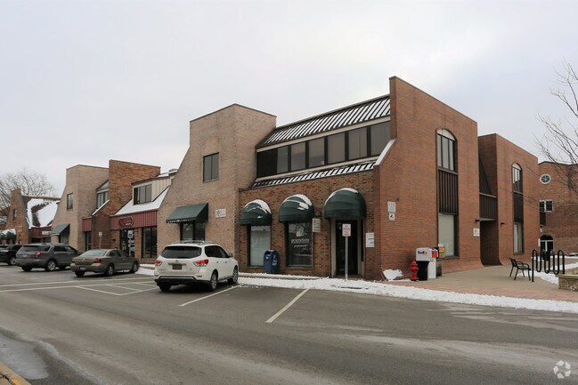
Property Record
East Bridge Dr, Berea, OH 44017


Current Lease Availabilities
Property Detail
East Bridge Dr
364-10-021
VOL 384 PG 56- 57 LOT B FF 220.05 0.5400 ACRES SEC 17 ADDITIONAL PARCEL 36410005 2017 SR
Officebuilding
CUYAHOGA
B and X Area of moderate flood hazard, usually the area between the limits of the 100-year and 500-year floods.
Ohio
2025
0.54 AC
2025
Southwest
134204
Cleveland
29,456 SF
Cleveland-Elyria, OH
NEARBY LISTINGS FOR SALE OR LEASE
DEMOGRAPHICS near East Bridge Dr
1 mile
3 mile
5 mile
2025 Total Population
9,217
53,381
150,904
2030 Population
9,148
52,896
149,549
Pop Growth 2025-2030
(0.75%)
(0.91%)
(0.90%)
Average Age
40
43
44
2025 Total Households
3,763
22,734
64,315
HH Growth 2025-2030
(0.96%)
(1.17%)
(1.02%)
Median Household Inc
$59,755
$81,640
$79,526
Avg Household Size
2.00
2.20
2.30
2025 Avg HH Vehicles
2.00
2.00
2.00
Median Home Value
$189,931
$227,835
$220,724
Median Year Built
1955
1968
1967
Nearby Places
Map Layers
Map Styles
 Street
 Aerial
Transit
 Traffic
 Biking
Places
Listings with unknown addresses are not visible on the map
- Restaurants
- Banks
- Shops
- Fitness
- Groceries
PUBLIC TRANSPORTATION
AIRPORT
Cleveland-Hopkins International
Drive
Walk
Distance
Cleveland-Hopkins International
13 min
6.1 mi
Nearby Properties
Address
Land Use
TOTAL SIZE
Lot Size
Zoning
Address
Land Use
TOTAL SIZE
Lot Size
Zoning
1,490,538 SF
19.29 AC
PF
Address
Land Use
TOTAL SIZE
Lot Size
Zoning
754.68 AC
GI
Address
Land Use
TOTAL SIZE
Lot Size
Zoning
523.64 AC
GI
Address
Land Use
TOTAL SIZE
Lot Size
Zoning
237,144 SF
2.12 AC
PG
Address
Land Use
TOTAL SIZE
Lot Size
Zoning
1,514 SF
23.65 AC
RSF-B
Address
Land Use
TOTAL SIZE
Lot Size
Zoning
208.22 AC
U5-A
Address
Land Use
TOTAL SIZE
Lot Size
Zoning
289,215 SF
20.56 AC
RSF-B
Address
Land Use
TOTAL SIZE
Lot Size
Zoning
768,485 SF
14.53 AC
R1-A
Address
Land Use
TOTAL SIZE
Lot Size
Zoning
244,717 SF
23.97 AC
RMF-1
Address
Land Use
TOTAL SIZE
Lot Size
Zoning
299,114 SF
23.65 AC
RSF-B
Address
Land Use
TOTAL SIZE
Lot Size
Zoning
126,000 SF
3.02 AC
PG
Address
Land Use
TOTAL SIZE
Lot Size
Zoning
309,231 SF
34.28 AC
Address
Land Use
TOTAL SIZE
Lot Size
Zoning
1,391,445 SF
136.05 AC
GI
Address
Land Use
TOTAL SIZE
Lot Size
Zoning
3.53 AC
SI
Address
Land Use
TOTAL SIZE
Lot Size
Zoning
300,120 SF
20.18 AC
GI
Address
Land Use
TOTAL SIZE
Lot Size
Zoning
263,867 SF
59.28 AC
PF
Address
Land Use
TOTAL SIZE
Lot Size
Zoning
189,624 SF
4.66 AC
CC
Address
Land Use
TOTAL SIZE
Lot Size
Zoning
426.60 AC
PF
Address
Land Use
TOTAL SIZE
Lot Size
Zoning
334,360 SF
8.22 AC
MF-HD
Address
Land Use
TOTAL SIZE
Lot Size
Zoning
78,000 SF
5.78 AC
OB
Address
Land Use
TOTAL SIZE
Lot Size
Zoning
275,274 SF
16.91 AC
RMF-1
Address
Land Use
TOTAL SIZE
Lot Size
Zoning
110,648 SF
10.79 AC
SR/LC
Address
Land Use
TOTAL SIZE
Lot Size
Zoning
112,629 SF
9.62 AC
RSF-B
Address
Land Use
TOTAL SIZE
Lot Size
Zoning
29,058 SF
3 AC
RMF-2
Address
Land Use
TOTAL SIZE
Lot Size
Zoning
113,100 SF
7.80 AC
GB
Address
Land Use
TOTAL SIZE
Lot Size
Zoning
59,296 SF
7.08 AC
CC
Address
Land Use
TOTAL SIZE
Lot Size
Zoning
111,819 SF
12.78 AC
PF
Address
Land Use
TOTAL SIZE
Lot Size
Zoning
243,375 SF
2.43 AC
RMF-1
Address
Land Use
TOTAL SIZE
Lot Size
Zoning
3,432 SF
24.15 AC
U5-B
Address
Land Use
TOTAL SIZE
Lot Size
Zoning
141,245 SF
8.90 AC
1F1
The World's #1 Commercial Real Estate Marketplace
Connect with us
© 2026 CoStar Group
The information above has been obtained from sources believed reliable. While we do not doubt its accuracy we have not verified it and make no guarantee, warranty or representation about it. It is your responsibility to independently confirm its accuracy and completeness. Any projections, opinions, assumptions, or estimates used are for example only and do not represent the current or future performance of the property. The value of this transaction to you depends on tax and other factors which should be evaluated by your tax, financial, and legal advisors. You and your advisors should conduct a careful, independent investigation of the property to determine to your satisfaction the suitability of the property for your needs.