Property Record
2 Bonnie Brae Rd, Spring City, PA 19475


NEARBY LISTINGS FOR SALE OR LEASE
Property Detail
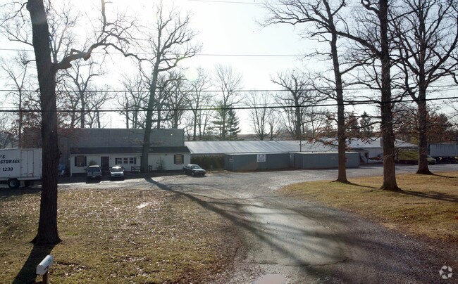
2 Bonnie Brae Rd
26-001-0059.0000
22.1 AC WHSE & 2 DWGS
Warehouse
Chester
X
Pennsylvania
42029C0060G
22.10 AC
2024
Chester
2025
Philadelphia
301002
Philadelphia-Camden-Wilmington, PA-NJ-DE-MD
19,867 SF
DEMOGRAPHICS near 2 Bonnie Brae Rd
1 Mile
3 Mile
5 Mile
2024 Total Population
2,536
47,499
89,884
2029 Population
2,652
49,286
92,736
Pop Growth 2024-2029
+ 4.57%
+ 3.76%
+ 3.17%
Average Age
38
40
40
2024 Total Households
932
19,923
35,574
HH Growth 2024-2029
+ 4.72%
+ 3.88%
+ 3.28%
Median Household Inc
$114,457
$92,094
$103,103
Avg Household Size
2.70
2.30
2.50
2024 Avg HH Vehicles
2.00
2.00
2.00
Median Home Value
$392,822
$310,405
$367,057
Median Year Built
1985
1974
1982
Nearby Places
Map Layers
Map Styles
 Street
 Aerial
- Restaurants
- Banks
- Shops
- Fitness
- Groceries
PUBLIC TRANSPORTATION
AIRPORT
Philadelphia International
DRIVE
WALK
Distance
Philadelphia International
62 min
34.3 mi
Lehigh Valley International
DRIVE
WALK
Distance
Lehigh Valley International
72 min
42.2 mi
Freight Ports
South Jersey Port
DRIVE
WALK
Distance
South Jersey Port
57 min
34.2 mi
SALE & LEASE HISTORY
LISTING DATE
SALE/LEASE

Aug 23, 2019
For Sale
Aug 23, 2019
For Sale
Nearby Properties
Address
Land Use
TOTAL SIZE
Lot Size
Zoning
Address
Land Use
TOTAL SIZE
Lot Size
Zoning
208,637 SF
13.37 AC
AG
Address
Land Use
TOTAL SIZE
Lot Size
Zoning
416,228 SF
18.24 AC
R3
Address
Land Use
TOTAL SIZE
Lot Size
Zoning
368,083 SF
126.15 AC
R2
Address
Land Use
TOTAL SIZE
Lot Size
Zoning
420,080 SF
7.33 AC
FCE
Address
Land Use
TOTAL SIZE
Lot Size
Zoning
425,170 SF
23 AC
FCE
Address
Land Use
TOTAL SIZE
Lot Size
Zoning
248,028 SF
4.26 AC
HC
Address
Land Use
TOTAL SIZE
Lot Size
Zoning
347,779 SF
32.59 AC
IN
Address
Land Use
TOTAL SIZE
Lot Size
Zoning
7.35 AC
FCE
Address
Land Use
TOTAL SIZE
Lot Size
Zoning
186,770 SF
24.30 AC
AR
Address
Land Use
TOTAL SIZE
Lot Size
Zoning
132,002 SF
0.41 AC
LICO1
Address
Land Use
TOTAL SIZE
Lot Size
Zoning
407,301 SF
8.04 AC
ARU
Address
Land Use
TOTAL SIZE
Lot Size
Zoning
100,256 SF
7 AC
LC
Address
Land Use
TOTAL SIZE
Lot Size
Zoning
355,439 SF
12.50 AC
APT
Address
Land Use
TOTAL SIZE
Lot Size
Zoning
230,880 SF
10.70 AC
APT
Address
Land Use
TOTAL SIZE
Lot Size
Zoning
143,400 SF
13.10 AC
MR
Address
Land Use
TOTAL SIZE
Lot Size
Zoning
68,378 SF
27 AC
R3
Address
Land Use
TOTAL SIZE
Lot Size
Zoning
137,596 SF
41 AC
IN
Address
Land Use
TOTAL SIZE
Lot Size
Zoning
90,300 SF
2.70 AC
PFZ
Address
Land Use
TOTAL SIZE
Lot Size
Zoning
73,360 SF
17.88 AC
R1
Address
Land Use
TOTAL SIZE
Lot Size
Zoning
106,185 SF
3.15 AC
LI
Address
Land Use
TOTAL SIZE
Lot Size
Zoning
124,507 SF
6.34 AC
LICO1
Address
Land Use
TOTAL SIZE
Lot Size
Zoning
74,302 SF
16.32 AC
R2
Address
Land Use
TOTAL SIZE
Lot Size
Zoning
169,167 SF
39.70 AC
FR
Address
Land Use
TOTAL SIZE
Lot Size
Zoning
83,629 SF
7.29 AC
R2
Address
Land Use
TOTAL SIZE
Lot Size
Zoning
148,089 SF
8.88 AC
C
Address
Land Use
TOTAL SIZE
Lot Size
Zoning
86,280 SF
3 AC
APT
Address
Land Use
TOTAL SIZE
Lot Size
Zoning
101,034 SF
7.03 AC
LICO1
Address
Land Use
TOTAL SIZE
Lot Size
Zoning
183,782 SF
18 AC
C
Address
Land Use
TOTAL SIZE
Lot Size
Zoning
80,608 SF
3.30 AC
APT
Address
Land Use
TOTAL SIZE
Lot Size
Zoning
72,890 SF
10 AC
C
The World's #1 Commercial Real Estate Marketplace
Connect with us
© 2025 CoStar Group
The information above has been obtained from sources believed reliable. While we do not doubt its accuracy we have not verified it and make no guarantee, warranty or representation about it. It is your responsibility to independently confirm its accuracy and completeness. Any projections, opinions, assumptions, or estimates used are for example only and do not represent the current or future performance of the property. The value of this transaction to you depends on tax and other factors which should be evaluated by your tax, financial, and legal advisors. You and your advisors should conduct a careful, independent investigation of the property to determine to your satisfaction the suitability of the property for your needs.