Property Record
2 Burkhart Dr, Auburn, NY 13021
NEARBY LISTINGS FOR SALE OR LEASE
Property Detail
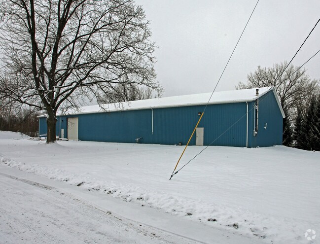
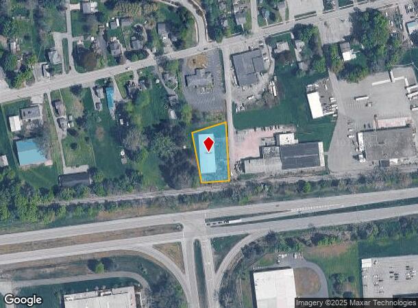
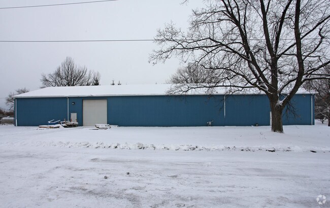
2 Burkhart Dr
052089-115-014-0001-012-002-0000
UNR. S.M. , SM E-114 FORM. P/O 115.00-1-44
Gasolinefuelbulkstorage
Cayuga
X
New York
36011C0311E
12.002
2025
0.84 AC
2024
Syracuse Surrounding
042100
Other Market Areas
9,600 SF
Auburn, NY
DEMOGRAPHICS near 2 Burkhart Dr
1 Mile
3 Mile
5 Mile
2024 Total Population
4,891
29,549
35,472
2029 Population
4,785
29,149
35,023
Pop Growth 2024-2029
(2.17%)
(1.35%)
(1.27%)
Average Age
40
43
43
2024 Total Households
2,138
12,794
15,257
HH Growth 2024-2029
(2.34%)
(1.49%)
(1.41%)
Median Household Inc
$44,198
$52,444
$57,551
Avg Household Size
2.20
2.10
2.10
2024 Avg HH Vehicles
1.00
1.00
2.00
Median Home Value
$134,011
$146,769
$161,876
Median Year Built
1948
1949
1950
Nearby Places
Map Layers
Map Styles
 Street
 Aerial
- Restaurants
- Banks
- Shops
- Fitness
- Groceries
PUBLIC TRANSPORTATION
AIRPORT
Syracuse Hancock International
DRIVE
WALK
Distance
Syracuse Hancock International
49 min
34.3 mi
Freight Ports
Albany, NY Port
DRIVE
WALK
Distance
Albany, NY Port
212 min
175.6 mi
Nearby Properties
Address
Land Use
TOTAL SIZE
Lot Size
Zoning
Address
Land Use
TOTAL SIZE
Lot Size
Zoning
6,085 SF
23 AC
CC
Address
Land Use
TOTAL SIZE
Lot Size
Zoning
200,000 SF
43.73 AC
AR
Address
Land Use
TOTAL SIZE
Lot Size
Zoning
2,496 SF
15.27 AC
R1
Address
Land Use
TOTAL SIZE
Lot Size
Zoning
17.41 AC
A
Address
Land Use
TOTAL SIZE
Lot Size
Zoning
225,619 SF
6.90 AC
C
Address
Land Use
TOTAL SIZE
Lot Size
Zoning
3,360 SF
29.33 AC
I1
Address
Land Use
TOTAL SIZE
Lot Size
Zoning
300,342 SF
52 AC
R1
Address
Land Use
TOTAL SIZE
Lot Size
Zoning
165,775 SF
39.40 AC
R1
Address
Land Use
TOTAL SIZE
Lot Size
Zoning
190,229 SF
29.04 AC
HC
Address
Land Use
TOTAL SIZE
Lot Size
Zoning
330,772 SF
27.80 AC
I
Address
Land Use
TOTAL SIZE
Lot Size
Zoning
100,000 SF
24.11 AC
C
Address
Land Use
TOTAL SIZE
Lot Size
Zoning
444,450 SF
30.70 AC
I1
Address
Land Use
TOTAL SIZE
Lot Size
Zoning
1,966 SF
20 AC
R2
Address
Land Use
TOTAL SIZE
Lot Size
Zoning
49,057 SF
9.89 AC
C
Address
Land Use
TOTAL SIZE
Lot Size
Zoning
113,388 SF
12.15 AC
R1
Address
Land Use
TOTAL SIZE
Lot Size
Zoning
88,967 SF
1.62 AC
D
Address
Land Use
TOTAL SIZE
Lot Size
Zoning
1,520 SF
14.50 AC
R2
Address
Land Use
TOTAL SIZE
Lot Size
Zoning
72,267 SF
2.75 AC
D
Address
Land Use
TOTAL SIZE
Lot Size
Zoning
3,920 SF
7.30 AC
R2
Address
Land Use
TOTAL SIZE
Lot Size
Zoning
117,877 SF
5.08 AC
D
Address
Land Use
TOTAL SIZE
Lot Size
Zoning
120,933 SF
1.47 AC
D
Address
Land Use
TOTAL SIZE
Lot Size
Zoning
109,990 SF
37.46 AC
R1
Address
Land Use
TOTAL SIZE
Lot Size
Zoning
1,015 SF
1.20 AC
C
Address
Land Use
TOTAL SIZE
Lot Size
Zoning
101,680 SF
4.40 AC
D
Address
Land Use
TOTAL SIZE
Lot Size
Zoning
132,874 SF
37.95 AC
C
Address
Land Use
TOTAL SIZE
Lot Size
Zoning
74,514 SF
57.60 AC
R1
Address
Land Use
TOTAL SIZE
Lot Size
Zoning
309,234 SF
24.50 AC
I
Address
Land Use
TOTAL SIZE
Lot Size
Zoning
39,802 SF
24.80 AC
I
Address
Land Use
TOTAL SIZE
Lot Size
Zoning
18,000 SF
2.20 AC
D
Address
Land Use
TOTAL SIZE
Lot Size
Zoning
68,890 SF
5.83 AC
C
The World's #1 Commercial Real Estate Marketplace
Connect with us
© 2025 CoStar Group
The information above has been obtained from sources believed reliable. While we do not doubt its accuracy we have not verified it and make no guarantee, warranty or representation about it. It is your responsibility to independently confirm its accuracy and completeness. Any projections, opinions, assumptions, or estimates used are for example only and do not represent the current or future performance of the property. The value of this transaction to you depends on tax and other factors which should be evaluated by your tax, financial, and legal advisors. You and your advisors should conduct a careful, independent investigation of the property to determine to your satisfaction the suitability of the property for your needs.