Property Record
2 Clarkson Wilson Ctr, Chesterfield, MO 63017


NEARBY LISTINGS FOR SALE OR LEASE
Property Detail
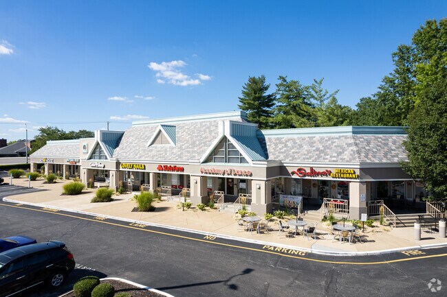
2 Clarkson Wilson Ctr
St. Louis, MO-IL
Clarkson Centre
20T-24-0171
CLARKSON CENTRE 4 13 88 LOT 1
Stripcommercialcenter
St. Louis
X
Missouri
29183C0465G
1
2024
5.17 AC
2025
Chesterfield Region
217851
St. Louis
43,300 SF
DEMOGRAPHICS near 2 Clarkson Wilson Ctr
1 mile
3 mile
5 mile
2024 Total Population
6,964
56,678
133,521
2029 Population
6,748
55,518
130,611
Pop Growth 2024-2029
(3.10%)
(2.05%)
(2.18%)
Average Age
45
43
43
2024 Total Households
2,542
22,292
50,812
HH Growth 2024-2029
(3.23%)
(2.02%)
(2.19%)
Median Household Inc
$165,843
$126,872
$125,063
Avg Household Size
2.70
2.50
2.60
2024 Avg HH Vehicles
2.00
2.00
2.00
Median Home Value
$477,918
$399,391
$380,647
Median Year Built
1981
1980
1981
Nearby Places
Map Layers
Map Styles
 Street
 Aerial
Transit
 Traffic
 Biking
Places
Listings with unknown addresses are not visible on the map
- Restaurants
- Banks
- Shops
- Fitness
- Groceries
PUBLIC TRANSPORTATION
AIRPORT
St Louis Lambert International
Drive
Walk
Distance
St Louis Lambert International
33 min
22.8 mi
Freight Ports
Tulsa Port of Inola
Drive
Walk
Distance
Tulsa Port of Inola
408 min
365.8 mi
Nearby Properties
Address
Land Use
TOTAL SIZE
Lot Size
Zoning
Address
Land Use
TOTAL SIZE
Lot Size
Zoning
8.21 AC
105C8
Address
Land Use
TOTAL SIZE
Lot Size
Zoning
1,298,224 SF
194.08 AC
C-8
Address
Land Use
TOTAL SIZE
Lot Size
Zoning
420,140 SF
16.49 AC
105C8
Address
Land Use
TOTAL SIZE
Lot Size
Zoning
462,876 SF
12.89 AC
105R8
Address
Land Use
TOTAL SIZE
Lot Size
Zoning
157,315 SF
41.71 AC
105C8
Address
Land Use
TOTAL SIZE
Lot Size
Zoning
352,152 SF
31.79 AC
105C8
Address
Land Use
TOTAL SIZE
Lot Size
Zoning
156,253 SF
10.64 AC
87PC
Address
Land Use
TOTAL SIZE
Lot Size
Zoning
Address
Land Use
TOTAL SIZE
Lot Size
Zoning
70.42 AC
87A
Address
Land Use
TOTAL SIZE
Lot Size
Zoning
269,687 SF
38.30 AC
105C8
Address
Land Use
TOTAL SIZE
Lot Size
Zoning
65.15 AC
105NU
Address
Land Use
TOTAL SIZE
Lot Size
Zoning
218,130 SF
7.31 AC
105PC&R
Address
Land Use
TOTAL SIZE
Lot Size
Zoning
363,584 SF
48.15 AC
FPNU
Address
Land Use
TOTAL SIZE
Lot Size
Zoning
344,386 SF
41.26 AC
R2
Address
Land Use
TOTAL SIZE
Lot Size
Zoning
60,928 SF
102.43 AC
NU
Address
Land Use
TOTAL SIZE
Lot Size
Zoning
359,937 SF
26.91 AC
R4
Address
Land Use
TOTAL SIZE
Lot Size
Zoning
242,380 SF
12.60 AC
105PC&R
Address
Land Use
TOTAL SIZE
Lot Size
Zoning
403,166 SF
23.17 AC
R4
Address
Land Use
TOTAL SIZE
Lot Size
Zoning
288,733 SF
36.80 AC
R5
Address
Land Use
TOTAL SIZE
Lot Size
Zoning
182,939 SF
3.80 AC
105PC
Address
Land Use
TOTAL SIZE
Lot Size
Zoning
285,752 SF
23.98 AC
105PC
Address
Land Use
TOTAL SIZE
Lot Size
Zoning
223,598 SF
13.95 AC
93C-1
Address
Land Use
TOTAL SIZE
Lot Size
Zoning
197,927 SF
16.61 AC
105C8
Address
Land Use
TOTAL SIZE
Lot Size
Zoning
204,940 SF
16.35 AC
FPNU
Address
Land Use
TOTAL SIZE
Lot Size
Zoning
175,448 SF
6.95 AC
Address
Land Use
TOTAL SIZE
Lot Size
Zoning
111,719 SF
9.51 AC
19C-1
Address
Land Use
TOTAL SIZE
Lot Size
Zoning
2,164 SF
22.98 AC
105PS
Address
Land Use
TOTAL SIZE
Lot Size
Zoning
108,384 SF
6.05 AC
105PC
Address
Land Use
TOTAL SIZE
Lot Size
Zoning
89,348 SF
2.61 AC
105C8
Address
Land Use
TOTAL SIZE
Lot Size
Zoning
58,710 SF
14.75 AC
105PC
The World's #1 Commercial Real Estate Marketplace
Connect with us
© 2026 CoStar Group
The information above has been obtained from sources believed reliable. While we do not doubt its accuracy we have not verified it and make no guarantee, warranty or representation about it. It is your responsibility to independently confirm its accuracy and completeness. Any projections, opinions, assumptions, or estimates used are for example only and do not represent the current or future performance of the property. The value of this transaction to you depends on tax and other factors which should be evaluated by your tax, financial, and legal advisors. You and your advisors should conduct a careful, independent investigation of the property to determine to your satisfaction the suitability of the property for your needs.