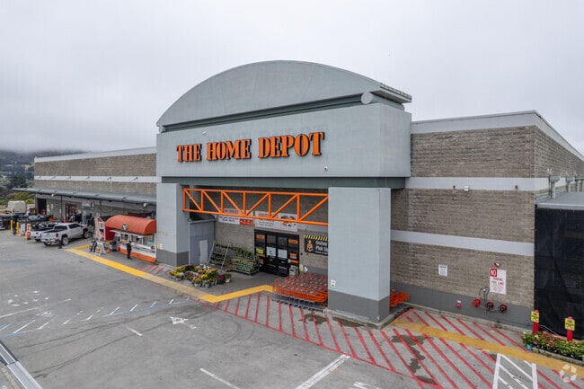
Property Record
2 Colma Blvd, Colma, CA 94014


Property Detail
2 Colma Blvd
008-322-550
9.081 AC MOL PTN OF LOT 18 280 METRO CENTER MAP NO 1 RSM 114/15-20
Industrialgeneral
San Mateo
G10000
California
B and X Area of moderate flood hazard, usually the area between the limits of the 100-year and 500-year floods.
18
2024
9.09 AC
2025
Brisbane/Daly City
601601
San Francisco
113,136 SF
San Francisco-San Mateo-Redwood City, CA
NEARBY LISTINGS FOR SALE OR LEASE
DEMOGRAPHICS near 2 Colma Blvd
1 mile
3 mile
5 mile
2025 Total Population
25,183
198,580
419,232
2030 Population
25,343
198,051
418,408
Pop Growth 2025-2030
+ 0.64%
(0.27%)
(0.20%)
Average Age
43
43
43
2025 Total Households
7,962
62,471
135,783
HH Growth 2025-2030
+ 0.60%
(0.27%)
(0.14%)
Median Household Inc
$111,471
$128,207
$128,297
Avg Household Size
3.00
3.00
2.90
2025 Avg HH Vehicles
2.00
2.00
2.00
Median Home Value
$981,970
$1,051,653
$1,074,991
Median Year Built
1973
1964
1957
Nearby Places
Map Layers
Map Styles
 Street
 Aerial
Transit
 Traffic
 Biking
Places
Listings with unknown addresses are not visible on the map
- Restaurants
- Banks
- Shops
- Fitness
- Groceries
PUBLIC TRANSPORTATION
TRANSIT/SUBWAY
Colma Station (Dublin/Pleasanton - Millbrae - Bay Area Rapid Transit (BART), Pittsburg/Bay Point - San Francisco International - Bay Area Rapid Transit (BART), Richmond - Millbrae - Bay Area Rapid Transit (BART))
Drive
Walk
Distance
Colma Station (Dublin/Pleasanton - Millbrae - Bay Area Rapid Transit (BART), Pittsburg/Bay Point - San Francisco International - Bay Area Rapid Transit (BART), Richmond - Millbrae - Bay Area Rapid Transit (BART))
4 min
18 min
1.0 mi
COMMUTER RAIL
Drive
Walk
Distance
11 min
5.1 mi
Drive
Walk
Distance
11 min
5.2 mi
AIRPORT
San Francisco International
Drive
Walk
Distance
San Francisco International
17 min
8.6 mi
Metro Oakland International
Drive
Walk
Distance
Metro Oakland International
43 min
29.2 mi
Freight Ports
Port of San Francisco
Drive
Walk
Distance
Port of San Francisco
19 min
12.6 mi
Nearby Properties
Address
Land Use
TOTAL SIZE
Lot Size
Zoning
Address
Land Use
TOTAL SIZE
Lot Size
Zoning
53.85 AC
Address
Land Use
TOTAL SIZE
Lot Size
Zoning
312,191 SF
2.74 AC
Address
Land Use
TOTAL SIZE
Lot Size
Zoning
167,105 SF
2.07 AC
C10000
Address
Land Use
TOTAL SIZE
Lot Size
Zoning
42.95 AC
Address
Land Use
TOTAL SIZE
Lot Size
Zoning
447,674 SF
21.51 AC
Address
Land Use
TOTAL SIZE
Lot Size
Zoning
178,110 SF
1.67 AC
Address
Land Use
TOTAL SIZE
Lot Size
Zoning
Address
Land Use
TOTAL SIZE
Lot Size
Zoning
10.62 AC
Address
Land Use
TOTAL SIZE
Lot Size
Zoning
187,865 SF
3.54 AC
Address
Land Use
TOTAL SIZE
Lot Size
Zoning
209,692 SF
8.20 AC
R30000
Address
Land Use
TOTAL SIZE
Lot Size
Zoning
2,011 SF
2.49 AC
Address
Land Use
TOTAL SIZE
Lot Size
Zoning
12.83 AC
PD0000
Address
Land Use
TOTAL SIZE
Lot Size
Zoning
175,618 SF
2.44 AC
Address
Land Use
TOTAL SIZE
Lot Size
Zoning
181,172 SF
2.11 AC
Address
Land Use
TOTAL SIZE
Lot Size
Zoning
108,917 SF
4.61 AC
PD0004
Address
Land Use
TOTAL SIZE
Lot Size
Zoning
153,054 SF
15.13 AC
Address
Land Use
TOTAL SIZE
Lot Size
Zoning
141,956 SF
1.74 AC
Address
Land Use
TOTAL SIZE
Lot Size
Zoning
73.91 AC
Address
Land Use
TOTAL SIZE
Lot Size
Zoning
128,506 SF
2.17 AC
Address
Land Use
TOTAL SIZE
Lot Size
Zoning
206.09 AC
Address
Land Use
TOTAL SIZE
Lot Size
Zoning
67,432 SF
4.55 AC
CL00C1
Address
Land Use
TOTAL SIZE
Lot Size
Zoning
113,782 SF
2.90 AC
Address
Land Use
TOTAL SIZE
Lot Size
Zoning
6.80 AC
RM1
Address
Land Use
TOTAL SIZE
Lot Size
Zoning
257,754 SF
1.37 AC
Address
Land Use
TOTAL SIZE
Lot Size
Zoning
63,943 SF
0.77 AC
Address
Land Use
TOTAL SIZE
Lot Size
Zoning
75,559 SF
2.48 AC
R30000
Address
Land Use
TOTAL SIZE
Lot Size
Zoning
410,683 SF
9.76 AC
R30000
Address
Land Use
TOTAL SIZE
Lot Size
Zoning
6.73 AC
CL00C1
Address
Land Use
TOTAL SIZE
Lot Size
Zoning
2.01 AC
RM1
The World's #1 Commercial Real Estate Marketplace
Connect with us
© 2026 CoStar Group
The information above has been obtained from sources believed reliable. While we do not doubt its accuracy we have not verified it and make no guarantee, warranty or representation about it. It is your responsibility to independently confirm its accuracy and completeness. Any projections, opinions, assumptions, or estimates used are for example only and do not represent the current or future performance of the property. The value of this transaction to you depends on tax and other factors which should be evaluated by your tax, financial, and legal advisors. You and your advisors should conduct a careful, independent investigation of the property to determine to your satisfaction the suitability of the property for your needs.