Property Record
2 Crandall Rd, Tiverton, RI 02878

Save to a Folder
{{folder.Name}}
{{folder.ListingIds.length}} Properties
{{folder.ListingIds.length}} Property
Create a New Folder
Property Detail
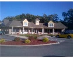
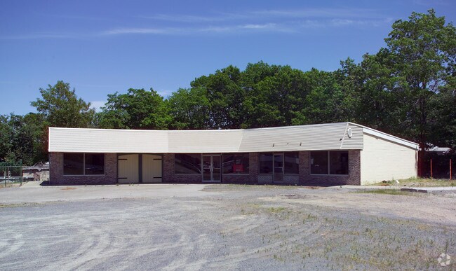
2 Crandall Rd
Commercialbuilding
Newport
GC
Rhode Island
B and X Area of moderate flood hazard, usually the area between the limits of the 100-year and 500-year floods.
1.50 AC
2025
Newport County
2025
Providence
041702
Providence-Warwick, RI-MA
4,229 SF
TIVE-000512-000000-000181
NEARBY LISTINGS FOR SALE OR LEASE
-
-
View all Tiverton listings for sale on LoopNet.com
DEMOGRAPHICS near 2 Crandall Rd
1 mile
3 mile
5 mile
2025 Total Population
1,720
13,218
84,163
2030 Population
1,658
13,046
84,334
Pop Growth 2025-2030
(3.60%)
(1.30%)
+ 0.20%
Average Age
47
46
42
2025 Total Households
714
5,393
35,958
HH Growth 2025-2030
(3.36%)
(1.15%)
+ 0.39%
Median Household Inc
$107,984
$104,775
$66,226
Avg Household Size
2.40
2.40
2.30
2025 Avg HH Vehicles
2.00
2.00
2.00
Median Home Value
$430,555
$452,602
$442,718
Median Year Built
1982
1978
1952
Nearby Places
Map Layers
Map Styles
 Street
 Aerial
Layers
 Traffic
 Biking
Places
Listings with unknown addresses are not visible on the map
- Restaurants
- Banks
- Shops
- Fitness
- Groceries
PUBLIC TRANSPORTATION
AIRPORT
Rhode Island Tf Green International
Drive
Walk
Distance
Rhode Island Tf Green International
46 min
29.5 mi
Freight Ports
Port of New Bedford Harbor
Drive
Walk
Distance
Port of New Bedford Harbor
24 min
14.3 mi
Nearby Properties
Address
Land Use
TOTAL SIZE
Lot Size
Zoning
Address
Land Use
TOTAL SIZE
Lot Size
Zoning
27.66 AC
I
Address
Land Use
TOTAL SIZE
Lot Size
Zoning
73,957 SF
46.62 AC
CO
Address
Land Use
TOTAL SIZE
Lot Size
Zoning
559.70 AC
S
Address
Land Use
TOTAL SIZE
Lot Size
Zoning
124,038 SF
74.50 AC
R60
Address
Land Use
TOTAL SIZE
Lot Size
Zoning
178,538 SF
17.27 AC
I
Address
Land Use
TOTAL SIZE
Lot Size
Zoning
144,773 SF
10.50 AC
R60
Address
Land Use
TOTAL SIZE
Lot Size
Zoning
9,288 SF
113.04 AC
R60
Address
Land Use
TOTAL SIZE
Lot Size
Zoning
10 AC
HC
Address
Land Use
TOTAL SIZE
Lot Size
Zoning
84,000 SF
3.31 AC
I
Address
Land Use
TOTAL SIZE
Lot Size
Zoning
22,847 SF
6.06 AC
GC
Address
Land Use
TOTAL SIZE
Lot Size
Zoning
40,985 SF
15.17 AC
R60
Address
Land Use
TOTAL SIZE
Lot Size
Zoning
13.49 AC
R30
Address
Land Use
TOTAL SIZE
Lot Size
Zoning
1,834 SF
205.53 AC
R80
Address
Land Use
TOTAL SIZE
Lot Size
Zoning
2,016 SF
25.73 AC
R40
Address
Land Use
TOTAL SIZE
Lot Size
Zoning
44.64 AC
I
Address
Land Use
TOTAL SIZE
Lot Size
Zoning
5 AC
R80
Address
Land Use
TOTAL SIZE
Lot Size
Zoning
28.59 AC
R80
Address
Land Use
TOTAL SIZE
Lot Size
Zoning
2.15 AC
R40
Address
Land Use
TOTAL SIZE
Lot Size
Zoning
7.30 AC
HC
Address
Land Use
TOTAL SIZE
Lot Size
Zoning
20,240 SF
6.89 AC
R60
Address
Land Use
TOTAL SIZE
Lot Size
Zoning
12 AC
I
Address
Land Use
TOTAL SIZE
Lot Size
Zoning
15,490 SF
1.46 AC
N/A
Address
Land Use
TOTAL SIZE
Lot Size
Zoning
2,912 SF
110.60 AC
R60
Address
Land Use
TOTAL SIZE
Lot Size
Zoning
2,664 SF
1.39 AC
R1
Address
Land Use
TOTAL SIZE
Lot Size
Zoning
135.87 AC
R60
Address
Land Use
TOTAL SIZE
Lot Size
Zoning
21,568 SF
6 AC
R60
Address
Land Use
TOTAL SIZE
Lot Size
Zoning
4,290 SF
0.98 AC
N/A
Address
Land Use
TOTAL SIZE
Lot Size
Zoning
4,458 SF
2.80 AC
R1
Address
Land Use
TOTAL SIZE
Lot Size
Zoning
3.75 AC
R60
Address
Land Use
TOTAL SIZE
Lot Size
Zoning
108.70 AC
R80
The World's #1 Commercial Real Estate Marketplace
Connect with us
© 2026 CoStar Group
The information above has been obtained from sources believed reliable. While we do not doubt its accuracy we have not verified it and make no guarantee, warranty or representation about it. It is your responsibility to independently confirm its accuracy and completeness. Any projections, opinions, assumptions, or estimates used are for example only and do not represent the current or future performance of the property. The value of this transaction to you depends on tax and other factors which should be evaluated by your tax, financial, and legal advisors. You and your advisors should conduct a careful, independent investigation of the property to determine to your satisfaction the suitability of the property for your needs.