Property Record
2 E Baltic St, Norwich, CT 06360
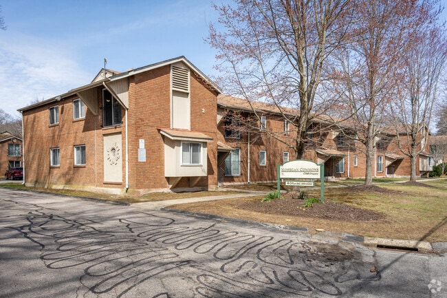

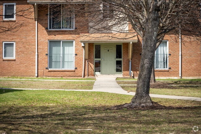
Property Detail
2 E Baltic St
NORW-000086-000005-000001
NEW LONDON
Apartmenthouse5plusunits
Connecticut
MF
1
B and X Area of moderate flood hazard, usually the area between the limits of the 100-year and 500-year floods.
6.65 AC
2025
Northeast New London/Norwich
2025
Hartford
696401
Norwich-New London-Willimantic, CT
NEARBY LISTINGS FOR SALE OR LEASE
-
-
View all Norwich listings for sale on LoopNet.com
DEMOGRAPHICS near 2 E Baltic St
1 mile
3 mile
5 mile
2025 Total Population
11,615
36,200
51,353
2030 Population
11,608
36,471
51,802
Pop Growth 2025-2030
(0.06%)
+ 0.75%
+ 0.87%
Average Age
38
40
41
2025 Total Households
4,672
15,088
21,272
HH Growth 2025-2030
(0.06%)
+ 0.76%
+ 0.85%
Median Household Inc
$54,982
$63,471
$70,410
Avg Household Size
2.30
2.30
2.30
2025 Avg HH Vehicles
1.00
2.00
2.00
Median Home Value
$234,647
$247,777
$262,947
Median Year Built
1948
1953
1959
Nearby Places
Map Layers
Map Styles
 Street
 Aerial
Layers
 Traffic
 Biking
Places
Listings with unknown addresses are not visible on the map
- Restaurants
- Banks
- Shops
- Fitness
- Groceries
Nearby Properties
Address
Land Use
TOTAL SIZE
Lot Size
Zoning
Address
Land Use
TOTAL SIZE
Lot Size
Zoning
45.74 AC
PDD
Address
Land Use
TOTAL SIZE
Lot Size
Zoning
200,847 SF
14.30 AC
R40
Address
Land Use
TOTAL SIZE
Lot Size
Zoning
16 AC
ROS
Address
Land Use
TOTAL SIZE
Lot Size
Zoning
Address
Land Use
TOTAL SIZE
Lot Size
Zoning
13.78 AC
R40
Address
Land Use
TOTAL SIZE
Lot Size
Zoning
179,652 SF
16.82 AC
PC
Address
Land Use
TOTAL SIZE
Lot Size
Zoning
2,102 SF
110.90 AC
PDD
Address
Land Use
TOTAL SIZE
Lot Size
Zoning
16,551 SF
18.11 AC
MF
Address
Land Use
TOTAL SIZE
Lot Size
Zoning
54.97 AC
GC
Address
Land Use
TOTAL SIZE
Lot Size
Zoning
128,565 SF
18.90 AC
R40
Address
Land Use
TOTAL SIZE
Lot Size
Zoning
129,948 SF
9.70 AC
PC
Address
Land Use
TOTAL SIZE
Lot Size
Zoning
18.66 AC
PC
Address
Land Use
TOTAL SIZE
Lot Size
Zoning
4.18 AC
R20
Address
Land Use
TOTAL SIZE
Lot Size
Zoning
8.78 AC
MF
Address
Land Use
TOTAL SIZE
Lot Size
Zoning
18,401 SF
12.88 AC
MF
Address
Land Use
TOTAL SIZE
Lot Size
Zoning
87,162 SF
30.20 AC
R20/MF
Address
Land Use
TOTAL SIZE
Lot Size
Zoning
152,265 SF
131 SF
ID
Address
Land Use
TOTAL SIZE
Lot Size
Zoning
151,735 SF
131 SF
ID
Address
Land Use
TOTAL SIZE
Lot Size
Zoning
79,192 SF
11.90 AC
MF
Address
Land Use
TOTAL SIZE
Lot Size
Zoning
6.39 AC
MF
Address
Land Use
TOTAL SIZE
Lot Size
Zoning
3.76 AC
MF
Address
Land Use
TOTAL SIZE
Lot Size
Zoning
351.80 AC
ROS
Address
Land Use
TOTAL SIZE
Lot Size
Zoning
70,639 SF
14 AC
R-80
Address
Land Use
TOTAL SIZE
Lot Size
Zoning
11.23 AC
MF
Address
Land Use
TOTAL SIZE
Lot Size
Zoning
3.85 AC
GC
Address
Land Use
TOTAL SIZE
Lot Size
Zoning
51,154 SF
0.38 AC
CC
Address
Land Use
TOTAL SIZE
Lot Size
Zoning
42,127 SF
0.63 AC
CC
Address
Land Use
TOTAL SIZE
Lot Size
Zoning
162,122 SF
8.48 AC
BP
Address
Land Use
TOTAL SIZE
Lot Size
Zoning
83,453 SF
5.80 AC
MF
Address
Land Use
TOTAL SIZE
Lot Size
Zoning
44,294 SF
5.18 AC
BP
The World's #1 Commercial Real Estate Marketplace
Connect with us
© 2026 CoStar Group
The information above has been obtained from sources believed reliable. While we do not doubt its accuracy we have not verified it and make no guarantee, warranty or representation about it. It is your responsibility to independently confirm its accuracy and completeness. Any projections, opinions, assumptions, or estimates used are for example only and do not represent the current or future performance of the property. The value of this transaction to you depends on tax and other factors which should be evaluated by your tax, financial, and legal advisors. You and your advisors should conduct a careful, independent investigation of the property to determine to your satisfaction the suitability of the property for your needs.