Property Record
10 E Texar Dr, Pensacola, FL 32503
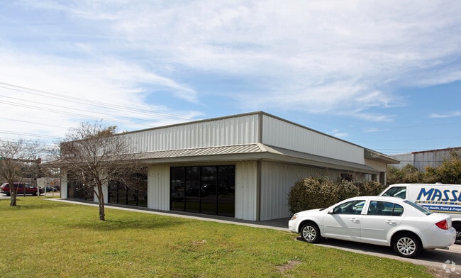


Property Detail
10 E Texar Dr
04-2S-30-5101-000-000
BEG AT SW COR OF N 1/2 OF MAURA GRANT N 37 DEG 2 MIN 12 SEC W ALG WLY LI OF GRANT 116 FT N 52 DEG 54 MIN 52 SEC E 29 78/100 FT TO ELY R/W OF PALAFOX HWY (78 50/100 FT R/W) FOR POB N 52 DEG 54 MIN 52 SEC E 860 66/100 FT TO WLY R/W OF LOUISVILLE & NASH
Warehouse
Escambia
M-2
Florida
B and X Area of moderate flood hazard, usually the area between the limits of the 100-year and 500-year floods.
3.73 AC
2024
Central Pensacola/S Brent
2025
Pensacola
001401
Pensacola-Ferry Pass-Brent, FL
15,480 SF
NEARBY LISTINGS FOR SALE OR LEASE
DEMOGRAPHICS near 10 E Texar Dr
1 mile
3 mile
5 mile
2025 Total Population
7,015
68,519
144,166
2030 Population
7,301
70,653
147,253
Pop Growth 2025-2030
+ 4.08%
+ 3.11%
+ 2.14%
Average Age
39
38
39
2025 Total Households
2,340
26,357
58,544
HH Growth 2025-2030
+ 4.36%
+ 3.25%
+ 2.16%
Median Household Inc
$38,036
$59,105
$64,052
Avg Household Size
2.40
2.30
2.30
2025 Avg HH Vehicles
1.00
2.00
2.00
Median Home Value
$178,630
$275,432
$254,416
Median Year Built
1967
1966
1973
Nearby Places
Map Layers
Map Styles
 Street
 Aerial
Transit
 Traffic
 Biking
Places
Listings with unknown addresses are not visible on the map
- Restaurants
- Banks
- Shops
- Fitness
- Groceries
PUBLIC TRANSPORTATION
AIRPORT
Pensacola International
Drive
Walk
Distance
Pensacola International
9 min
3.7 mi
Freight Ports
Port of Mobile
Drive
Walk
Distance
Port of Mobile
66 min
55.8 mi
SALE & LEASE HISTORY
LISTING DATE
SALE/LEASE

Sep 12, 2024
For Lease
Feb 08, 2023
For Lease
Nearby Properties
Address
Land Use
TOTAL SIZE
Lot Size
Zoning
Address
Land Use
TOTAL SIZE
Lot Size
Zoning
1,487,006 SF
39.92 AC
C-1
Address
Land Use
TOTAL SIZE
Lot Size
Zoning
820,379 SF
52.64 AC
C-3
Address
Land Use
TOTAL SIZE
Lot Size
Zoning
39.22 AC
R-1AA
Address
Land Use
TOTAL SIZE
Lot Size
Zoning
544,835 SF
3.29 AC
C-2,C-2A
Address
Land Use
TOTAL SIZE
Lot Size
Zoning
1,479,067 SF
77.37 AC
COM
Address
Land Use
TOTAL SIZE
Lot Size
Zoning
5,732 SF
71.97 AC
R-1AA
Address
Land Use
TOTAL SIZE
Lot Size
Zoning
365,037 SF
5.79 AC
C-3
Address
Land Use
TOTAL SIZE
Lot Size
Zoning
518,234 SF
30.84 AC
C-2
Address
Land Use
TOTAL SIZE
Lot Size
Zoning
296,361 SF
13.03 AC
GRD
Address
Land Use
TOTAL SIZE
Lot Size
Zoning
655,451 SF
1,269.99 AC
ARZ
Address
Land Use
TOTAL SIZE
Lot Size
Zoning
368,724 SF
3.17 AC
C-2A
Address
Land Use
TOTAL SIZE
Lot Size
Zoning
210,644 SF
13.14 AC
R-2
Address
Land Use
TOTAL SIZE
Lot Size
Zoning
56,970 SF
5.94 AC
WRD
Address
Land Use
TOTAL SIZE
Lot Size
Zoning
289,397 SF
12.38 AC
PUB
Address
Land Use
TOTAL SIZE
Lot Size
Zoning
197,545 SF
8.60 AC
R-2A
Address
Land Use
TOTAL SIZE
Lot Size
Zoning
171,830 SF
1.20 AC
C-1
Address
Land Use
TOTAL SIZE
Lot Size
Zoning
485,500 SF
15.92 AC
COM
Address
Land Use
TOTAL SIZE
Lot Size
Zoning
263,938 SF
58.17 AC
C-1,R-1AA,
Address
Land Use
TOTAL SIZE
Lot Size
Zoning
155,886 SF
5.98 AC
R-2
Address
Land Use
TOTAL SIZE
Lot Size
Zoning
189,008 SF
9.56 AC
R-2A
Address
Land Use
TOTAL SIZE
Lot Size
Zoning
327,045 SF
7.47 AC
C-2A
Address
Land Use
TOTAL SIZE
Lot Size
Zoning
168,911 SF
11.89 AC
C-2
Address
Land Use
TOTAL SIZE
Lot Size
Zoning
96,686 SF
1.06 AC
C-2A
Address
Land Use
TOTAL SIZE
Lot Size
Zoning
114,000 SF
3.23 AC
C-2,C-2A
Address
Land Use
TOTAL SIZE
Lot Size
Zoning
178,451 SF
3.88 AC
GRD
Address
Land Use
TOTAL SIZE
Lot Size
Zoning
156,182 SF
7.90 AC
R-2
Address
Land Use
TOTAL SIZE
Lot Size
Zoning
99,623 SF
1.87 AC
C-2A
Address
Land Use
TOTAL SIZE
Lot Size
Zoning
258,438 SF
48.49 AC
PUB
Address
Land Use
TOTAL SIZE
Lot Size
Zoning
282,738 SF
14.64 AC
PUB
Address
Land Use
TOTAL SIZE
Lot Size
Zoning
103,111 SF
12.02 AC
C-1
The World's #1 Commercial Real Estate Marketplace
Connect with us
© 2026 CoStar Group
The information above has been obtained from sources believed reliable. While we do not doubt its accuracy we have not verified it and make no guarantee, warranty or representation about it. It is your responsibility to independently confirm its accuracy and completeness. Any projections, opinions, assumptions, or estimates used are for example only and do not represent the current or future performance of the property. The value of this transaction to you depends on tax and other factors which should be evaluated by your tax, financial, and legal advisors. You and your advisors should conduct a careful, independent investigation of the property to determine to your satisfaction the suitability of the property for your needs.