Property Record
2 Gingerbread Ln, East Hampton, NY 11937
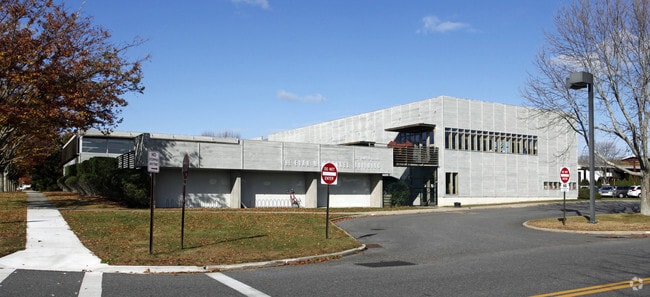


Property Detail
2 Gingerbread Ln
Nassau County-Suffolk County, NY
DAYTON/ORS WILKINSON/ANO SCH DIST #1 GINGERBREAD LA TC 260
0301-002-00-07-00-001-003
Suffolk
Publicschool
New York
B and X Area of moderate flood hazard, usually the area between the limits of the 100-year and 500-year floods.
1
0
10 AC
2025
Eastern Suffolk
200901
Long Island (New York)
NEARBY LISTINGS FOR SALE OR LEASE
DEMOGRAPHICS near 2 Gingerbread Ln
1 mile
3 mile
5 mile
2025 Total Population
4,118
17,382
31,294
2030 Population
4,492
18,787
33,402
Pop Growth 2025-2030
+ 9.08%
+ 8.08%
+ 6.74%
Average Age
46
45
44
2025 Total Households
1,661
6,730
11,982
HH Growth 2025-2030
+ 9.45%
+ 8.31%
+ 6.84%
Median Household Inc
$112,037
$114,133
$122,072
Avg Household Size
2.50
2.50
2.60
2025 Avg HH Vehicles
2.00
2.00
2.00
Median Home Value
$1,081,909
$1,059,548
$1,040,061
Median Year Built
1967
1980
1981
Nearby Places
Map Layers
Map Styles
 Street
 Aerial
Layers
 Traffic
 Biking
Places
Listings with unknown addresses are not visible on the map
- Restaurants
- Banks
- Shops
- Fitness
- Groceries
PUBLIC TRANSPORTATION
TRANSIT/SUBWAY
East Hampton Station (Montauk Branch - Long Island Rail Road)
Drive
Walk
Distance
East Hampton Station (Montauk Branch - Long Island Rail Road)
1 min
5 min
0.2 mi
COMMUTER RAIL
East Hampton Station (Montauk Branch - Long Island Rail Road)
Drive
Walk
Distance
East Hampton Station (Montauk Branch - Long Island Rail Road)
1 min
4 min
0.2 mi
Amagansett Station (Montauk Branch - Long Island Rail Road)
Drive
Walk
Distance
Amagansett Station (Montauk Branch - Long Island Rail Road)
9 min
3.7 mi
Freight Ports
Port of New Haven
Drive
Walk
Distance
Port of New Haven
199 min
88.8 mi
Nearby Properties
Address
Land Use
TOTAL SIZE
Lot Size
Zoning
Address
Land Use
TOTAL SIZE
Lot Size
Zoning
2,240 SF
19.46 AC
R40
Address
Land Use
TOTAL SIZE
Lot Size
Zoning
4,132 SF
1.08 AC
R40
Address
Land Use
TOTAL SIZE
Lot Size
Zoning
10,182 SF
0.79 AC
B2
Address
Land Use
TOTAL SIZE
Lot Size
Zoning
3,298 SF
0.18 AC
VILLA
Address
Land Use
TOTAL SIZE
Lot Size
Zoning
4,718 SF
1.09 AC
R20
Address
Land Use
TOTAL SIZE
Lot Size
Zoning
53.67 AC
Address
Land Use
TOTAL SIZE
Lot Size
Zoning
3.01 AC
Address
Land Use
TOTAL SIZE
Lot Size
Zoning
17.58 AC
Address
Land Use
TOTAL SIZE
Lot Size
Zoning
1.08 AC
VILLA
Address
Land Use
TOTAL SIZE
Lot Size
Zoning
2,039 SF
0.29 AC
HO
Address
Land Use
TOTAL SIZE
Lot Size
Zoning
Address
Land Use
TOTAL SIZE
Lot Size
Zoning
0.77 AC
R80
Address
Land Use
TOTAL SIZE
Lot Size
Zoning
Address
Land Use
TOTAL SIZE
Lot Size
Zoning
0.50 AC
R20
Address
Land Use
TOTAL SIZE
Lot Size
Zoning
Address
Land Use
TOTAL SIZE
Lot Size
Zoning
Address
Land Use
TOTAL SIZE
Lot Size
Zoning
8.10 AC
Address
Land Use
TOTAL SIZE
Lot Size
Zoning
2.10 AC
Address
Land Use
TOTAL SIZE
Lot Size
Zoning
0.82 AC
BD
Address
Land Use
TOTAL SIZE
Lot Size
Zoning
Address
Land Use
TOTAL SIZE
Lot Size
Zoning
4.50 AC
Address
Land Use
TOTAL SIZE
Lot Size
Zoning
62.64 AC
Address
Land Use
TOTAL SIZE
Lot Size
Zoning
Address
Land Use
TOTAL SIZE
Lot Size
Zoning
1.38 AC
Address
Land Use
TOTAL SIZE
Lot Size
Zoning
79.86 AC
Address
Land Use
TOTAL SIZE
Lot Size
Zoning
1.50 AC
Address
Land Use
TOTAL SIZE
Lot Size
Zoning
13.89 AC
Address
Land Use
TOTAL SIZE
Lot Size
Zoning
Address
Land Use
TOTAL SIZE
Lot Size
Zoning
0.72 AC
Address
Land Use
TOTAL SIZE
Lot Size
Zoning
9.50 AC
The World's #1 Commercial Real Estate Marketplace
Connect with us
© 2026 CoStar Group
The information above has been obtained from sources believed reliable. While we do not doubt its accuracy we have not verified it and make no guarantee, warranty or representation about it. It is your responsibility to independently confirm its accuracy and completeness. Any projections, opinions, assumptions, or estimates used are for example only and do not represent the current or future performance of the property. The value of this transaction to you depends on tax and other factors which should be evaluated by your tax, financial, and legal advisors. You and your advisors should conduct a careful, independent investigation of the property to determine to your satisfaction the suitability of the property for your needs.