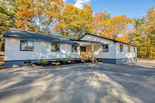
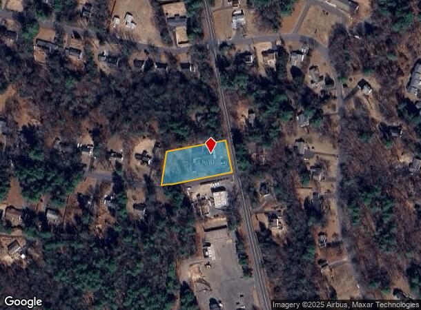
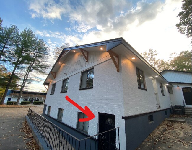
Property Record
2 Gordon St, Simsbury, CT 06070
NEARBY LISTINGS FOR SALE OR LEASE
Property Detail
2 Gordon St
SIMS-000003H-000426-000017
Hartford
Officebuilding
Connecticut
X
17
09003C0191F
0.88 AC
2025
Simsbury
2025
Hartford
466201
Hartford-West Hartford-East Hartford, CT
3,440 SF
DEMOGRAPHICS near 2 Gordon St
1 Mile
3 Mile
5 Mile
2024 Total Population
2,522
16,697
33,143
2029 Population
2,496
16,630
33,014
Pop Growth 2024-2029
(1.03%)
(0.40%)
(0.39%)
Average Age
42
43
44
2024 Total Households
1,093
6,729
13,241
HH Growth 2024-2029
(1.01%)
(0.48%)
(0.45%)
Median Household Inc
$97,876
$120,182
$120,963
Avg Household Size
2.30
2.40
2.40
2024 Avg HH Vehicles
2.00
2.00
2.00
Median Home Value
$337,222
$337,698
$339,407
Median Year Built
1976
1971
1973
Nearby Places
Map Layers
Map Styles
 Street
 Aerial
- Restaurants
- Banks
- Shops
- Fitness
- Groceries
PUBLIC TRANSPORTATION
AIRPORT
Bradley International
DRIVE
WALK
Distance
Bradley International
25 min
8.6 mi
Freight Ports
Port of New Haven
DRIVE
WALK
Distance
Port of New Haven
67 min
47.7 mi
SALE & LEASE HISTORY
LISTING DATE
SALE/LEASE

Sep 24, 2016
For Lease
Sep 24, 2016
For Sale
Jun 29, 2023
For Lease
Dec 21, 2023
For Lease
Dec 16, 2019
For Lease
Dec 16, 2019
For Sale
Apr 16, 2021
For Lease
Nearby Properties
Address
Land Use
TOTAL SIZE
Lot Size
Zoning
Address
Land Use
TOTAL SIZE
Lot Size
Zoning
221,054 SF
28.85 AC
R-40
Address
Land Use
TOTAL SIZE
Lot Size
Zoning
9,882 SF
181.60 AC
R-40
Address
Land Use
TOTAL SIZE
Lot Size
Zoning
139,125 SF
35 AC
R-15
Address
Land Use
TOTAL SIZE
Lot Size
Zoning
10.26 AC
PAD
Address
Land Use
TOTAL SIZE
Lot Size
Zoning
1,517 SF
45.69 AC
CC
Address
Land Use
TOTAL SIZE
Lot Size
Zoning
13,375 SF
25.15 AC
R-40
Address
Land Use
TOTAL SIZE
Lot Size
Zoning
89,800 SF
20.20 AC
R-40
Address
Land Use
TOTAL SIZE
Lot Size
Zoning
34.66 AC
T1
Address
Land Use
TOTAL SIZE
Lot Size
Zoning
101,000 SF
R-40
Address
Land Use
TOTAL SIZE
Lot Size
Zoning
1,576 SF
9.52 AC
T1
Address
Land Use
TOTAL SIZE
Lot Size
Zoning
110.71 AC
R-40
Address
Land Use
TOTAL SIZE
Lot Size
Zoning
26,941 SF
3.58 AC
SCZ
Address
Land Use
TOTAL SIZE
Lot Size
Zoning
49,484 SF
14 AC
R-15
Address
Land Use
TOTAL SIZE
Lot Size
Zoning
35,039 SF
3.97 AC
SCZ
Address
Land Use
TOTAL SIZE
Lot Size
Zoning
37,178 SF
4.40 AC
R-25
Address
Land Use
TOTAL SIZE
Lot Size
Zoning
70,317 SF
17.08 AC
I-1
Address
Land Use
TOTAL SIZE
Lot Size
Zoning
49,808 SF
7.19 AC
B-2
Address
Land Use
TOTAL SIZE
Lot Size
Zoning
1,225 SF
0.92 AC
R-40
Address
Land Use
TOTAL SIZE
Lot Size
Zoning
30,413 SF
6.13 AC
R-40
Address
Land Use
TOTAL SIZE
Lot Size
Zoning
16 AC
RD
Address
Land Use
TOTAL SIZE
Lot Size
Zoning
235.81 AC
I-1
Address
Land Use
TOTAL SIZE
Lot Size
Zoning
13.65 AC
R-40
Address
Land Use
TOTAL SIZE
Lot Size
Zoning
51,268 SF
4.80 AC
SCZ
Address
Land Use
TOTAL SIZE
Lot Size
Zoning
13,380 SF
4.04 AC
SCZ
Address
Land Use
TOTAL SIZE
Lot Size
Zoning
13,275 SF
5.92 AC
I-2
Address
Land Use
TOTAL SIZE
Lot Size
Zoning
13.05 AC
C2
Address
Land Use
TOTAL SIZE
Lot Size
Zoning
5.32 AC
ED
Address
Land Use
TOTAL SIZE
Lot Size
Zoning
15,940 SF
1.33 AC
SCZ
Address
Land Use
TOTAL SIZE
Lot Size
Zoning
14.38 AC
CC
Address
Land Use
TOTAL SIZE
Lot Size
Zoning
43,832 SF
3.50 AC
SCZ
The World's #1 Commercial Real Estate Marketplace
Connect with us
© 2026 CoStar Group
The information above has been obtained from sources believed reliable. While we do not doubt its accuracy we have not verified it and make no guarantee, warranty or representation about it. It is your responsibility to independently confirm its accuracy and completeness. Any projections, opinions, assumptions, or estimates used are for example only and do not represent the current or future performance of the property. The value of this transaction to you depends on tax and other factors which should be evaluated by your tax, financial, and legal advisors. You and your advisors should conduct a careful, independent investigation of the property to determine to your satisfaction the suitability of the property for your needs.