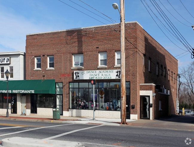
Property Record
3 Main St, Reisterstown, MD 21136


NEARBY LISTINGS FOR SALE OR LEASE
Property Detail
3 Main St
Baltimore-Columbia-Towson, MD
Opp Westminester
04-0403000126
.183 AC ES OPP WESTMINESTER
Storebuilding
Baltimore
X
Maryland
2400100205G
445
2024
0.18 AC
2025
Reisterstown Rd Corridor
404404
Baltimore
10,125 SF
DEMOGRAPHICS near 3 Main St
1 mile
3 mile
5 mile
2024 Total Population
7,063
38,343
73,164
2029 Population
6,980
37,767
72,463
Pop Growth 2024-2029
(1.18%)
(1.50%)
(0.96%)
Average Age
42
40
40
2024 Total Households
2,680
14,405
27,965
HH Growth 2024-2029
(1.16%)
(1.56%)
(1.00%)
Median Household Inc
$84,442
$86,150
$89,273
Avg Household Size
2.60
2.60
2.50
2024 Avg HH Vehicles
2.00
2.00
2.00
Median Home Value
$322,237
$354,137
$365,610
Median Year Built
1985
1982
1986
Nearby Places
Map Layers
Map Styles
 Street
 Aerial
Transit
 Traffic
 Biking
Places
Listings with unknown addresses are not visible on the map
- Restaurants
- Banks
- Shops
- Fitness
- Groceries
PUBLIC TRANSPORTATION
AIRPORT
Baltimore/Washington International Thurgood Marshall
Drive
Walk
Distance
Baltimore/Washington International Thurgood Marshall
37 min
24.7 mi
Freight Ports
Port of Baltimore
Drive
Walk
Distance
Port of Baltimore
37 min
25.2 mi
SALE & LEASE HISTORY
LISTING DATE
SALE/LEASE

Jul 02, 2019
For Lease
Nearby Properties
Address
Land Use
TOTAL SIZE
Lot Size
Zoning
Address
Land Use
TOTAL SIZE
Lot Size
Zoning
31,185 SF
486.08 AC
RC2
Address
Land Use
TOTAL SIZE
Lot Size
Zoning
18.87 AC
DR16
Address
Land Use
TOTAL SIZE
Lot Size
Zoning
151,140 SF
39.06 AC
Address
Land Use
TOTAL SIZE
Lot Size
Zoning
114,141 SF
54.89 AC
Address
Land Use
TOTAL SIZE
Lot Size
Zoning
15.86 AC
DR16
Address
Land Use
TOTAL SIZE
Lot Size
Zoning
4,762 SF
15.93 AC
BMCCC
Address
Land Use
TOTAL SIZE
Lot Size
Zoning
125,171 SF
8.80 AC
Address
Land Use
TOTAL SIZE
Lot Size
Zoning
11.76 AC
DR3.5
Address
Land Use
TOTAL SIZE
Lot Size
Zoning
8.47 AC
DR16
Address
Land Use
TOTAL SIZE
Lot Size
Zoning
212,692 SF
6.15 AC
DR16
Address
Land Use
TOTAL SIZE
Lot Size
Zoning
8.70 AC
DR16
Address
Land Use
TOTAL SIZE
Lot Size
Zoning
7.75 AC
DR5.5
Address
Land Use
TOTAL SIZE
Lot Size
Zoning
12.96 AC
DR16
Address
Land Use
TOTAL SIZE
Lot Size
Zoning
11.14 AC
DR16
Address
Land Use
TOTAL SIZE
Lot Size
Zoning
107,713 SF
3.85 AC
Address
Land Use
TOTAL SIZE
Lot Size
Zoning
157,975 SF
5.49 AC
BL
Address
Land Use
TOTAL SIZE
Lot Size
Zoning
7.13 AC
DR16
Address
Land Use
TOTAL SIZE
Lot Size
Zoning
6.97 AC
DR3.5
Address
Land Use
TOTAL SIZE
Lot Size
Zoning
7.93 AC
DR16
Address
Land Use
TOTAL SIZE
Lot Size
Zoning
6.88 AC
DR3.5
Address
Land Use
TOTAL SIZE
Lot Size
Zoning
91,776 SF
1.33 AC
Address
Land Use
TOTAL SIZE
Lot Size
Zoning
8.33 AC
DR16
Address
Land Use
TOTAL SIZE
Lot Size
Zoning
70,882 SF
19.06 AC
Address
Land Use
TOTAL SIZE
Lot Size
Zoning
58,200 SF
6.89 AC
BL
Address
Land Use
TOTAL SIZE
Lot Size
Zoning
5.91 AC
DR16
Address
Land Use
TOTAL SIZE
Lot Size
Zoning
15 AC
BMCCC
Address
Land Use
TOTAL SIZE
Lot Size
Zoning
7.36 AC
DR16
Address
Land Use
TOTAL SIZE
Lot Size
Zoning
69,077 SF
8.64 AC
DR3,3
Address
Land Use
TOTAL SIZE
Lot Size
Zoning
52,370 SF
9.13 AC
DR2
Address
Land Use
TOTAL SIZE
Lot Size
Zoning
6.87 AC
DR16
The World's #1 Commercial Real Estate Marketplace
Connect with us
© 2026 CoStar Group
The information above has been obtained from sources believed reliable. While we do not doubt its accuracy we have not verified it and make no guarantee, warranty or representation about it. It is your responsibility to independently confirm its accuracy and completeness. Any projections, opinions, assumptions, or estimates used are for example only and do not represent the current or future performance of the property. The value of this transaction to you depends on tax and other factors which should be evaluated by your tax, financial, and legal advisors. You and your advisors should conduct a careful, independent investigation of the property to determine to your satisfaction the suitability of the property for your needs.