Property Record
2 Hemingway Dr, Riverside, RI 02915
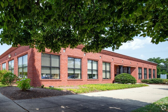

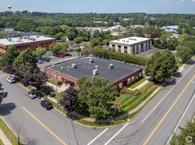

Property Detail
2 Hemingway Dr
EPRO-000508-000001-000008
PROVIDENCE
Commercialbuilding
Rhode Island
I1
8
B and X Area of moderate flood hazard, usually the area between the limits of the 100-year and 500-year floods.
0.86 AC
2025
East Providence
2025
Providence
010501
Providence-Warwick, RI-MA
9,555 SF
NEARBY LISTINGS FOR SALE OR LEASE
DEMOGRAPHICS near 2 Hemingway Dr
1 mile
3 mile
5 mile
2025 Total Population
7,151
70,171
239,280
2030 Population
7,410
72,323
245,599
Pop Growth 2025-2030
+ 3.62%
+ 3.07%
+ 2.64%
Average Age
44
42
40
2025 Total Households
3,061
29,822
96,830
HH Growth 2025-2030
+ 3.72%
+ 3.15%
+ 2.89%
Median Household Inc
$77,923
$79,282
$78,493
Avg Household Size
2.20
2.20
2.30
2025 Avg HH Vehicles
2.00
2.00
2.00
Median Home Value
$383,362
$397,241
$414,194
Median Year Built
1963
1954
1949
Nearby Places
Map Layers
Map Styles
 Street
 Aerial
Layers
 Traffic
 Biking
Places
Listings with unknown addresses are not visible on the map
- Restaurants
- Banks
- Shops
- Fitness
- Groceries
PUBLIC TRANSPORTATION
COMMUTER RAIL
Providence (Providence/Stoughton Line - Massachusetts Bay Transportation Authority Commuter Rail (Purple Line))
Drive
Walk
Distance
Providence (Providence/Stoughton Line - Massachusetts Bay Transportation Authority Commuter Rail (Purple Line))
9 min
5.6 mi
Pawtucket/Central Falls (Foxboro Event Service - MBTA, Providence/Stoughton Line - MBTA)
Drive
Walk
Distance
Pawtucket/Central Falls (Foxboro Event Service - MBTA, Providence/Stoughton Line - MBTA)
15 min
8.1 mi
AIRPORT
Rhode Island Tf Green International
Drive
Walk
Distance
Rhode Island Tf Green International
22 min
12.4 mi
Freight Ports
Port of Davisville, RI
Drive
Walk
Distance
Port of Davisville, RI
38 min
24.8 mi
SALE & LEASE HISTORY
LISTING DATE
SALE/LEASE

Nov 05, 2020
For Lease
Mar 04, 2021
For Sale
Nearby Properties
Address
Land Use
TOTAL SIZE
Lot Size
Zoning
Address
Land Use
TOTAL SIZE
Lot Size
Zoning
317,728 SF
28.20 AC
O1
Address
Land Use
TOTAL SIZE
Lot Size
Zoning
Address
Land Use
TOTAL SIZE
Lot Size
Zoning
7.53 AC
I-2
Address
Land Use
TOTAL SIZE
Lot Size
Zoning
15.20 AC
R5
Address
Land Use
TOTAL SIZE
Lot Size
Zoning
38.09 AC
CD
Address
Land Use
TOTAL SIZE
Lot Size
Zoning
104,999 SF
8.86 AC
C-3
Address
Land Use
TOTAL SIZE
Lot Size
Zoning
455.47 AC
I3
Address
Land Use
TOTAL SIZE
Lot Size
Zoning
139.58 AC
O1
Address
Land Use
TOTAL SIZE
Lot Size
Zoning
16.48 AC
W-3
Address
Land Use
TOTAL SIZE
Lot Size
Zoning
10.90 AC
EI
Address
Land Use
TOTAL SIZE
Lot Size
Zoning
225,067 SF
40.70 AC
HB
Address
Land Use
TOTAL SIZE
Lot Size
Zoning
4.91 AC
I-2
Address
Land Use
TOTAL SIZE
Lot Size
Zoning
8.05 AC
C1
Address
Land Use
TOTAL SIZE
Lot Size
Zoning
Address
Land Use
TOTAL SIZE
Lot Size
Zoning
18.01 AC
C3
Address
Land Use
TOTAL SIZE
Lot Size
Zoning
248,000 SF
75.88 AC
I
Address
Land Use
TOTAL SIZE
Lot Size
Zoning
4.62 AC
R5
Address
Land Use
TOTAL SIZE
Lot Size
Zoning
77,631 SF
2.97 AC
I-2
Address
Land Use
TOTAL SIZE
Lot Size
Zoning
12.67 AC
R5
Address
Land Use
TOTAL SIZE
Lot Size
Zoning
9.35 AC
C1
Address
Land Use
TOTAL SIZE
Lot Size
Zoning
170,345 SF
3.76 AC
R6
Address
Land Use
TOTAL SIZE
Lot Size
Zoning
171,290 SF
27.80 AC
R2
Address
Land Use
TOTAL SIZE
Lot Size
Zoning
53.20 AC
C1
Address
Land Use
TOTAL SIZE
Lot Size
Zoning
225,458 SF
24.95 AC
I1
Address
Land Use
TOTAL SIZE
Lot Size
Zoning
155,770 SF
1.37 AC
M-1
Address
Land Use
TOTAL SIZE
Lot Size
Zoning
201,941 SF
5.30 AC
I-2
Address
Land Use
TOTAL SIZE
Lot Size
Zoning
223,374 SF
14 AC
O1
Address
Land Use
TOTAL SIZE
Lot Size
Zoning
4.82 AC
I-2
Address
Land Use
TOTAL SIZE
Lot Size
Zoning
87,544 SF
5.05 AC
KP
Address
Land Use
TOTAL SIZE
Lot Size
Zoning
7.44 AC
R5
The World's #1 Commercial Real Estate Marketplace
Connect with us
© 2026 CoStar Group
The information above has been obtained from sources believed reliable. While we do not doubt its accuracy we have not verified it and make no guarantee, warranty or representation about it. It is your responsibility to independently confirm its accuracy and completeness. Any projections, opinions, assumptions, or estimates used are for example only and do not represent the current or future performance of the property. The value of this transaction to you depends on tax and other factors which should be evaluated by your tax, financial, and legal advisors. You and your advisors should conduct a careful, independent investigation of the property to determine to your satisfaction the suitability of the property for your needs.