Property Record
2 Highland St, Rochester, NH 03868
NEARBY LISTINGS FOR SALE OR LEASE
Property Detail
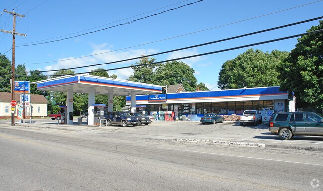
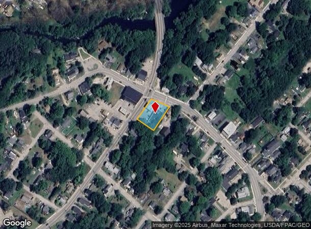
2 Highland St
Storebuilding
Strafford
X
New Hampshire
23031C0504G
0.39 AC
2024
Strafford County
2024
Boston
084202
Boston-Cambridge-Newton, MA-NH
3,400 SF
RCHE-000103-000106
DEMOGRAPHICS near 2 Highland St
1 Mile
3 Mile
5 Mile
2024 Total Population
2,345
18,442
36,160
2029 Population
2,437
19,250
37,812
Pop Growth 2024-2029
+ 3.92%
+ 4.38%
+ 4.57%
Average Age
40
43
43
2024 Total Households
959
7,792
15,089
HH Growth 2024-2029
+ 3.96%
+ 4.44%
+ 4.63%
Median Household Inc
$88,301
$76,489
$81,817
Avg Household Size
2.40
2.30
2.30
2024 Avg HH Vehicles
2.00
2.00
2.00
Median Home Value
$248,357
$229,675
$246,734
Median Year Built
1979
1974
1979
Nearby Places
Map Layers
Map Styles
 Street
 Aerial
- Restaurants
- Banks
- Shops
- Fitness
- Groceries
PUBLIC TRANSPORTATION
AIRPORT
Portsmouth International at Pease
DRIVE
WALK
Distance
Portsmouth International at Pease
37 min
22.4 mi
Freight Ports
Portland, ME
DRIVE
WALK
Distance
Portland, ME
64 min
47.1 mi
Nearby Properties
Address
Land Use
TOTAL SIZE
Lot Size
Zoning
Address
Land Use
TOTAL SIZE
Lot Size
Zoning
483,789 SF
37 AC
R2
Address
Land Use
TOTAL SIZE
Lot Size
Zoning
219,360 SF
6.23 AC
HSP
Address
Land Use
TOTAL SIZE
Lot Size
Zoning
86,420 SF
3.30 AC
DTC
Address
Land Use
TOTAL SIZE
Lot Size
Zoning
59,235 SF
22.08 AC
A
Address
Land Use
TOTAL SIZE
Lot Size
Zoning
68,535 SF
7.10 AC
R2
Address
Land Use
TOTAL SIZE
Lot Size
Zoning
236,340 SF
27.68 AC
HC
Address
Land Use
TOTAL SIZE
Lot Size
Zoning
58,500 SF
11.55 AC
R2
Address
Land Use
TOTAL SIZE
Lot Size
Zoning
111,807 SF
31.93 AC
HC
Address
Land Use
TOTAL SIZE
Lot Size
Zoning
49,146 SF
7.10 AC
R2
Address
Land Use
TOTAL SIZE
Lot Size
Zoning
221,995 SF
35.47 AC
IND
Address
Land Use
TOTAL SIZE
Lot Size
Zoning
53,517 SF
30 AC
A
Address
Land Use
TOTAL SIZE
Lot Size
Zoning
59,160 SF
10.44 AC
R1
Address
Land Use
TOTAL SIZE
Lot Size
Zoning
51,968 SF
5.40 AC
R2
Address
Land Use
TOTAL SIZE
Lot Size
Zoning
66,786 SF
2.41 AC
R2
Address
Land Use
TOTAL SIZE
Lot Size
Zoning
2,022 SF
5.01 AC
R2
Address
Land Use
TOTAL SIZE
Lot Size
Zoning
114,452 SF
5.81 AC
NMU
Address
Land Use
TOTAL SIZE
Lot Size
Zoning
40,577 SF
5.40 AC
R1
Address
Land Use
TOTAL SIZE
Lot Size
Zoning
87.64 AC
A
Address
Land Use
TOTAL SIZE
Lot Size
Zoning
65,452 SF
8.87 AC
HC
Address
Land Use
TOTAL SIZE
Lot Size
Zoning
49,889 SF
2.70 AC
R2
Address
Land Use
TOTAL SIZE
Lot Size
Zoning
30 AC
RA
Address
Land Use
TOTAL SIZE
Lot Size
Zoning
44,272 SF
27 AC
A
Address
Land Use
TOTAL SIZE
Lot Size
Zoning
23,623 SF
1.12 AC
DTC
Address
Land Use
TOTAL SIZE
Lot Size
Zoning
172,966 SF
36.48 AC
IND
Address
Land Use
TOTAL SIZE
Lot Size
Zoning
26,612 SF
31 AC
DTC
Address
Land Use
TOTAL SIZE
Lot Size
Zoning
1,500 SF
37 AC
R2
Address
Land Use
TOTAL SIZE
Lot Size
Zoning
1,288 SF
72 AC
A
Address
Land Use
TOTAL SIZE
Lot Size
Zoning
36,638 SF
4.71 AC
HSP
Address
Land Use
TOTAL SIZE
Lot Size
Zoning
21,504 SF
11.45 AC
R2
Address
Land Use
TOTAL SIZE
Lot Size
Zoning
16,080 SF
6.41 AC
IND
The World's #1 Commercial Real Estate Marketplace
Connect with us
© 2026 CoStar Group
The information above has been obtained from sources believed reliable. While we do not doubt its accuracy we have not verified it and make no guarantee, warranty or representation about it. It is your responsibility to independently confirm its accuracy and completeness. Any projections, opinions, assumptions, or estimates used are for example only and do not represent the current or future performance of the property. The value of this transaction to you depends on tax and other factors which should be evaluated by your tax, financial, and legal advisors. You and your advisors should conduct a careful, independent investigation of the property to determine to your satisfaction the suitability of the property for your needs.