Property Record
2 Linden Ln, Hyde Park, NY 12538
NEARBY LISTINGS FOR SALE OR LEASE
Property Detail
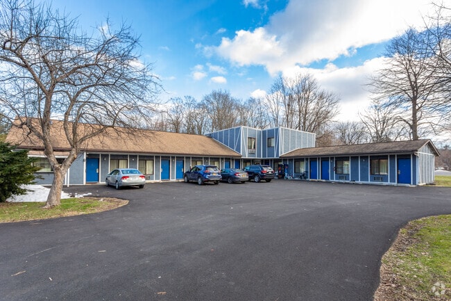
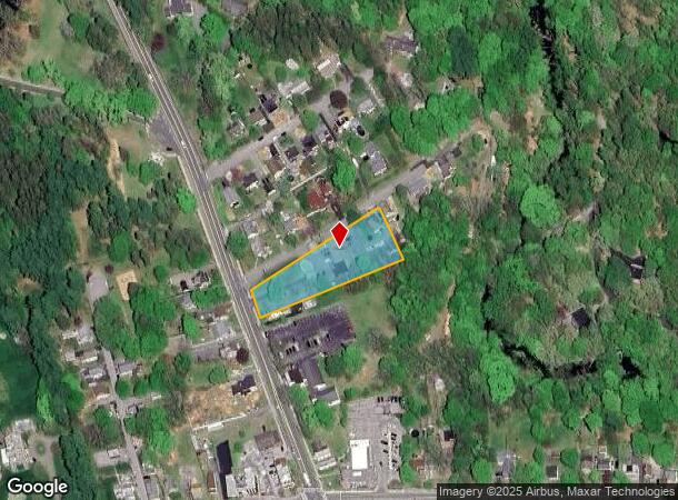
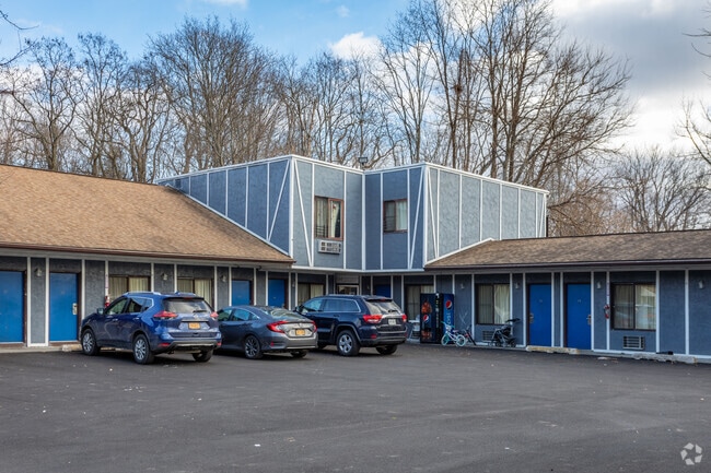
2 Linden Ln
133200-6065-04-817350-0000
1 AC 1986 0280 1955 0627
Motel
Dutchess
X
New York
36027C0266E
817
2025
1 AC
2024
Fishkill
070201
Westchester/So Connecticut
8,909 SF
Dutchess County-Putnam County, NY
DEMOGRAPHICS near 2 Linden Ln
1 Mile
3 Mile
5 Mile
2024 Total Population
2,399
11,795
31,779
2029 Population
2,396
11,781
31,780
Pop Growth 2024-2029
(0.13%)
(0.12%)
0.00%
Average Age
43
44
40
2024 Total Households
1,061
4,797
10,773
HH Growth 2024-2029
(0.19%)
(0.17%)
(0.04%)
Median Household Inc
$70,384
$78,322
$85,924
Avg Household Size
2.20
2.20
2.30
2024 Avg HH Vehicles
1.00
2.00
2.00
Median Home Value
$264,329
$265,315
$277,227
Median Year Built
1958
1966
1969
Nearby Places
- Restaurants
- Banks
- Shops
- Fitness
- Groceries
PUBLIC TRANSPORTATION
COMMUTER RAIL
Poughkeepsie Station (Hudson Line - Metro-North Commuter Railroad Company (Metro-North))
DRIVE
WALK
Distance
Poughkeepsie Station (Hudson Line - Metro-North Commuter Railroad Company (Metro-North))
9 min
6.5 mi
AIRPORT
New York Stewart International
DRIVE
WALK
Distance
New York Stewart International
42 min
30.0 mi
Freight Ports
Albany, NY Port
DRIVE
WALK
Distance
Albany, NY Port
91 min
64.2 mi
Nearby Properties
Address
Land Use
TOTAL SIZE
Lot Size
Zoning
Address
Land Use
TOTAL SIZE
Lot Size
Zoning
162.70 AC
R20
Address
Land Use
TOTAL SIZE
Lot Size
Zoning
15.50 AC
N
Address
Land Use
TOTAL SIZE
Lot Size
Zoning
250,645 SF
65 AC
GB
Address
Land Use
TOTAL SIZE
Lot Size
Zoning
23,195 SF
142.20 AC
RF1
Address
Land Use
TOTAL SIZE
Lot Size
Zoning
5,665 SF
510.60 AC
R40
Address
Land Use
TOTAL SIZE
Lot Size
Zoning
53,841 SF
195.70 AC
WF
Address
Land Use
TOTAL SIZE
Lot Size
Zoning
169,527 SF
56.30 AC
N
Address
Land Use
TOTAL SIZE
Lot Size
Zoning
14,786 SF
24.80 AC
R40
Address
Land Use
TOTAL SIZE
Lot Size
Zoning
59,424 SF
15.41 AC
TCHD
Address
Land Use
TOTAL SIZE
Lot Size
Zoning
132,561 SF
15 AC
TCHD
Address
Land Use
TOTAL SIZE
Lot Size
Zoning
21,440 SF
33.20 AC
WF
Address
Land Use
TOTAL SIZE
Lot Size
Zoning
108,714 SF
64.17 AC
N
Address
Land Use
TOTAL SIZE
Lot Size
Zoning
49,334 SF
16.30 AC
WF
Address
Land Use
TOTAL SIZE
Lot Size
Zoning
47,524 SF
13 AC
N
Address
Land Use
TOTAL SIZE
Lot Size
Zoning
80,688 SF
86.88 AC
WF
Address
Land Use
TOTAL SIZE
Lot Size
Zoning
21,464 SF
7.69 AC
EPBD
Address
Land Use
TOTAL SIZE
Lot Size
Zoning
123,407 SF
7.71 AC
NC
Address
Land Use
TOTAL SIZE
Lot Size
Zoning
11,483 SF
15.25 AC
NC
Address
Land Use
TOTAL SIZE
Lot Size
Zoning
17,531 SF
176.08 AC
GB
Address
Land Use
TOTAL SIZE
Lot Size
Zoning
30,114 SF
23.40 AC
WF
Address
Land Use
TOTAL SIZE
Lot Size
Zoning
52,509 SF
14.28 AC
TCHD
Address
Land Use
TOTAL SIZE
Lot Size
Zoning
371.40 AC
R1
Address
Land Use
TOTAL SIZE
Lot Size
Zoning
3,696 SF
13.70 AC
R40
Address
Land Use
TOTAL SIZE
Lot Size
Zoning
9,325 SF
4 AC
GC
Address
Land Use
TOTAL SIZE
Lot Size
Zoning
130.56 AC
RF1
Address
Land Use
TOTAL SIZE
Lot Size
Zoning
27,597 SF
8.76 AC
R40
Address
Land Use
TOTAL SIZE
Lot Size
Zoning
60.60 AC
WF
Address
Land Use
TOTAL SIZE
Lot Size
Zoning
17,982 SF
21.36 AC
EPBD
Address
Land Use
TOTAL SIZE
Lot Size
Zoning
13,908 SF
11.86 AC
EPBD
Address
Land Use
TOTAL SIZE
Lot Size
Zoning
48,075 SF
3.30 AC
WF
The World's #1 Commercial Real Estate Marketplace
Connect with us
© 2025 CoStar Group
The information above has been obtained from sources believed reliable. While we do not doubt its accuracy we have not verified it and make no guarantee, warranty or representation about it. It is your responsibility to independently confirm its accuracy and completeness. Any projections, opinions, assumptions, or estimates used are for example only and do not represent the current or future performance of the property. The value of this transaction to you depends on tax and other factors which should be evaluated by your tax, financial, and legal advisors. You and your advisors should conduct a careful, independent investigation of the property to determine to your satisfaction the suitability of the property for your needs.