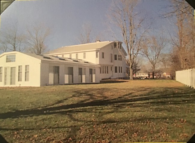
Property Record
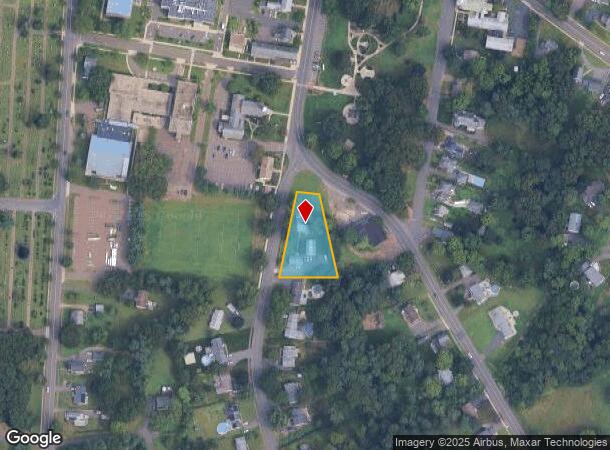
2 Maple Ave, North Haven, CT 06473
Property Detail
2 Maple Ave
NRHV-000060-000000-000195
New Haven
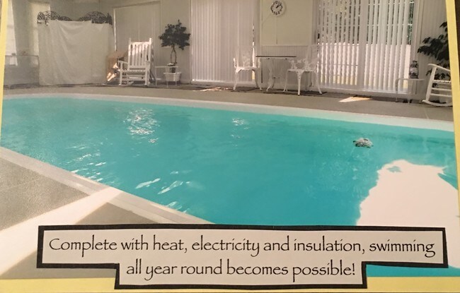
Duplex
Connecticut
X
195
09009C0313K
0.69 AC
2025
North Haven
2025
Westchester/So Connecticut
167201
New Haven, CT
4,124 SF
NEARBY LISTINGS FOR SALE OR LEASE
DEMOGRAPHICS near 2 Maple Ave
1 mile
3 mile
5 mile
2024 Total Population
5,176
41,158
120,343
2029 Population
5,170
41,154
120,237
Pop Growth 2024-2029
(0.12%)
(0.01%)
(0.09%)
Average Age
44
43
42
2024 Total Households
2,201
16,389
48,490
HH Growth 2024-2029
(0.09%)
(0.08%)
(0.07%)
Median Household Inc
$89,408
$99,736
$84,793
Avg Household Size
2.30
2.40
2.30
2024 Avg HH Vehicles
2.00
2.00
2.00
Median Home Value
$303,448
$306,483
$283,005
Median Year Built
1966
1966
1967
Nearby Places
Map Layers
Map Styles
 Street
 Aerial
Transit
 Traffic
 Biking
Places
Listings with unknown addresses are not visible on the map
- Restaurants
- Banks
- Shops
- Fitness
- Groceries
PUBLIC TRANSPORTATION
COMMUTER RAIL
Drive
Walk
Distance
9 min
5.5 mi
Drive
Walk
Distance
10 min
5.8 mi
AIRPORT
Tweed/New Haven
Drive
Walk
Distance
Tweed/New Haven
21 min
9.6 mi
Freight Ports
Port of New Haven
Drive
Walk
Distance
Port of New Haven
16 min
8.0 mi
SALE & LEASE HISTORY
LISTING DATE
SALE/LEASE

Sep 01, 2017
For Sale
Oct 11, 2017
For Sale
Nearby Properties
Address
Land Use
TOTAL SIZE
Lot Size
Zoning
Address
Land Use
TOTAL SIZE
Lot Size
Zoning
100 AC
LO15
Address
Land Use
TOTAL SIZE
Lot Size
Zoning
268,989 SF
22.59 AC
R20
Address
Land Use
TOTAL SIZE
Lot Size
Zoning
855,000 SF
142.06 AC
IL80
Address
Land Use
TOTAL SIZE
Lot Size
Zoning
5.14 AC
H/C
Address
Land Use
TOTAL SIZE
Lot Size
Zoning
33,122 SF
23.06 AC
T4
Address
Land Use
TOTAL SIZE
Lot Size
Zoning
28,824 SF
44.93 AC
T4
Address
Land Use
TOTAL SIZE
Lot Size
Zoning
15.32 AC
T4
Address
Land Use
TOTAL SIZE
Lot Size
Zoning
66.68 AC
IG80
Address
Land Use
TOTAL SIZE
Lot Size
Zoning
36,520 SF
4.64 AC
IL30
Address
Land Use
TOTAL SIZE
Lot Size
Zoning
17.71 AC
IL80
Address
Land Use
TOTAL SIZE
Lot Size
Zoning
57,467 SF
3.72 AC
T4
Address
Land Use
TOTAL SIZE
Lot Size
Zoning
134,029 SF
27.54 AC
R20
Address
Land Use
TOTAL SIZE
Lot Size
Zoning
97,898 SF
11.40 AC
R20
Address
Land Use
TOTAL SIZE
Lot Size
Zoning
23.40 AC
IG80
Address
Land Use
TOTAL SIZE
Lot Size
Zoning
27.36 AC
IL80
Address
Land Use
TOTAL SIZE
Lot Size
Zoning
10.70 AC
IL30
Address
Land Use
TOTAL SIZE
Lot Size
Zoning
119,658 SF
7.48 AC
O12
Address
Land Use
TOTAL SIZE
Lot Size
Zoning
3 AC
T5
Address
Land Use
TOTAL SIZE
Lot Size
Zoning
3.84 AC
CB40
Address
Land Use
TOTAL SIZE
Lot Size
Zoning
17,949 SF
8.02 AC
CB40
Address
Land Use
TOTAL SIZE
Lot Size
Zoning
15.57 AC
IL80
Address
Land Use
TOTAL SIZE
Lot Size
Zoning
85,974 SF
7.05 AC
T-4
Address
Land Use
TOTAL SIZE
Lot Size
Zoning
9.80 AC
CA20
Address
Land Use
TOTAL SIZE
Lot Size
Zoning
15,432 SF
5.67 AC
CB40
Address
Land Use
TOTAL SIZE
Lot Size
Zoning
17.73 AC
IL30
Address
Land Use
TOTAL SIZE
Lot Size
Zoning
20.01 AC
R20
Address
Land Use
TOTAL SIZE
Lot Size
Zoning
4.45 AC
CB40
Address
Land Use
TOTAL SIZE
Lot Size
Zoning
11.88 AC
T5
Address
Land Use
TOTAL SIZE
Lot Size
Zoning
125,680 SF
10.70 AC
IL80
Address
Land Use
TOTAL SIZE
Lot Size
Zoning
59,567 SF
20.43 AC
T4
The World's #1 Commercial Real Estate Marketplace
Connect with us
© 2026 CoStar Group
The information above has been obtained from sources believed reliable. While we do not doubt its accuracy we have not verified it and make no guarantee, warranty or representation about it. It is your responsibility to independently confirm its accuracy and completeness. Any projections, opinions, assumptions, or estimates used are for example only and do not represent the current or future performance of the property. The value of this transaction to you depends on tax and other factors which should be evaluated by your tax, financial, and legal advisors. You and your advisors should conduct a careful, independent investigation of the property to determine to your satisfaction the suitability of the property for your needs.