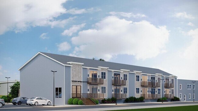
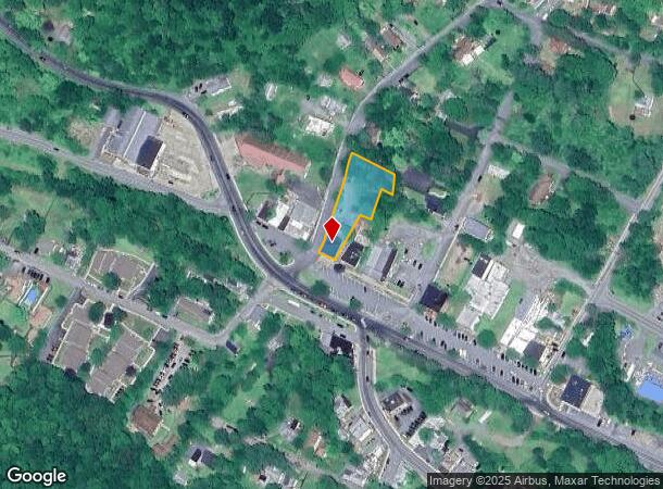
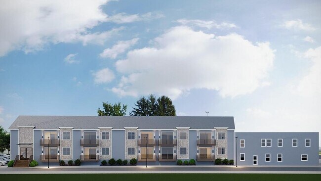
Property Record
2 Maple Ave S, Woodridge, NY 12789
NEARBY LISTINGS FOR SALE OR LEASE
Property Detail
2 Maple Ave S
Commercialofficeresidentialmixeduse
Sullivan
X
New York
36111C0675F
9
2025
0.71 AC
2024
Hudson Valley Area
951000
Other Market Areas
5,001 SF
2801-106-0-0002-009-000
DEMOGRAPHICS near 2 Maple Ave S
1 Mile
3 Mile
5 Mile
2024 Total Population
1,238
6,270
11,636
2029 Population
1,358
6,562
11,916
Pop Growth 2024-2029
+ 9.69%
+ 4.66%
+ 2.41%
Average Age
41
40
40
2024 Total Households
522
1,835
3,324
HH Growth 2024-2029
+ 9.96%
+ 6.10%
+ 3.01%
Median Household Inc
$63,596
$52,685
$45,319
Avg Household Size
2.30
2.60
2.60
2024 Avg HH Vehicles
2.00
2.00
2.00
Median Home Value
$129,845
$145,628
$180,430
Median Year Built
1985
1985
1981
Nearby Places
- Restaurants
- Banks
- Shops
- Fitness
- Groceries
PUBLIC TRANSPORTATION
AIRPORT
New York Stewart International
DRIVE
WALK
Distance
New York Stewart International
63 min
39.5 mi
Freight Ports
Port Newark Container Terminal
DRIVE
WALK
Distance
Port Newark Container Terminal
130 min
96.5 mi
SALE & LEASE HISTORY
LISTING DATE
SALE/LEASE

Mar 11, 2025
For Sale
Nearby Properties
Address
Land Use
TOTAL SIZE
Lot Size
Zoning
Address
Land Use
TOTAL SIZE
Lot Size
Zoning
0.01 AC
Address
Land Use
TOTAL SIZE
Lot Size
Zoning
0.01 AC
Address
Land Use
TOTAL SIZE
Lot Size
Zoning
14,628 SF
45.40 AC
Address
Land Use
TOTAL SIZE
Lot Size
Zoning
Address
Land Use
TOTAL SIZE
Lot Size
Zoning
8,000 SF
120.56 AC
RR
Address
Land Use
TOTAL SIZE
Lot Size
Zoning
3,506 SF
125.90 AC
Address
Land Use
TOTAL SIZE
Lot Size
Zoning
120.40 AC
R1
Address
Land Use
TOTAL SIZE
Lot Size
Zoning
1,100 SF
28.11 AC
Address
Land Use
TOTAL SIZE
Lot Size
Zoning
61,486 SF
55.90 AC
Address
Land Use
TOTAL SIZE
Lot Size
Zoning
33,408 SF
13.65 AC
B1
Address
Land Use
TOTAL SIZE
Lot Size
Zoning
29.51 AC
Address
Land Use
TOTAL SIZE
Lot Size
Zoning
16,520 SF
4.50 AC
R1
Address
Land Use
TOTAL SIZE
Lot Size
Zoning
2,106 SF
32.40 AC
Address
Land Use
TOTAL SIZE
Lot Size
Zoning
1,500 SF
274.95 AC
Address
Land Use
TOTAL SIZE
Lot Size
Zoning
1,418 SF
12.49 AC
Address
Land Use
TOTAL SIZE
Lot Size
Zoning
10,472 SF
4.10 AC
B2
Address
Land Use
TOTAL SIZE
Lot Size
Zoning
6,060 SF
92.14 AC
Address
Land Use
TOTAL SIZE
Lot Size
Zoning
6,744 SF
4.50 AC
Address
Land Use
TOTAL SIZE
Lot Size
Zoning
5,432 SF
78.26 AC
Address
Land Use
TOTAL SIZE
Lot Size
Zoning
5,255 SF
44.94 AC
R1
Address
Land Use
TOTAL SIZE
Lot Size
Zoning
70,295 SF
1.47 AC
Address
Land Use
TOTAL SIZE
Lot Size
Zoning
15,872 SF
23.99 AC
Address
Land Use
TOTAL SIZE
Lot Size
Zoning
1.11 AC
Address
Land Use
TOTAL SIZE
Lot Size
Zoning
2,400 SF
17.12 AC
Address
Land Use
TOTAL SIZE
Lot Size
Zoning
2,320 SF
18.91 AC
Address
Land Use
TOTAL SIZE
Lot Size
Zoning
3,392 SF
174 AC
F
Address
Land Use
TOTAL SIZE
Lot Size
Zoning
6,093 SF
0.40 AC
B2
Address
Land Use
TOTAL SIZE
Lot Size
Zoning
9,048 SF
50.43 AC
Address
Land Use
TOTAL SIZE
Lot Size
Zoning
21,456 SF
22.86 AC
Address
Land Use
TOTAL SIZE
Lot Size
Zoning
30,916 SF
138 AC
The World's #1 Commercial Real Estate Marketplace
Connect with us
© 2025 CoStar Group
The information above has been obtained from sources believed reliable. While we do not doubt its accuracy we have not verified it and make no guarantee, warranty or representation about it. It is your responsibility to independently confirm its accuracy and completeness. Any projections, opinions, assumptions, or estimates used are for example only and do not represent the current or future performance of the property. The value of this transaction to you depends on tax and other factors which should be evaluated by your tax, financial, and legal advisors. You and your advisors should conduct a careful, independent investigation of the property to determine to your satisfaction the suitability of the property for your needs.