Property Record
2 Meehan Ln, Cumberland, RI 02864


Property Detail
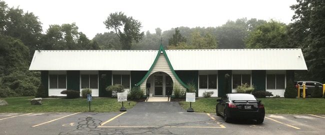
2 Meehan Ln
Commercialbuilding
Providence
30
Rhode Island
B and X Area of moderate flood hazard, usually the area between the limits of the 100-year and 500-year floods.
2.73 AC
2025
Woonsocket
2025
Providence
011402
Providence-Warwick, RI-MA
4,000 SF
CUMB-000044-000030-000000
NEARBY LISTINGS FOR SALE OR LEASE
DEMOGRAPHICS near 2 Meehan Ln
1 mile
3 mile
5 mile
2025 Total Population
3,352
36,937
109,466
2030 Population
3,500
38,447
113,210
Pop Growth 2025-2030
+ 4.42%
+ 4.09%
+ 3.42%
Average Age
43
43
41
2025 Total Households
1,354
14,806
43,874
HH Growth 2025-2030
+ 4.36%
+ 4.07%
+ 3.42%
Median Household Inc
$132,849
$108,111
$87,966
Avg Household Size
2.40
2.40
2.40
2025 Avg HH Vehicles
2.00
2.00
2.00
Median Home Value
$446,047
$430,268
$429,241
Median Year Built
1974
1972
1965
Nearby Places
Map Layers
Map Styles
 Street
 Aerial
Layers
 Traffic
 Biking
Places
Listings with unknown addresses are not visible on the map
- Restaurants
- Banks
- Shops
- Fitness
- Groceries
PUBLIC TRANSPORTATION
COMMUTER RAIL
Drive
Walk
Distance
15 min
9.0 mi
AIRPORT
Rhode Island Tf Green International
Drive
Walk
Distance
Rhode Island Tf Green International
36 min
22.7 mi
Worcester Regional
Drive
Walk
Distance
Worcester Regional
51 min
36.8 mi
General Edward Lawrence Logan International
Drive
Walk
Distance
General Edward Lawrence Logan International
68 min
49.8 mi
Freight Ports
Port of Davisville, RI
Drive
Walk
Distance
Port of Davisville, RI
49 min
35.1 mi
SALE & LEASE HISTORY
LISTING DATE
SALE/LEASE

Oct 15, 2021
For Sale
Oct 01, 2021
For Sale
Jan 05, 2022
For Lease
Nearby Properties
Address
Land Use
TOTAL SIZE
Lot Size
Zoning
Address
Land Use
TOTAL SIZE
Lot Size
Zoning
227,000 SF
6.72 AC
R3
Address
Land Use
TOTAL SIZE
Lot Size
Zoning
41.01 AC
30
Address
Land Use
TOTAL SIZE
Lot Size
Zoning
16.10 AC
60
Address
Land Use
TOTAL SIZE
Lot Size
Zoning
26.54 AC
90
Address
Land Use
TOTAL SIZE
Lot Size
Zoning
17.10 AC
I1
Address
Land Use
TOTAL SIZE
Lot Size
Zoning
11.61 AC
60
Address
Land Use
TOTAL SIZE
Lot Size
Zoning
18.49 AC
60
Address
Land Use
TOTAL SIZE
Lot Size
Zoning
5,520 SF
9.81 AC
R1
Address
Land Use
TOTAL SIZE
Lot Size
Zoning
115,258 SF
10.08 AC
100
Address
Land Use
TOTAL SIZE
Lot Size
Zoning
19,774 SF
23.53 AC
R1
Address
Land Use
TOTAL SIZE
Lot Size
Zoning
8.33 AC
R2
Address
Land Use
TOTAL SIZE
Lot Size
Zoning
105,384 SF
17.07 AC
120
Address
Land Use
TOTAL SIZE
Lot Size
Zoning
10.09 AC
RG7
Address
Land Use
TOTAL SIZE
Lot Size
Zoning
149,422 SF
14.45 AC
60
Address
Land Use
TOTAL SIZE
Lot Size
Zoning
403,844 SF
10.78 AC
I2
Address
Land Use
TOTAL SIZE
Lot Size
Zoning
65,344 SF
12.03 AC
40
Address
Land Use
TOTAL SIZE
Lot Size
Zoning
5.63 AC
R2
Address
Land Use
TOTAL SIZE
Lot Size
Zoning
74,147 SF
19.64 AC
RS12
Address
Land Use
TOTAL SIZE
Lot Size
Zoning
9.28 AC
60
Address
Land Use
TOTAL SIZE
Lot Size
Zoning
23.19 AC
C2
Address
Land Use
TOTAL SIZE
Lot Size
Zoning
103,988 SF
25.42 AC
30
Address
Land Use
TOTAL SIZE
Lot Size
Zoning
85,921 SF
34.74 AC
90
Address
Land Use
TOTAL SIZE
Lot Size
Zoning
69,708 SF
3.23 AC
120
Address
Land Use
TOTAL SIZE
Lot Size
Zoning
8.25 AC
C2
Address
Land Use
TOTAL SIZE
Lot Size
Zoning
51,622 SF
8.14 AC
30
Address
Land Use
TOTAL SIZE
Lot Size
Zoning
142.75 AC
CR1
Address
Land Use
TOTAL SIZE
Lot Size
Zoning
8.29 AC
50
Address
Land Use
TOTAL SIZE
Lot Size
Zoning
41,206 SF
2.92 AC
R3
Address
Land Use
TOTAL SIZE
Lot Size
Zoning
2,576 SF
604.70 AC
Address
Land Use
TOTAL SIZE
Lot Size
Zoning
4 AC
RG7
The World's #1 Commercial Real Estate Marketplace
Connect with us
© 2026 CoStar Group
The information above has been obtained from sources believed reliable. While we do not doubt its accuracy we have not verified it and make no guarantee, warranty or representation about it. It is your responsibility to independently confirm its accuracy and completeness. Any projections, opinions, assumptions, or estimates used are for example only and do not represent the current or future performance of the property. The value of this transaction to you depends on tax and other factors which should be evaluated by your tax, financial, and legal advisors. You and your advisors should conduct a careful, independent investigation of the property to determine to your satisfaction the suitability of the property for your needs.