Property Record
2 N Airport Loop, Rogers, AR 72756

This Property Is For Sale
NEARBY LISTINGS FOR SALE OR LEASE
Property Detail
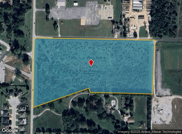
2 N Airport Loop
Fayetteville-Springdale-Rogers, AR
Rogers
02-00634-002
A TRACT OF LAND IN THE FRACTIONAL NW1/4 OF THE SW1/4 OF SECTION 30, TOWNSHIP 20 NORTH, RANGE 29 WEST, CITY OF ROGERS, BENTON COUNTY, ARKANSAS, BEING MORE PARTICULARLY DESCRIBED AS FOLLOWS: BEGINNING AT THE NORTHWEST CORNER OF SAID FRACTIONAL NW1/4 OF
Residentialacreage
Benton
X
Arkansas
05007C0115K
17.26 AC
2025
East Rogers
2025
Fayetteville/Springdale/Rogers
020203
DEMOGRAPHICS near 2 N Airport Loop
1 mile
3 mile
5 mile
2024 Total Population
1,321
20,286
72,074
2029 Population
1,534
23,678
84,336
Pop Growth 2024-2029
+ 16.12%
+ 16.72%
+ 17.01%
Average Age
38
37
38
2024 Total Households
411
7,262
26,355
HH Growth 2024-2029
+ 16.06%
+ 16.74%
+ 17.09%
Median Household Inc
$77,344
$64,597
$66,499
Avg Household Size
2.80
2.70
2.60
2024 Avg HH Vehicles
2.00
2.00
2.00
Median Home Value
$268,124
$249,516
$212,292
Median Year Built
1989
1990
1990
Nearby Places
Map Layers
Map Styles
 Street
 Aerial
Transit
 Traffic
 Biking
Places
Listings with unknown addresses are not visible on the map
- Restaurants
- Banks
- Shops
- Fitness
- Groceries
PUBLIC TRANSPORTATION
AIRPORT
Northwest Arkansas Ntl
Drive
Walk
Distance
Northwest Arkansas Ntl
35 min
17.7 mi
Freight Ports
Tulsa Port of Inola
Drive
Walk
Distance
Tulsa Port of Inola
122 min
102.9 mi
Nearby Properties
Address
Land Use
TOTAL SIZE
Lot Size
Zoning
Address
Land Use
TOTAL SIZE
Lot Size
Zoning
117,522 SF
0.12 AC
Address
Land Use
TOTAL SIZE
Lot Size
Zoning
573,476 SF
57.80 AC
Address
Land Use
TOTAL SIZE
Lot Size
Zoning
249,843 SF
19.21 AC
Address
Land Use
TOTAL SIZE
Lot Size
Zoning
214,791 SF
9.13 AC
Address
Land Use
TOTAL SIZE
Lot Size
Zoning
156,100 SF
7.89 AC
Address
Land Use
TOTAL SIZE
Lot Size
Zoning
152,759 SF
12.01 AC
Address
Land Use
TOTAL SIZE
Lot Size
Zoning
114,250 SF
7.54 AC
Address
Land Use
TOTAL SIZE
Lot Size
Zoning
117,522 SF
13.66 AC
Address
Land Use
TOTAL SIZE
Lot Size
Zoning
231,576 SF
15.18 AC
Address
Land Use
TOTAL SIZE
Lot Size
Zoning
46,851 SF
4.28 AC
Address
Land Use
TOTAL SIZE
Lot Size
Zoning
263,095 SF
13.17 AC
Address
Land Use
TOTAL SIZE
Lot Size
Zoning
402,500 SF
19.54 AC
Address
Land Use
TOTAL SIZE
Lot Size
Zoning
112,935 SF
6.75 AC
Address
Land Use
TOTAL SIZE
Lot Size
Zoning
195,563 SF
15.49 AC
Address
Land Use
TOTAL SIZE
Lot Size
Zoning
109,683 SF
Address
Land Use
TOTAL SIZE
Lot Size
Zoning
143,368 SF
11.72 AC
Address
Land Use
TOTAL SIZE
Lot Size
Zoning
160,798 SF
14.84 AC
Address
Land Use
TOTAL SIZE
Lot Size
Zoning
57,609 SF
8.53 AC
Address
Land Use
TOTAL SIZE
Lot Size
Zoning
123,568 SF
12.12 AC
Address
Land Use
TOTAL SIZE
Lot Size
Zoning
77,040 SF
6.69 AC
Address
Land Use
TOTAL SIZE
Lot Size
Zoning
172,912 SF
9.80 AC
Address
Land Use
TOTAL SIZE
Lot Size
Zoning
34,037 SF
9.45 AC
Address
Land Use
TOTAL SIZE
Lot Size
Zoning
210,915 SF
15.28 AC
Address
Land Use
TOTAL SIZE
Lot Size
Zoning
109,704 SF
11.57 AC
Address
Land Use
TOTAL SIZE
Lot Size
Zoning
278,819 SF
20 AC
Address
Land Use
TOTAL SIZE
Lot Size
Zoning
16,768 SF
13.03 AC
Address
Land Use
TOTAL SIZE
Lot Size
Zoning
100,000 SF
5.50 AC
Address
Land Use
TOTAL SIZE
Lot Size
Zoning
167,026 SF
19.35 AC
Address
Land Use
TOTAL SIZE
Lot Size
Zoning
15,901 SF
6.76 AC
Address
Land Use
TOTAL SIZE
Lot Size
Zoning
42,032 SF
15 AC
The World's #1 Commercial Real Estate Marketplace
Connect with us
© 2026 CoStar Group
The information above has been obtained from sources believed reliable. While we do not doubt its accuracy we have not verified it and make no guarantee, warranty or representation about it. It is your responsibility to independently confirm its accuracy and completeness. Any projections, opinions, assumptions, or estimates used are for example only and do not represent the current or future performance of the property. The value of this transaction to you depends on tax and other factors which should be evaluated by your tax, financial, and legal advisors. You and your advisors should conduct a careful, independent investigation of the property to determine to your satisfaction the suitability of the property for your needs.