Property Record
2 N Mount Tom Rd, Mio, MI 48647
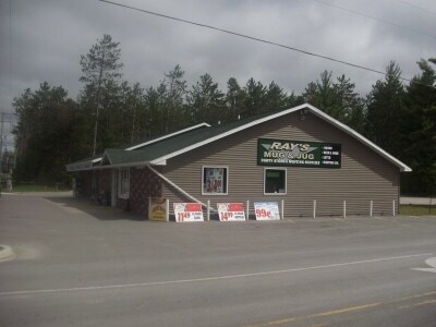

Property Detail
2 N Mount Tom Rd
Other Market Areas
T27N R3E SEC 31 - S 208' OF W 253' OF SW 1/4 OF SW 1/4. 2000 COMB W/003-031-027-10,027-15,029-00
00303102950
Oscoda
Commercialnec
Michigan
2025
1.23 AC
2025
Michigan North Central Area
970300
NEARBY LISTINGS FOR SALE OR LEASE
-
-
No Photo
-
View all Mio listings for sale on LoopNet.com
DEMOGRAPHICS near 2 N Mount Tom Rd
1 mile
3 mile
5 mile
2025 Total Population
405
2,318
3,806
2030 Population
408
2,365
3,877
Pop Growth 2025-2030
+ 0.74%
+ 2.03%
+ 1.87%
Average Age
44
45
45
2025 Total Households
174
1,024
1,650
HH Growth 2025-2030
0.00%
+ 1.95%
+ 1.82%
Median Household Inc
$47,500
$49,321
$51,529
Avg Household Size
2.20
2.20
2.30
2025 Avg HH Vehicles
2.00
2.00
2.00
Median Home Value
$117,647
$142,418
$148,498
Median Year Built
1967
1970
1972
Nearby Places
Map Layers
Map Styles
 Street
 Aerial
Layers
 Traffic
 Biking
Places
Listings with unknown addresses are not visible on the map
- Restaurants
- Banks
- Shops
- Fitness
- Groceries
SALE & LEASE HISTORY
LISTING DATE
SALE/LEASE

Sep 24, 2016
For Sale
Nearby Properties
Address
Land Use
TOTAL SIZE
Lot Size
Zoning
Address
Land Use
TOTAL SIZE
Lot Size
Zoning
1.70 AC
Address
Land Use
TOTAL SIZE
Lot Size
Zoning
1.60 AC
Address
Land Use
TOTAL SIZE
Lot Size
Zoning
Address
Land Use
TOTAL SIZE
Lot Size
Zoning
132.53 AC
Address
Land Use
TOTAL SIZE
Lot Size
Zoning
2.02 AC
Address
Land Use
TOTAL SIZE
Lot Size
Zoning
88.67 AC
Address
Land Use
TOTAL SIZE
Lot Size
Zoning
76.30 AC
Address
Land Use
TOTAL SIZE
Lot Size
Zoning
1.61 AC
Address
Land Use
TOTAL SIZE
Lot Size
Zoning
54.70 AC
Address
Land Use
TOTAL SIZE
Lot Size
Zoning
1.74 AC
Address
Land Use
TOTAL SIZE
Lot Size
Zoning
1.75 AC
Address
Land Use
TOTAL SIZE
Lot Size
Zoning
320 AC
Address
Land Use
TOTAL SIZE
Lot Size
Zoning
38.55 AC
Address
Land Use
TOTAL SIZE
Lot Size
Zoning
155 AC
Address
Land Use
TOTAL SIZE
Lot Size
Zoning
1.38 AC
Address
Land Use
TOTAL SIZE
Lot Size
Zoning
1.49 AC
Address
Land Use
TOTAL SIZE
Lot Size
Zoning
200 AC
Address
Land Use
TOTAL SIZE
Lot Size
Zoning
1.50 AC
Address
Land Use
TOTAL SIZE
Lot Size
Zoning
153.95 AC
Address
Land Use
TOTAL SIZE
Lot Size
Zoning
143.71 AC
Address
Land Use
TOTAL SIZE
Lot Size
Zoning
Address
Land Use
TOTAL SIZE
Lot Size
Zoning
Address
Land Use
TOTAL SIZE
Lot Size
Zoning
11.14 AC
Address
Land Use
TOTAL SIZE
Lot Size
Zoning
76.63 AC
Address
Land Use
TOTAL SIZE
Lot Size
Zoning
73.17 AC
Address
Land Use
TOTAL SIZE
Lot Size
Zoning
102.62 AC
Address
Land Use
TOTAL SIZE
Lot Size
Zoning
200 AC
Address
Land Use
TOTAL SIZE
Lot Size
Zoning
86.99 AC
Address
Land Use
TOTAL SIZE
Lot Size
Zoning
50.62 AC
Address
Land Use
TOTAL SIZE
Lot Size
Zoning
0.80 AC
The World's #1 Commercial Real Estate Marketplace
Connect with us
© 2026 CoStar Group
The information above has been obtained from sources believed reliable. While we do not doubt its accuracy we have not verified it and make no guarantee, warranty or representation about it. It is your responsibility to independently confirm its accuracy and completeness. Any projections, opinions, assumptions, or estimates used are for example only and do not represent the current or future performance of the property. The value of this transaction to you depends on tax and other factors which should be evaluated by your tax, financial, and legal advisors. You and your advisors should conduct a careful, independent investigation of the property to determine to your satisfaction the suitability of the property for your needs.