Property Record
2 North Rd, Chester, NJ 07930
This Property Is For Sale
NEARBY LISTINGS FOR SALE OR LEASE
Property Detail
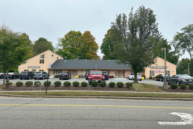
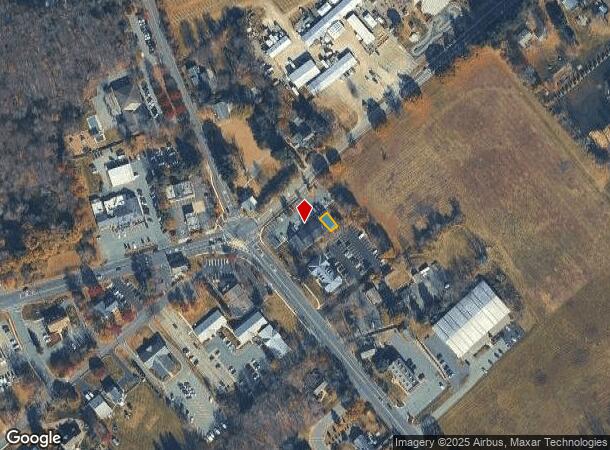
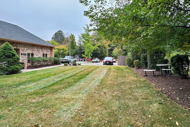
2 North Rd
Northern New Jersey
Crossroads Professional Center
Newark, NJ-PA
FACILITY NAME: CANCER HOPE NETWORK
06-00115-0000-00001-0000-CA001
Morris
Taxexempt
New Jersey
0
1
2025
0.24 AC
045901
Western Morris
1,961 SF
DEMOGRAPHICS near 2 North Rd
1 Mile
3 Mile
5 Mile
2024 Total Population
2,160
11,107
41,002
2029 Population
2,156
11,066
40,827
Pop Growth 2024-2029
(0.19%)
(0.37%)
(0.43%)
Average Age
43
43
42
2024 Total Households
777
3,841
14,444
HH Growth 2024-2029
(0.26%)
(0.39%)
(0.48%)
Median Household Inc
$143,749
$165,842
$157,407
Avg Household Size
2.70
2.80
2.80
2024 Avg HH Vehicles
2.00
2.00
2.00
Median Home Value
$649,595
$661,549
$573,076
Median Year Built
1973
1976
1974
Nearby Places
- Restaurants
- Banks
- Shops
- Fitness
- Groceries
PUBLIC TRANSPORTATION
COMMUTER RAIL
Gladstone (Morris & Essex Gladstone Branch - NJ Transit Commuter Rail (NJ Transit))
DRIVE
WALK
Distance
Gladstone (Morris & Essex Gladstone Branch - NJ Transit Commuter Rail (NJ Transit))
10 min
6.0 mi
Peapack (Morris & Essex Gladstone Branch - NJ Transit Commuter Rail (NJ Transit))
DRIVE
WALK
Distance
Peapack (Morris & Essex Gladstone Branch - NJ Transit Commuter Rail (NJ Transit))
12 min
7.1 mi
AIRPORT
Newark Liberty International
DRIVE
WALK
Distance
Newark Liberty International
46 min
33.5 mi
Freight Ports
Maher Terminal
DRIVE
WALK
Distance
Maher Terminal
49 min
34.0 mi
Nearby Properties
Address
Land Use
TOTAL SIZE
Lot Size
Zoning
Address
Land Use
TOTAL SIZE
Lot Size
Zoning
242 AC
G-I
Address
Land Use
TOTAL SIZE
Lot Size
Zoning
21.56 AC
B-3
Address
Land Use
TOTAL SIZE
Lot Size
Zoning
1,017 SF
1,485.15 AC
P
Address
Land Use
TOTAL SIZE
Lot Size
Zoning
50.50 AC
R-5
Address
Land Use
TOTAL SIZE
Lot Size
Zoning
104,682 SF
8.96 AC
B-3
Address
Land Use
TOTAL SIZE
Lot Size
Zoning
720 SF
1,022.40 AC
R-2
Address
Land Use
TOTAL SIZE
Lot Size
Zoning
27.40 AC
P
Address
Land Use
TOTAL SIZE
Lot Size
Zoning
610.04 AC
R-5
Address
Land Use
TOTAL SIZE
Lot Size
Zoning
39.63 AC
P
Address
Land Use
TOTAL SIZE
Lot Size
Zoning
49,548 SF
19.99 AC
P
Address
Land Use
TOTAL SIZE
Lot Size
Zoning
65,914 SF
7.25 AC
B-3
Address
Land Use
TOTAL SIZE
Lot Size
Zoning
1,036 SF
285.42 AC
P
Address
Land Use
TOTAL SIZE
Lot Size
Zoning
52,027 SF
33.23 AC
R-2
Address
Land Use
TOTAL SIZE
Lot Size
Zoning
1,516 SF
40.74 AC
R-LD
Address
Land Use
TOTAL SIZE
Lot Size
Zoning
3,328 SF
12.65 AC
B-2
Address
Land Use
TOTAL SIZE
Lot Size
Zoning
222.10 AC
R-3
Address
Land Use
TOTAL SIZE
Lot Size
Zoning
213.55 AC
R-5
Address
Land Use
TOTAL SIZE
Lot Size
Zoning
14,500 SF
1.10 AC
R5
Address
Land Use
TOTAL SIZE
Lot Size
Zoning
13,529 SF
4.96 AC
R-5
Address
Land Use
TOTAL SIZE
Lot Size
Zoning
10,889 SF
2.40 AC
R-HD
Address
Land Use
TOTAL SIZE
Lot Size
Zoning
146 AC
P
Address
Land Use
TOTAL SIZE
Lot Size
Zoning
9.52 AC
IL
Address
Land Use
TOTAL SIZE
Lot Size
Zoning
31,680 SF
3.23 AC
OP
Address
Land Use
TOTAL SIZE
Lot Size
Zoning
28,260 SF
2.84 AC
B-3
Address
Land Use
TOTAL SIZE
Lot Size
Zoning
64.01 AC
I
Address
Land Use
TOTAL SIZE
Lot Size
Zoning
151.11 AC
R-2
Address
Land Use
TOTAL SIZE
Lot Size
Zoning
22,907 SF
1.88 AC
C-2
Address
Land Use
TOTAL SIZE
Lot Size
Zoning
12,818 SF
3 AC
R-10
Address
Land Use
TOTAL SIZE
Lot Size
Zoning
1,331 SF
7.44 AC
R-2
Address
Land Use
TOTAL SIZE
Lot Size
Zoning
44 AC
BE
The World's #1 Commercial Real Estate Marketplace
Connect with us
© 2025 CoStar Group
The information above has been obtained from sources believed reliable. While we do not doubt its accuracy we have not verified it and make no guarantee, warranty or representation about it. It is your responsibility to independently confirm its accuracy and completeness. Any projections, opinions, assumptions, or estimates used are for example only and do not represent the current or future performance of the property. The value of this transaction to you depends on tax and other factors which should be evaluated by your tax, financial, and legal advisors. You and your advisors should conduct a careful, independent investigation of the property to determine to your satisfaction the suitability of the property for your needs.