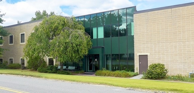
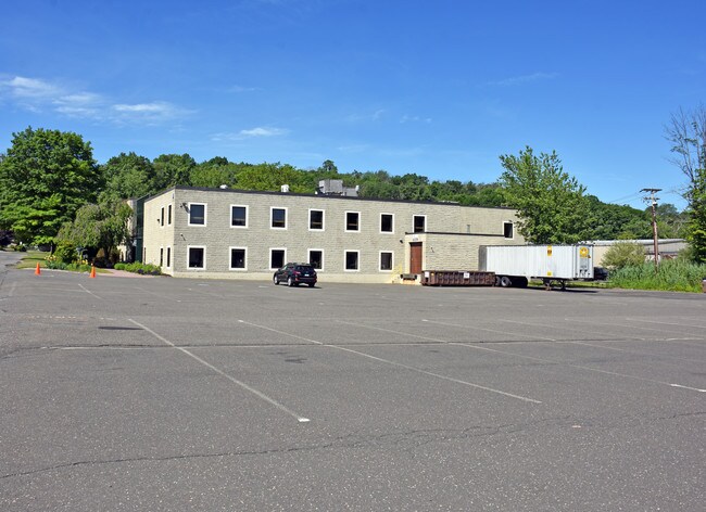
Property Record
2 Precision Rd, Danbury, CT 06810

Property Detail
2 Precision Rd
DANB-000017E-000000-000090
FAIRFIELD
Manufacturinglight
Connecticut
IL40
90
A Areas with a 1% annual chance of flooding and a 26% chance of flooding over the life of a 30-year mortgage.
1.85 AC
2025
Danbury
2025
Westchester/So Connecticut
210502
Bridgeport-Stamford-Danbury, CT
37,408 SF
NEARBY LISTINGS FOR SALE OR LEASE
-
-
View all Danbury listings for sale on LoopNet.com
DEMOGRAPHICS near 2 Precision Rd
1 mile
3 mile
5 mile
2025 Total Population
3,641
50,522
105,732
2030 Population
3,705
51,324
107,534
Pop Growth 2025-2030
+ 1.76%
+ 1.59%
+ 1.70%
Average Age
43
40
41
2025 Total Households
1,418
18,519
38,766
HH Growth 2025-2030
+ 1.90%
+ 1.79%
+ 1.79%
Median Household Inc
$94,156
$81,105
$92,631
Avg Household Size
2.40
2.60
2.60
2025 Avg HH Vehicles
2.00
2.00
2.00
Median Home Value
$438,497
$439,029
$441,502
Median Year Built
1983
1971
1973
Nearby Places
Map Layers
Map Styles
 Street
 Aerial
Transit
 Traffic
 Biking
Places
Listings with unknown addresses are not visible on the map
- Restaurants
- Banks
- Shops
- Fitness
- Groceries
PUBLIC TRANSPORTATION
COMMUTER RAIL
Danbury Station (New Haven Line - Metro-North Commuter Railroad Company (Metro-North))
Drive
Walk
Distance
Danbury Station (New Haven Line - Metro-North Commuter Railroad Company (Metro-North))
8 min
3.4 mi
Bethel Station (New Haven Line - Metro-North Commuter Railroad Company (Metro-North))
Drive
Walk
Distance
Bethel Station (New Haven Line - Metro-North Commuter Railroad Company (Metro-North))
15 min
5.5 mi
AIRPORT
Westchester County
Drive
Walk
Distance
Westchester County
43 min
32.0 mi
Tweed/New Haven
Drive
Walk
Distance
Tweed/New Haven
66 min
42.1 mi
New York Stewart International
Drive
Walk
Distance
New York Stewart International
60 min
43.1 mi
Freight Ports
Port of New Haven
Drive
Walk
Distance
Port of New Haven
60 min
39.9 mi
SALE & LEASE HISTORY
LISTING DATE
SALE/LEASE

Jun 12, 2019
For Sale
Nearby Properties
Address
Land Use
TOTAL SIZE
Lot Size
Zoning
Address
Land Use
TOTAL SIZE
Lot Size
Zoning
23,091 SF
84.73 AC
R160
Address
Land Use
TOTAL SIZE
Lot Size
Zoning
505.03 AC
PND
Address
Land Use
TOTAL SIZE
Lot Size
Zoning
9.04 AC
CCBD
Address
Land Use
TOTAL SIZE
Lot Size
Zoning
54.91 AC
RA40
Address
Land Use
TOTAL SIZE
Lot Size
Zoning
253,696 SF
83.75 AC
CDD
Address
Land Use
TOTAL SIZE
Lot Size
Zoning
56.59 AC
IL40
Address
Land Use
TOTAL SIZE
Lot Size
Zoning
47.39 AC
PND
Address
Land Use
TOTAL SIZE
Lot Size
Zoning
135.19 AC
IL40
Address
Land Use
TOTAL SIZE
Lot Size
Zoning
7.98 AC
RH3
Address
Land Use
TOTAL SIZE
Lot Size
Zoning
18.63 AC
CG20
Address
Land Use
TOTAL SIZE
Lot Size
Zoning
32.98 AC
PND
Address
Land Use
TOTAL SIZE
Lot Size
Zoning
273,127 SF
10.33 AC
RA-40
Address
Land Use
TOTAL SIZE
Lot Size
Zoning
10.51 AC
RMF-4
Address
Land Use
TOTAL SIZE
Lot Size
Zoning
31 AC
RMF4
Address
Land Use
TOTAL SIZE
Lot Size
Zoning
165,840 SF
9.49 AC
CG20
Address
Land Use
TOTAL SIZE
Lot Size
Zoning
478,816 SF
39.59 AC
IL40
Address
Land Use
TOTAL SIZE
Lot Size
Zoning
196,513 SF
PND
Address
Land Use
TOTAL SIZE
Lot Size
Zoning
196,544 SF
PND
Address
Land Use
TOTAL SIZE
Lot Size
Zoning
10.44 AC
CA80
Address
Land Use
TOTAL SIZE
Lot Size
Zoning
158,981 SF
12.79 AC
RA20
Address
Land Use
TOTAL SIZE
Lot Size
Zoning
45.78 AC
RM12
Address
Land Use
TOTAL SIZE
Lot Size
Zoning
7.28 AC
RH3
Address
Land Use
TOTAL SIZE
Lot Size
Zoning
47,564 SF
4.45 AC
CCBD
Address
Land Use
TOTAL SIZE
Lot Size
Zoning
10 AC
CG-20
Address
Land Use
TOTAL SIZE
Lot Size
Zoning
17.24 AC
IL-40
Address
Land Use
TOTAL SIZE
Lot Size
Zoning
198,560 SF
3.30 AC
CLCB
Address
Land Use
TOTAL SIZE
Lot Size
Zoning
10.51 AC
IL40
Address
Land Use
TOTAL SIZE
Lot Size
Zoning
12.51 AC
IL40
Address
Land Use
TOTAL SIZE
Lot Size
Zoning
133,936 SF
5.61 AC
IL40
Address
Land Use
TOTAL SIZE
Lot Size
Zoning
7,732 SF
42.55 AC
RMF-4
The World's #1 Commercial Real Estate Marketplace
Connect with us
© 2026 CoStar Group
The information above has been obtained from sources believed reliable. While we do not doubt its accuracy we have not verified it and make no guarantee, warranty or representation about it. It is your responsibility to independently confirm its accuracy and completeness. Any projections, opinions, assumptions, or estimates used are for example only and do not represent the current or future performance of the property. The value of this transaction to you depends on tax and other factors which should be evaluated by your tax, financial, and legal advisors. You and your advisors should conduct a careful, independent investigation of the property to determine to your satisfaction the suitability of the property for your needs.