Property Record
2 Railroad Ave, Hannacroix, NY 12087
NEARBY LISTINGS FOR SALE OR LEASE
Property Detail
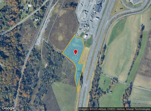
2 Railroad Ave
Residentialacreage
Greene
X
New York
36039C0120F
21.000
2025
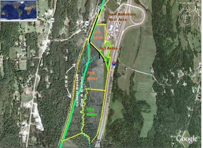
6.30 AC
2024
Greene County
080100
Albany/Schenectady/Troy
1,963 SF
194200-017-003-0002-021-000-0000
DEMOGRAPHICS near 2 Railroad Ave
1 Mile
3 Mile
5 Mile
2024 Total Population
306
3,487
11,018
2029 Population
301
3,455
10,954
Pop Growth 2024-2029
(1.63%)
(0.92%)
(0.58%)
Average Age
45
44
43
2024 Total Households
129
1,487
4,750
HH Growth 2024-2029
(1.55%)
(1.08%)
(0.67%)
Median Household Inc
$86,328
$79,137
$70,452
Avg Household Size
2.40
2.30
2.30
2024 Avg HH Vehicles
3.00
2.00
2.00
Median Home Value
$222,093
$214,439
$195,302
Median Year Built
1949
1963
1965
Nearby Places
- Restaurants
- Banks
- Shops
- Fitness
- Groceries
PUBLIC TRANSPORTATION
AIRPORT
Albany International
DRIVE
WALK
Distance
Albany International
43 min
29.5 mi
Freight Ports
Albany, NY Port
DRIVE
WALK
Distance
Albany, NY Port
24 min
16.4 mi
Nearby Properties
Address
Land Use
TOTAL SIZE
Lot Size
Zoning
Address
Land Use
TOTAL SIZE
Lot Size
Zoning
11,320 SF
26.30 AC
R-2
Address
Land Use
TOTAL SIZE
Lot Size
Zoning
77,199 SF
13.41 AC
C-1 P
Address
Land Use
TOTAL SIZE
Lot Size
Zoning
164.73 AC
07 - MIXED
Address
Land Use
TOTAL SIZE
Lot Size
Zoning
143.63 AC
Address
Land Use
TOTAL SIZE
Lot Size
Zoning
36,513 SF
2.24 AC
01 - NOT Z
Address
Land Use
TOTAL SIZE
Lot Size
Zoning
86,144 SF
24.70 AC
01 - NOT Z
Address
Land Use
TOTAL SIZE
Lot Size
Zoning
1,200 SF
50.48 AC
07 - MIXED
Address
Land Use
TOTAL SIZE
Lot Size
Zoning
30,720 SF
8.25 AC
01 - NOT Z
Address
Land Use
TOTAL SIZE
Lot Size
Zoning
3,910 SF
13 AC
07 - MIXED
Address
Land Use
TOTAL SIZE
Lot Size
Zoning
6,400 SF
11.73 AC
02 - SINGL
Address
Land Use
TOTAL SIZE
Lot Size
Zoning
1,945 SF
14.52 AC
01 - NOT Z
Address
Land Use
TOTAL SIZE
Lot Size
Zoning
2,896 SF
104 AC
02 - SINGL
Address
Land Use
TOTAL SIZE
Lot Size
Zoning
0.56 AC
05 - COMME
Address
Land Use
TOTAL SIZE
Lot Size
Zoning
11,000 SF
13.20 AC
01 - NOT Z
Address
Land Use
TOTAL SIZE
Lot Size
Zoning
26.42 AC
03 - MULTI
Address
Land Use
TOTAL SIZE
Lot Size
Zoning
7,724 SF
1.54 AC
02 - SINGL
Address
Land Use
TOTAL SIZE
Lot Size
Zoning
6,000 SF
3.30 AC
Address
Land Use
TOTAL SIZE
Lot Size
Zoning
187 AC
07 - MIXED
Address
Land Use
TOTAL SIZE
Lot Size
Zoning
7,887 SF
1.30 AC
C-1 P
Address
Land Use
TOTAL SIZE
Lot Size
Zoning
4,140 SF
2.03 AC
01 - NOT Z
Address
Land Use
TOTAL SIZE
Lot Size
Zoning
41.10 AC
07 - MIXED
Address
Land Use
TOTAL SIZE
Lot Size
Zoning
172.30 AC
07 - MIXED
Address
Land Use
TOTAL SIZE
Lot Size
Zoning
4,786 SF
141.01 AC
03 - MULTI
Address
Land Use
TOTAL SIZE
Lot Size
Zoning
9,110 SF
2 AC
07 - MIXED
Address
Land Use
TOTAL SIZE
Lot Size
Zoning
155 AC
07 - MIXED
Address
Land Use
TOTAL SIZE
Lot Size
Zoning
147.70 AC
07 - MIXED
Address
Land Use
TOTAL SIZE
Lot Size
Zoning
76.43 AC
03 - MULTI
Address
Land Use
TOTAL SIZE
Lot Size
Zoning
4.75 AC
07 - MIXED
Address
Land Use
TOTAL SIZE
Lot Size
Zoning
4,420 SF
0.01 AC
I
Address
Land Use
TOTAL SIZE
Lot Size
Zoning
7.25 AC
03
The World's #1 Commercial Real Estate Marketplace
Connect with us
© 2025 CoStar Group
The information above has been obtained from sources believed reliable. While we do not doubt its accuracy we have not verified it and make no guarantee, warranty or representation about it. It is your responsibility to independently confirm its accuracy and completeness. Any projections, opinions, assumptions, or estimates used are for example only and do not represent the current or future performance of the property. The value of this transaction to you depends on tax and other factors which should be evaluated by your tax, financial, and legal advisors. You and your advisors should conduct a careful, independent investigation of the property to determine to your satisfaction the suitability of the property for your needs.