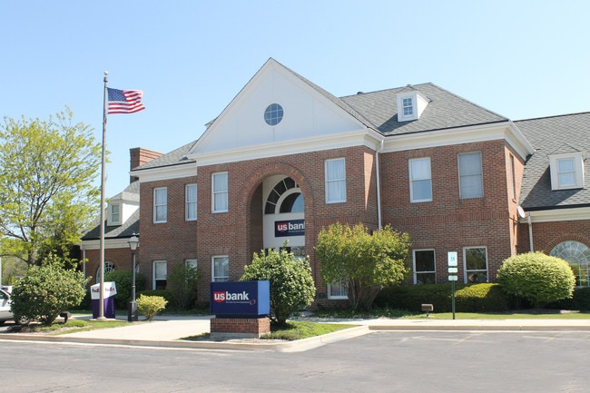
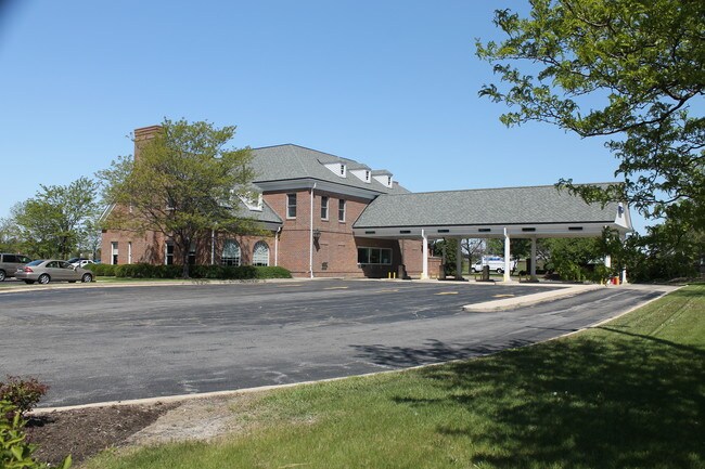
Property Record
2 S Rt 59, Aurora, IL 60504
Property Detail
2 S Rt 59
07-33-400-045
WHITE EAGLE COMMONS ALL
Commercialnec
DUPAGE
C
Illinois
B and X Area of moderate flood hazard, usually the area between the limits of the 100-year and 500-year floods.
12
2024
1.52 AC
2024
Western East/West Corr
853100
Chicago
14,448 SF
Chicago-Naperville-Elgin, IL-IN
NEARBY LISTINGS FOR SALE OR LEASE
DEMOGRAPHICS near 2 S Rt 59
1 mile
3 mile
5 mile
2025 Total Population
9,127
97,143
254,440
2030 Population
9,318
98,483
258,585
Pop Growth 2025-2030
+ 2.09%
+ 1.38%
+ 1.63%
Average Age
40
38
39
2025 Total Households
3,123
33,426
87,428
HH Growth 2025-2030
+ 1.99%
+ 1.44%
+ 1.71%
Median Household Inc
$140,413
$135,123
$128,913
Avg Household Size
2.90
2.90
2.80
2025 Avg HH Vehicles
2.00
2.00
2.00
Median Home Value
$476,873
$434,092
$425,913
Median Year Built
1996
1994
1992
Nearby Places
Map Layers
Map Styles
 Street
 Aerial
Transit
 Traffic
 Biking
Places
Listings with unknown addresses are not visible on the map
- Restaurants
- Banks
- Shops
- Fitness
- Groceries
PUBLIC TRANSPORTATION
COMMUTER RAIL
Route 59 Station (Burlington Northern-Santa Fe Railway Line - Northeast Illinois Regional Commuter Railroad (Metra))
Drive
Walk
Distance
Route 59 Station (Burlington Northern-Santa Fe Railway Line - Northeast Illinois Regional Commuter Railroad (Metra))
10 min
4.2 mi
Naperville Station (Burlington Northern-Santa Fe Railway Line - Northeast Illinois Regional Commuter Railroad (Metra))
Drive
Walk
Distance
Naperville Station (Burlington Northern-Santa Fe Railway Line - Northeast Illinois Regional Commuter Railroad (Metra))
14 min
6.6 mi
AIRPORT
Chicago Midway International
Drive
Walk
Distance
Chicago Midway International
45 min
27.2 mi
Chicago O'Hare International
Drive
Walk
Distance
Chicago O'Hare International
52 min
34.1 mi
Nearby Properties
Address
Land Use
TOTAL SIZE
Lot Size
Zoning
Address
Land Use
TOTAL SIZE
Lot Size
Zoning
916,143 SF
32.66 AC
Address
Land Use
TOTAL SIZE
Lot Size
Zoning
29.20 AC
C
Address
Land Use
TOTAL SIZE
Lot Size
Zoning
19.92 AC
C
Address
Land Use
TOTAL SIZE
Lot Size
Zoning
Address
Land Use
TOTAL SIZE
Lot Size
Zoning
Address
Land Use
TOTAL SIZE
Lot Size
Zoning
829,087 SF
35.83 AC
C
Address
Land Use
TOTAL SIZE
Lot Size
Zoning
22.35 AC
Address
Land Use
TOTAL SIZE
Lot Size
Zoning
283,844 SF
16.06 AC
M
Address
Land Use
TOTAL SIZE
Lot Size
Zoning
20.97 AC
R
Address
Land Use
TOTAL SIZE
Lot Size
Zoning
24.91 AC
Address
Land Use
TOTAL SIZE
Lot Size
Zoning
17.84 AC
M
Address
Land Use
TOTAL SIZE
Lot Size
Zoning
11.02 AC
M
Address
Land Use
TOTAL SIZE
Lot Size
Zoning
9.83 AC
C
Address
Land Use
TOTAL SIZE
Lot Size
Zoning
293,121 SF
9.50 AC
Address
Land Use
TOTAL SIZE
Lot Size
Zoning
173,303 SF
19.53 AC
Address
Land Use
TOTAL SIZE
Lot Size
Zoning
10 AC
C
Address
Land Use
TOTAL SIZE
Lot Size
Zoning
342,257 SF
31.05 AC
C
Address
Land Use
TOTAL SIZE
Lot Size
Zoning
133,779 SF
9.77 AC
C
Address
Land Use
TOTAL SIZE
Lot Size
Zoning
367,519 SF
15.98 AC
Address
Land Use
TOTAL SIZE
Lot Size
Zoning
139,200 SF
11.17 AC
R
Address
Land Use
TOTAL SIZE
Lot Size
Zoning
315,100 SF
23.74 AC
Address
Land Use
TOTAL SIZE
Lot Size
Zoning
252,909 SF
5.81 AC
Address
Land Use
TOTAL SIZE
Lot Size
Zoning
189,289 SF
18.56 AC
Address
Land Use
TOTAL SIZE
Lot Size
Zoning
331,425 SF
17.62 AC
Address
Land Use
TOTAL SIZE
Lot Size
Zoning
242,949 SF
26.73 AC
C
Address
Land Use
TOTAL SIZE
Lot Size
Zoning
88,369 SF
8.02 AC
Address
Land Use
TOTAL SIZE
Lot Size
Zoning
116,621 SF
8.50 AC
O
Address
Land Use
TOTAL SIZE
Lot Size
Zoning
155,459 SF
16.81 AC
C
Address
Land Use
TOTAL SIZE
Lot Size
Zoning
338,220 SF
37.91 AC
C
Address
Land Use
TOTAL SIZE
Lot Size
Zoning
505,040 SF
46.13 AC
The World's #1 Commercial Real Estate Marketplace
Connect with us
© 2026 CoStar Group
The information above has been obtained from sources believed reliable. While we do not doubt its accuracy we have not verified it and make no guarantee, warranty or representation about it. It is your responsibility to independently confirm its accuracy and completeness. Any projections, opinions, assumptions, or estimates used are for example only and do not represent the current or future performance of the property. The value of this transaction to you depends on tax and other factors which should be evaluated by your tax, financial, and legal advisors. You and your advisors should conduct a careful, independent investigation of the property to determine to your satisfaction the suitability of the property for your needs.