Property Record
4 Skyline Dr, Hawthorne, NY 10532


NEARBY LISTINGS FOR SALE OR LEASE
Property Detail
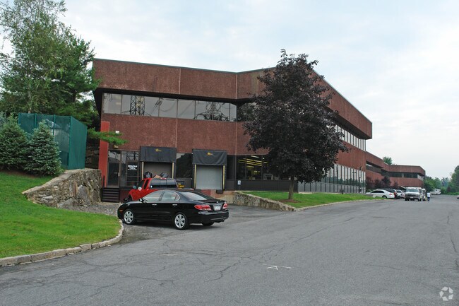
4 Skyline Dr
3489-116-008-00001-001-0000
Subdivision Map Prepared For Robert Mart
Warehouse
Westchester
X
New York
36119C0254F
1.000
2025
7 AC
2024
West I-287 Corridor
981000
Westchester/So Connecticut
30,478 SF
New York-Jersey City-White Plains, NY-NJ
DEMOGRAPHICS near 4 Skyline Dr
1 Mile
3 Mile
5 Mile
2024 Total Population
2,410
53,060
153,330
2029 Population
2,389
52,126
150,915
Pop Growth 2024-2029
(0.87%)
(1.76%)
(1.58%)
Average Age
37
41
42
2024 Total Households
575
18,400
57,379
HH Growth 2024-2029
(0.52%)
(1.98%)
(1.63%)
Median Household Inc
$70,178
$121,196
$128,599
Avg Household Size
2.50
2.70
2.50
2024 Avg HH Vehicles
2.00
2.00
2.00
Median Home Value
$731,762
$680,639
$666,870
Median Year Built
1962
1960
1962
Nearby Places
Map Layers
Map Styles
 Street
 Aerial
- Restaurants
- Banks
- Shops
- Fitness
- Groceries
PUBLIC TRANSPORTATION
COMMUTER RAIL
Hawthorne Station (Harlem Line - Metro-North Commuter Railroad Company (Metro-North))
DRIVE
WALK
Distance
Hawthorne Station (Harlem Line - Metro-North Commuter Railroad Company (Metro-North))
4 min
2.0 mi
Mount Pleasant Station (Harlem Line - Metro-North Commuter Railroad Company (Metro-North))
DRIVE
WALK
Distance
Mount Pleasant Station (Harlem Line - Metro-North Commuter Railroad Company (Metro-North))
5 min
2.7 mi
AIRPORT
Westchester County
DRIVE
WALK
Distance
Westchester County
21 min
12.1 mi
LaGuardia
DRIVE
WALK
Distance
LaGuardia
42 min
28.0 mi
Freight Ports
NY - Red Hook Container Terminal
DRIVE
WALK
Distance
NY - Red Hook Container Terminal
55 min
36.2 mi
SALE & LEASE HISTORY
LISTING DATE
SALE/LEASE

Sep 24, 2016
For Lease
Sep 18, 2017
For Lease
Apr 10, 2018
For Lease
Nearby Properties
Address
Land Use
TOTAL SIZE
Lot Size
Zoning
Address
Land Use
TOTAL SIZE
Lot Size
Zoning
358.83 AC
Address
Land Use
TOTAL SIZE
Lot Size
Zoning
85.40 AC
Address
Land Use
TOTAL SIZE
Lot Size
Zoning
4.45 AC
B
Address
Land Use
TOTAL SIZE
Lot Size
Zoning
2,760 SF
60.76 AC
Address
Land Use
TOTAL SIZE
Lot Size
Zoning
63.40 AC
R-40
Address
Land Use
TOTAL SIZE
Lot Size
Zoning
22.92 AC
Address
Land Use
TOTAL SIZE
Lot Size
Zoning
75.87 AC
R-20
Address
Land Use
TOTAL SIZE
Lot Size
Zoning
Address
Land Use
TOTAL SIZE
Lot Size
Zoning
24.28 AC
Address
Land Use
TOTAL SIZE
Lot Size
Zoning
17.61 AC
Address
Land Use
TOTAL SIZE
Lot Size
Zoning
36.59 AC
Address
Land Use
TOTAL SIZE
Lot Size
Zoning
17.17 AC
Address
Land Use
TOTAL SIZE
Lot Size
Zoning
14.86 AC
OB
Address
Land Use
TOTAL SIZE
Lot Size
Zoning
24.66 AC
Address
Land Use
TOTAL SIZE
Lot Size
Zoning
42.30 AC
C2
Address
Land Use
TOTAL SIZE
Lot Size
Zoning
7.78 AC
Address
Land Use
TOTAL SIZE
Lot Size
Zoning
19.25 AC
Address
Land Use
TOTAL SIZE
Lot Size
Zoning
28.51 AC
Address
Land Use
TOTAL SIZE
Lot Size
Zoning
253,167 SF
9.11 AC
OB
Address
Land Use
TOTAL SIZE
Lot Size
Zoning
60.01 AC
Address
Land Use
TOTAL SIZE
Lot Size
Zoning
11.61 AC
Address
Land Use
TOTAL SIZE
Lot Size
Zoning
Address
Land Use
TOTAL SIZE
Lot Size
Zoning
57.73 AC
Address
Land Use
TOTAL SIZE
Lot Size
Zoning
22.50 AC
Address
Land Use
TOTAL SIZE
Lot Size
Zoning
68,000 SF
1.53 AC
B
Address
Land Use
TOTAL SIZE
Lot Size
Zoning
Address
Land Use
TOTAL SIZE
Lot Size
Zoning
Address
Land Use
TOTAL SIZE
Lot Size
Zoning
1.69 AC
Address
Land Use
TOTAL SIZE
Lot Size
Zoning
29.42 AC
PUD
Address
Land Use
TOTAL SIZE
Lot Size
Zoning
The World's #1 Commercial Real Estate Marketplace
Connect with us
© 2026 CoStar Group
The information above has been obtained from sources believed reliable. While we do not doubt its accuracy we have not verified it and make no guarantee, warranty or representation about it. It is your responsibility to independently confirm its accuracy and completeness. Any projections, opinions, assumptions, or estimates used are for example only and do not represent the current or future performance of the property. The value of this transaction to you depends on tax and other factors which should be evaluated by your tax, financial, and legal advisors. You and your advisors should conduct a careful, independent investigation of the property to determine to your satisfaction the suitability of the property for your needs.