Property Record
2 W Mill Rd, Long Valley, NJ 07853

Save to a Folder
{{folder.Name}}
{{folder.ListingIds.length}} Properties
{{folder.ListingIds.length}} Property
Create a New Folder
Property Detail
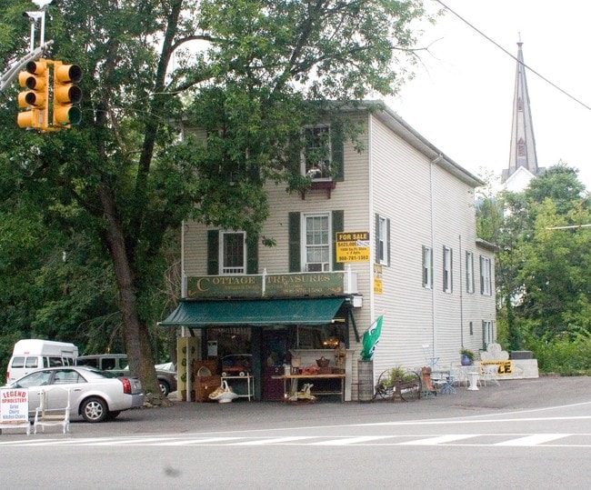
2 W Mill Rd
Newark, NJ
Morris
38-00033-0000-00045
New Jersey
Storebuilding
45
C1
0.30 AC
2024
Western Morris
2026
Northern New Jersey
046298
NEARBY LISTINGS FOR SALE OR LEASE
-
-
View all Long Valley listings for sale on LoopNet.com
DEMOGRAPHICS near 2 W Mill Rd
1 mile
3 mile
5 mile
2025 Total Population
1,309
11,602
36,969
2030 Population
1,332
11,765
37,517
Pop Growth 2025-2030
+ 1.76%
+ 1.40%
+ 1.48%
Average Age
43
43
43
2025 Total Households
455
3,945
13,410
HH Growth 2025-2030
+ 1.76%
+ 1.42%
+ 1.45%
Median Household Inc
$146,136
$183,449
$151,942
Avg Household Size
2.90
2.90
2.70
2025 Avg HH Vehicles
2.00
2.00
2.00
Median Home Value
$576,923
$670,238
$598,217
Median Year Built
1974
1976
1978
Nearby Places
Map Layers
Map Styles
 Street
 Aerial
Layers
 Traffic
 Biking
Places
Listings with unknown addresses are not visible on the map
- Restaurants
- Banks
- Shops
- Fitness
- Groceries
PUBLIC TRANSPORTATION
COMMUTER RAIL
Hackettstown (Montclair-Boonton Line - NJ Transit Commuter Rail (NJ Transit), Morris & Essex Morristown Line - NJ Transit Commuter Rail (NJ Transit))
Drive
Walk
Distance
Hackettstown (Montclair-Boonton Line - NJ Transit Commuter Rail (NJ Transit), Morris & Essex Morristown Line - NJ Transit Commuter Rail (NJ Transit))
12 min
6.8 mi
Gladstone (Morris & Essex Gladstone Branch - NJ Transit Commuter Rail (NJ Transit))
Drive
Walk
Distance
Gladstone (Morris & Essex Gladstone Branch - NJ Transit Commuter Rail (NJ Transit))
16 min
9.4 mi
AIRPORT
Newark Liberty International
Drive
Walk
Distance
Newark Liberty International
55 min
39.0 mi
Lehigh Valley International
Drive
Walk
Distance
Lehigh Valley International
69 min
45.9 mi
Freight Ports
Maher Terminal
Drive
Walk
Distance
Maher Terminal
59 min
39.6 mi
Nearby Properties
Address
Land Use
TOTAL SIZE
Lot Size
Zoning
Address
Land Use
TOTAL SIZE
Lot Size
Zoning
25.18 AC
R-5
Address
Land Use
TOTAL SIZE
Lot Size
Zoning
12.60 AC
R1R2
Address
Land Use
TOTAL SIZE
Lot Size
Zoning
14.40 AC
R-1
Address
Land Use
TOTAL SIZE
Lot Size
Zoning
10 AC
R-5
Address
Land Use
TOTAL SIZE
Lot Size
Zoning
2,296 SF
10 AC
R-5
Address
Land Use
TOTAL SIZE
Lot Size
Zoning
69,042 SF
7.20 AC
L-I
Address
Land Use
TOTAL SIZE
Lot Size
Zoning
2,191 SF
5 AC
C-1
Address
Land Use
TOTAL SIZE
Lot Size
Zoning
3.41 AC
C1
Address
Land Use
TOTAL SIZE
Lot Size
Zoning
8.90 AC
R1R2
Address
Land Use
TOTAL SIZE
Lot Size
Zoning
34.66 AC
R-5
Address
Land Use
TOTAL SIZE
Lot Size
Zoning
5 AC
R-5
Address
Land Use
TOTAL SIZE
Lot Size
Zoning
1.12 AC
R1R2
Address
Land Use
TOTAL SIZE
Lot Size
Zoning
53.35 AC
R-5
Address
Land Use
TOTAL SIZE
Lot Size
Zoning
73.89 AC
R-5
Address
Land Use
TOTAL SIZE
Lot Size
Zoning
6,543 SF
2 AC
R-5
Address
Land Use
TOTAL SIZE
Lot Size
Zoning
10.13 AC
R-5
Address
Land Use
TOTAL SIZE
Lot Size
Zoning
5 AC
R-5
Address
Land Use
TOTAL SIZE
Lot Size
Zoning
Address
Land Use
TOTAL SIZE
Lot Size
Zoning
1.37 AC
R-20
Address
Land Use
TOTAL SIZE
Lot Size
Zoning
3,850 SF
7.44 AC
C1
Address
Land Use
TOTAL SIZE
Lot Size
Zoning
13.92 AC
R-5
Address
Land Use
TOTAL SIZE
Lot Size
Zoning
1,582 SF
8 AC
LB
Address
Land Use
TOTAL SIZE
Lot Size
Zoning
201.53 AC
R-5
Address
Land Use
TOTAL SIZE
Lot Size
Zoning
34.47 AC
OR/I
Address
Land Use
TOTAL SIZE
Lot Size
Zoning
8,439 SF
2 AC
R-5
Address
Land Use
TOTAL SIZE
Lot Size
Zoning
4.59 AC
R-5
Address
Land Use
TOTAL SIZE
Lot Size
Zoning
8.06 AC
OR/I
Address
Land Use
TOTAL SIZE
Lot Size
Zoning
9,286 SF
34.15 AC
R-5
Address
Land Use
TOTAL SIZE
Lot Size
Zoning
4,198 SF
25 AC
R-5
Address
Land Use
TOTAL SIZE
Lot Size
Zoning
9.43 AC
C1
The World's #1 Commercial Real Estate Marketplace
Connect with us
© 2026 CoStar Group
The information above has been obtained from sources believed reliable. While we do not doubt its accuracy we have not verified it and make no guarantee, warranty or representation about it. It is your responsibility to independently confirm its accuracy and completeness. Any projections, opinions, assumptions, or estimates used are for example only and do not represent the current or future performance of the property. The value of this transaction to you depends on tax and other factors which should be evaluated by your tax, financial, and legal advisors. You and your advisors should conduct a careful, independent investigation of the property to determine to your satisfaction the suitability of the property for your needs.