Property Record
2 Whitney Rd, Concord, NH 03301
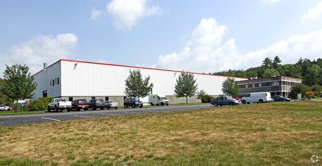

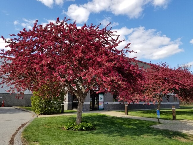
Property Detail
2 Whitney Rd
Taxexempt
Merrimack
IN
New Hampshire
B and X Area of moderate flood hazard, usually the area between the limits of the 100-year and 500-year floods.
11.09 AC
2023
Concord/New Hampshire North Area
2025
Other Market Areas
032800
Concord, NH
70,566 SF
CNCD-000006P-000000-000013
NEARBY LISTINGS FOR SALE OR LEASE
DEMOGRAPHICS near 2 Whitney Rd
1 mile
3 mile
5 mile
2025 Total Population
1,794
15,719
23,227
2030 Population
1,841
16,060
23,694
Pop Growth 2025-2030
+ 2.62%
+ 2.17%
+ 2.01%
Average Age
41
42
43
2025 Total Households
745
6,188
8,906
HH Growth 2025-2030
+ 2.68%
+ 2.31%
+ 2.18%
Median Household Inc
$76,415
$86,032
$93,334
Avg Household Size
2.40
2.30
2.40
2025 Avg HH Vehicles
2.00
2.00
2.00
Median Home Value
$307,954
$346,932
$360,052
Median Year Built
1962
1983
1982
Nearby Places
Map Layers
Map Styles
 Street
 Aerial
Transit
 Traffic
 Biking
Places
Listings with unknown addresses are not visible on the map
- Restaurants
- Banks
- Shops
- Fitness
- Groceries
PUBLIC TRANSPORTATION
AIRPORT
Manchester Boston Regional
Drive
Walk
Distance
Manchester Boston Regional
45 min
30.5 mi
Freight Ports
Port of Boston
Drive
Walk
Distance
Port of Boston
111 min
79.1 mi
SALE & LEASE HISTORY
LISTING DATE
SALE/LEASE

Jan 07, 2022
For Lease
Nearby Properties
Address
Land Use
TOTAL SIZE
Lot Size
Zoning
Address
Land Use
TOTAL SIZE
Lot Size
Zoning
23.80 AC
IN
Address
Land Use
TOTAL SIZE
Lot Size
Zoning
56.19 AC
IN
Address
Land Use
TOTAL SIZE
Lot Size
Zoning
6,816 SF
64.44 AC
RO
Address
Land Use
TOTAL SIZE
Lot Size
Zoning
14.41 AC
GWP
Address
Land Use
TOTAL SIZE
Lot Size
Zoning
RES/AG
Address
Land Use
TOTAL SIZE
Lot Size
Zoning
8.50 AC
CG
Address
Land Use
TOTAL SIZE
Lot Size
Zoning
66,460 SF
20.98 AC
RM
Address
Land Use
TOTAL SIZE
Lot Size
Zoning
61,687 SF
8.69 AC
CG
Address
Land Use
TOTAL SIZE
Lot Size
Zoning
47,273 SF
91.79 AC
COM W
Address
Land Use
TOTAL SIZE
Lot Size
Zoning
69,818 SF
12.39 AC
RM
Address
Land Use
TOTAL SIZE
Lot Size
Zoning
12 AC
RH
Address
Land Use
TOTAL SIZE
Lot Size
Zoning
1.25 AC
MRD
Address
Land Use
TOTAL SIZE
Lot Size
Zoning
5.50 AC
DEFAUL
Address
Land Use
TOTAL SIZE
Lot Size
Zoning
6.73 AC
CG
Address
Land Use
TOTAL SIZE
Lot Size
Zoning
12.05 AC
RM
Address
Land Use
TOTAL SIZE
Lot Size
Zoning
25,363 SF
6.21 AC
CG
Address
Land Use
TOTAL SIZE
Lot Size
Zoning
4.90 AC
RH
Address
Land Use
TOTAL SIZE
Lot Size
Zoning
9.60 AC
RD
Address
Land Use
TOTAL SIZE
Lot Size
Zoning
2.49 AC
CG
Address
Land Use
TOTAL SIZE
Lot Size
Zoning
169 AC
RO
Address
Land Use
TOTAL SIZE
Lot Size
Zoning
62,528 SF
9.20 AC
RM
Address
Land Use
TOTAL SIZE
Lot Size
Zoning
4.41 AC
RH
Address
Land Use
TOTAL SIZE
Lot Size
Zoning
32.08 AC
RH
Address
Land Use
TOTAL SIZE
Lot Size
Zoning
8.21 AC
IN
Address
Land Use
TOTAL SIZE
Lot Size
Zoning
3,347 SF
7.20 AC
VD
Address
Land Use
TOTAL SIZE
Lot Size
Zoning
2,685 SF
11.42 AC
VD
Address
Land Use
TOTAL SIZE
Lot Size
Zoning
19,577 SF
2.88 AC
CMW&S
Address
Land Use
TOTAL SIZE
Lot Size
Zoning
30.15 AC
RH
Address
Land Use
TOTAL SIZE
Lot Size
Zoning
225 SF
27.50 AC
RH
The World's #1 Commercial Real Estate Marketplace
Connect with us
© 2026 CoStar Group
The information above has been obtained from sources believed reliable. While we do not doubt its accuracy we have not verified it and make no guarantee, warranty or representation about it. It is your responsibility to independently confirm its accuracy and completeness. Any projections, opinions, assumptions, or estimates used are for example only and do not represent the current or future performance of the property. The value of this transaction to you depends on tax and other factors which should be evaluated by your tax, financial, and legal advisors. You and your advisors should conduct a careful, independent investigation of the property to determine to your satisfaction the suitability of the property for your needs.