Property Record
2 Windham Depot Rd, Derry, NH 03038
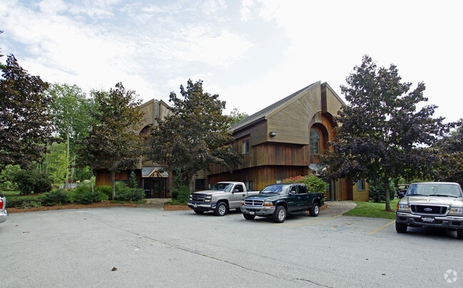

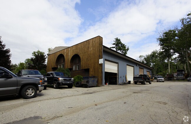
Property Detail
2 Windham Depot Rd
Commercialbuilding
Rockingham
GC4
New Hampshire
B and X Area of moderate flood hazard, usually the area between the limits of the 100-year and 500-year floods.
1.82 AC
2025
Rockingham
2025
Boston
003601
Boston-Cambridge-Newton, MA-NH
9,542 SF
DERY-000003-000000-000010
NEARBY LISTINGS FOR SALE OR LEASE
-
-
View all Derry listings for lease on LoopNet.com
DEMOGRAPHICS near 2 Windham Depot Rd
1 mile
3 mile
5 mile
2025 Total Population
2,061
20,460
63,628
2030 Population
2,059
20,450
64,124
Pop Growth 2025-2030
(0.10%)
(0.05%)
+ 0.78%
Average Age
42
41
42
2025 Total Households
715
7,521
24,153
HH Growth 2025-2030
(0.28%)
(0.25%)
+ 0.65%
Median Household Inc
$156,056
$127,640
$117,143
Avg Household Size
2.80
2.70
2.60
2025 Avg HH Vehicles
3.00
2.00
2.00
Median Home Value
$513,736
$496,955
$504,524
Median Year Built
1984
1983
1981
Nearby Places
Map Layers
Map Styles
 Street
 Aerial
Transit
 Traffic
 Biking
Places
Listings with unknown addresses are not visible on the map
- Restaurants
- Banks
- Shops
- Fitness
- Groceries
PUBLIC TRANSPORTATION
AIRPORT
Manchester Boston Regional
Drive
Walk
Distance
Manchester Boston Regional
31 min
13.1 mi
General Edward Lawrence Logan International
Drive
Walk
Distance
General Edward Lawrence Logan International
56 min
40.7 mi
Portsmouth International at Pease
Drive
Walk
Distance
Portsmouth International at Pease
65 min
44.3 mi
Freight Ports
Port of Boston
Drive
Walk
Distance
Port of Boston
57 min
40.4 mi
SALE & LEASE HISTORY
LISTING DATE
SALE/LEASE

Sep 17, 2019
For Lease
Apr 06, 2022
For Lease
Nearby Properties
Address
Land Use
TOTAL SIZE
Lot Size
Zoning
Address
Land Use
TOTAL SIZE
Lot Size
Zoning
146,407 SF
15.39 AC
OMB
Address
Land Use
TOTAL SIZE
Lot Size
Zoning
12.94 AC
MFR
Address
Land Use
TOTAL SIZE
Lot Size
Zoning
108,248 SF
5.92 AC
OMB
Address
Land Use
TOTAL SIZE
Lot Size
Zoning
21,433 SF
7.54 AC
LID
Address
Land Use
TOTAL SIZE
Lot Size
Zoning
4.10 AC
MFR
Address
Land Use
TOTAL SIZE
Lot Size
Zoning
4.14 AC
MFR
Address
Land Use
TOTAL SIZE
Lot Size
Zoning
59,565 SF
41.20 AC
RD
Address
Land Use
TOTAL SIZE
Lot Size
Zoning
4 AC
MFR
Address
Land Use
TOTAL SIZE
Lot Size
Zoning
51,881 SF
12.01 AC
MDR
Address
Land Use
TOTAL SIZE
Lot Size
Zoning
19,920 SF
15 AC
PBT
Address
Land Use
TOTAL SIZE
Lot Size
Zoning
32,328 SF
2.43 AC
MFR
Address
Land Use
TOTAL SIZE
Lot Size
Zoning
7.21 AC
IND5
Address
Land Use
TOTAL SIZE
Lot Size
Zoning
3,602 SF
7.45 AC
RD
Address
Land Use
TOTAL SIZE
Lot Size
Zoning
25,560 SF
2 AC
MHDR
Address
Land Use
TOTAL SIZE
Lot Size
Zoning
25,560 SF
2.40 AC
MHDR
Address
Land Use
TOTAL SIZE
Lot Size
Zoning
31,896 SF
2.50 AC
MFR
Address
Land Use
TOTAL SIZE
Lot Size
Zoning
31,896 SF
1.81 AC
MFR
Address
Land Use
TOTAL SIZE
Lot Size
Zoning
31,896 SF
1.81 AC
MFR
Address
Land Use
TOTAL SIZE
Lot Size
Zoning
320 SF
13.40 AC
RUR
Address
Land Use
TOTAL SIZE
Lot Size
Zoning
60,654 SF
7.03 AC
IND1
Address
Land Use
TOTAL SIZE
Lot Size
Zoning
2.50 AC
MFR
Address
Land Use
TOTAL SIZE
Lot Size
Zoning
936 SF
15.40 AC
MHPD
Address
Land Use
TOTAL SIZE
Lot Size
Zoning
25,512 SF
2.50 AC
MFR
Address
Land Use
TOTAL SIZE
Lot Size
Zoning
25,512 SF
2.11 AC
MFR
Address
Land Use
TOTAL SIZE
Lot Size
Zoning
25,512 SF
2.10 AC
MFR
Address
Land Use
TOTAL SIZE
Lot Size
Zoning
25,512 SF
2 AC
MFR
Address
Land Use
TOTAL SIZE
Lot Size
Zoning
21,600 SF
1.72 AC
MHDR
Address
Land Use
TOTAL SIZE
Lot Size
Zoning
21,600 SF
1.70 AC
MHDR
Address
Land Use
TOTAL SIZE
Lot Size
Zoning
40,000 SF
7.53 AC
CDA
Address
Land Use
TOTAL SIZE
Lot Size
Zoning
23,532 SF
1.43 AC
MFR
The World's #1 Commercial Real Estate Marketplace
Connect with us
© 2026 CoStar Group
The information above has been obtained from sources believed reliable. While we do not doubt its accuracy we have not verified it and make no guarantee, warranty or representation about it. It is your responsibility to independently confirm its accuracy and completeness. Any projections, opinions, assumptions, or estimates used are for example only and do not represent the current or future performance of the property. The value of this transaction to you depends on tax and other factors which should be evaluated by your tax, financial, and legal advisors. You and your advisors should conduct a careful, independent investigation of the property to determine to your satisfaction the suitability of the property for your needs.