Property Record
Maple & Wagaraw Rd, Fairview, NJ 07022

Current Lease Availabilities
NEARBY LISTINGS FOR SALE OR LEASE
Property Detail
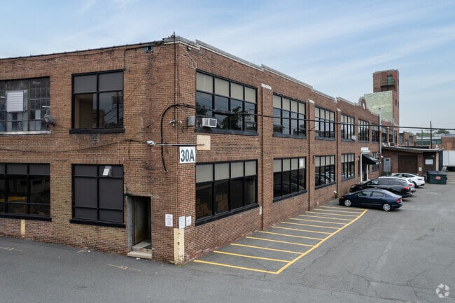
Maple & Wagaraw Rd
17-06801-0000-00005
1.1AC 5.01
Industrialgeneral
Bergen
AE
New Jersey
34031C0209G
5
2024
1.10 AC
2025
Northwest Bergen
018200
Northern New Jersey
19,585 SF
New York-Jersey City-White Plains, NY-NJ
DEMOGRAPHICS near Maple & Wagaraw Rd
1 Mile
3 Mile
5 Mile
2024 Total Population
23,795
233,226
471,677
2029 Population
22,774
225,714
459,121
Pop Growth 2024-2029
(4.29%)
(3.22%)
(2.66%)
Average Age
39
38
40
2024 Total Households
8,220
76,942
158,045
HH Growth 2024-2029
(4.50%)
(3.30%)
(2.76%)
Median Household Inc
$77,270
$72,383
$84,915
Avg Household Size
2.80
2.90
2.90
2024 Avg HH Vehicles
2.00
2.00
2.00
Median Home Value
$443,750
$462,482
$485,894
Median Year Built
1949
1952
1954
Nearby Places
- Restaurants
- Banks
- Shops
- Fitness
- Groceries
PUBLIC TRANSPORTATION
COMMUTER RAIL
Hawthorne (Main/Port Jervis Line - NJ Transit Commuter Rail (NJ Transit))
DRIVE
WALK
Distance
Hawthorne (Main/Port Jervis Line - NJ Transit Commuter Rail (NJ Transit))
3 min
20 min
1.1 mi
Radburn (Bergen County/Port Jervis Line - NJ Transit Commuter Rail (NJ Transit))
DRIVE
WALK
Distance
Radburn (Bergen County/Port Jervis Line - NJ Transit Commuter Rail (NJ Transit))
5 min
2.0 mi
AIRPORT
Newark Liberty International
DRIVE
WALK
Distance
Newark Liberty International
30 min
23.0 mi
LaGuardia
DRIVE
WALK
Distance
LaGuardia
36 min
23.7 mi
Westchester County
DRIVE
WALK
Distance
Westchester County
57 min
39.5 mi
Freight Ports
Port Newark Container Terminal
DRIVE
WALK
Distance
Port Newark Container Terminal
34 min
22.2 mi
Nearby Properties
Address
Land Use
TOTAL SIZE
Lot Size
Zoning
Address
Land Use
TOTAL SIZE
Lot Size
Zoning
466,866 SF
154.93 AC
R150
Address
Land Use
TOTAL SIZE
Lot Size
Zoning
7,060 SF
115.84 AC
HP
Address
Land Use
TOTAL SIZE
Lot Size
Zoning
45,000 SF
124.04 AC
R-A
Address
Land Use
TOTAL SIZE
Lot Size
Zoning
12,268 SF
98 AC
CR
Address
Land Use
TOTAL SIZE
Lot Size
Zoning
79,310 SF
2 AC
B-2
Address
Land Use
TOTAL SIZE
Lot Size
Zoning
26,816 SF
25.50 AC
POP
Address
Land Use
TOTAL SIZE
Lot Size
Zoning
9.96 AC
MU
Address
Land Use
TOTAL SIZE
Lot Size
Zoning
57,680 SF
20.01 AC
CR
Address
Land Use
TOTAL SIZE
Lot Size
Zoning
84.08 AC
Address
Land Use
TOTAL SIZE
Lot Size
Zoning
7.83 AC
Address
Land Use
TOTAL SIZE
Lot Size
Zoning
1.80 AC
Address
Land Use
TOTAL SIZE
Lot Size
Zoning
19.20 AC
Address
Land Use
TOTAL SIZE
Lot Size
Zoning
824,024 SF
39.71 AC
I1
Address
Land Use
TOTAL SIZE
Lot Size
Zoning
90.48 AC
Address
Land Use
TOTAL SIZE
Lot Size
Zoning
210,907 SF
10 AC
R100
Address
Land Use
TOTAL SIZE
Lot Size
Zoning
Address
Land Use
TOTAL SIZE
Lot Size
Zoning
5.88 AC
Address
Land Use
TOTAL SIZE
Lot Size
Zoning
59.45 AC
R100
Address
Land Use
TOTAL SIZE
Lot Size
Zoning
27.25 AC
Address
Land Use
TOTAL SIZE
Lot Size
Zoning
2.67 AC
AH2
Address
Land Use
TOTAL SIZE
Lot Size
Zoning
11.87 AC
Address
Land Use
TOTAL SIZE
Lot Size
Zoning
0.12 AC
Address
Land Use
TOTAL SIZE
Lot Size
Zoning
Address
Land Use
TOTAL SIZE
Lot Size
Zoning
192,252 SF
5 AC
Address
Land Use
TOTAL SIZE
Lot Size
Zoning
183,072 SF
5.50 AC
Address
Land Use
TOTAL SIZE
Lot Size
Zoning
140,626 SF
3.28 AC
B-2
Address
Land Use
TOTAL SIZE
Lot Size
Zoning
91,212 SF
9.52 AC
R-03
Address
Land Use
TOTAL SIZE
Lot Size
Zoning
21.82 AC
Address
Land Use
TOTAL SIZE
Lot Size
Zoning
11.89 AC
Address
Land Use
TOTAL SIZE
Lot Size
Zoning
3.58 AC
The World's #1 Commercial Real Estate Marketplace
Connect with us
© 2025 CoStar Group
The information above has been obtained from sources believed reliable. While we do not doubt its accuracy we have not verified it and make no guarantee, warranty or representation about it. It is your responsibility to independently confirm its accuracy and completeness. Any projections, opinions, assumptions, or estimates used are for example only and do not represent the current or future performance of the property. The value of this transaction to you depends on tax and other factors which should be evaluated by your tax, financial, and legal advisors. You and your advisors should conduct a careful, independent investigation of the property to determine to your satisfaction the suitability of the property for your needs.