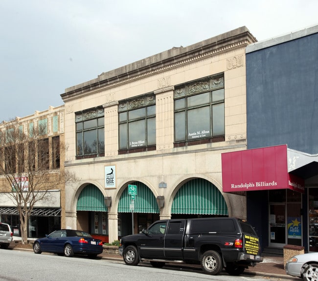
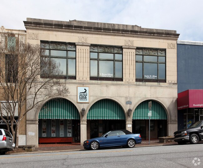
Property Record
20 2Nd St Nw, Hickory, NC 28601
NEARBY LISTINGS FOR SALE OR LEASE
Property Detail
20 2Nd St Nw
3702075988400000
20 2ND ST NW
Commercialnec
Catawba
X
North Carolina
3710370200J
0.20 AC
2024
Catawba County
2025
Charlotte
010501
Hickory-Lenoir-Morganton, NC
15,300 SF
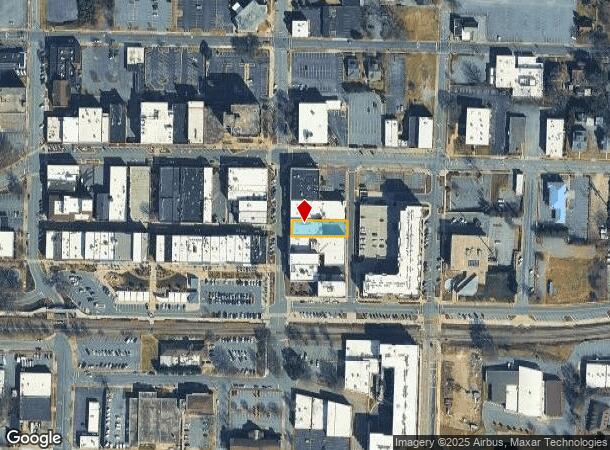
DEMOGRAPHICS near 20 2Nd St Nw
1 Mile
3 Mile
5 Mile
2024 Total Population
7,680
37,883
72,905
2029 Population
8,081
39,710
75,819
Pop Growth 2024-2029
+ 5.22%
+ 4.82%
+ 4.00%
Average Age
40
41
41
2024 Total Households
3,037
16,056
29,988
HH Growth 2024-2029
+ 5.43%
+ 4.83%
+ 4.01%
Median Household Inc
$36,836
$50,077
$56,532
Avg Household Size
2.20
2.20
2.30
2024 Avg HH Vehicles
2.00
2.00
2.00
Median Home Value
$179,305
$180,902
$183,661
Median Year Built
1966
1975
1979
Nearby Places
Map Layers
Map Styles
 Street
 Aerial
- Restaurants
- Banks
- Shops
- Fitness
- Groceries
SALE & LEASE HISTORY
LISTING DATE
SALE/LEASE

Nov 01, 2016
For Sale
Nov 01, 2016
For Lease
Jan 20, 2017
For Lease
Nearby Properties
Address
Land Use
TOTAL SIZE
Lot Size
Zoning
Address
Land Use
TOTAL SIZE
Lot Size
Zoning
10,422 SF
4.23 AC
OI
Address
Land Use
TOTAL SIZE
Lot Size
Zoning
8,492 SF
15.83 AC
R-4
Address
Land Use
TOTAL SIZE
Lot Size
Zoning
16,594 SF
7.22 AC
PD
Address
Land Use
TOTAL SIZE
Lot Size
Zoning
19.87 AC
OI
Address
Land Use
TOTAL SIZE
Lot Size
Zoning
27,008 SF
12.02 AC
R-3
Address
Land Use
TOTAL SIZE
Lot Size
Zoning
27.56 AC
OI
Address
Land Use
TOTAL SIZE
Lot Size
Zoning
94,152 SF
14.46 AC
IND
Address
Land Use
TOTAL SIZE
Lot Size
Zoning
7,722 SF
10.01 AC
R-4
Address
Land Use
TOTAL SIZE
Lot Size
Zoning
57,658 SF
10.64 AC
OI
Address
Land Use
TOTAL SIZE
Lot Size
Zoning
326,813 SF
37.87 AC
IND
Address
Land Use
TOTAL SIZE
Lot Size
Zoning
8,436 SF
13.28 AC
R-4
Address
Land Use
TOTAL SIZE
Lot Size
Zoning
31,854 SF
24.55 AC
PD
Address
Land Use
TOTAL SIZE
Lot Size
Zoning
353,092 SF
35.72 AC
IND
Address
Land Use
TOTAL SIZE
Lot Size
Zoning
9,376 SF
0.75 AC
C-1
Address
Land Use
TOTAL SIZE
Lot Size
Zoning
311,263 SF
37.58 AC
IND
Address
Land Use
TOTAL SIZE
Lot Size
Zoning
7,240 SF
INDUSTRIAL
Address
Land Use
TOTAL SIZE
Lot Size
Zoning
30,415 SF
1.59 AC
C-1
Address
Land Use
TOTAL SIZE
Lot Size
Zoning
234,541 SF
9.07 AC
C-3
Address
Land Use
TOTAL SIZE
Lot Size
Zoning
146,932 SF
27.08 AC
C-3
Address
Land Use
TOTAL SIZE
Lot Size
Zoning
90,440 SF
5.17 AC
OI
Address
Land Use
TOTAL SIZE
Lot Size
Zoning
9,950 SF
9.42 AC
R-3
Address
Land Use
TOTAL SIZE
Lot Size
Zoning
8,960 SF
14.07 AC
R-4
Address
Land Use
TOTAL SIZE
Lot Size
Zoning
8,637 SF
5 AC
CC-1
Address
Land Use
TOTAL SIZE
Lot Size
Zoning
385,204 SF
14.33 AC
C-3
Address
Land Use
TOTAL SIZE
Lot Size
Zoning
14.15 AC
OI
Address
Land Use
TOTAL SIZE
Lot Size
Zoning
22,319 SF
15.57 AC
CC-1
Address
Land Use
TOTAL SIZE
Lot Size
Zoning
60,130 SF
4.02 AC
IND
Address
Land Use
TOTAL SIZE
Lot Size
Zoning
8.36 AC
OI
Address
Land Use
TOTAL SIZE
Lot Size
Zoning
39,752 SF
11.46 AC
PD
Address
Land Use
TOTAL SIZE
Lot Size
Zoning
6,144 SF
11.37 AC
R-4
The World's #1 Commercial Real Estate Marketplace
Connect with us
© 2025 CoStar Group
The information above has been obtained from sources believed reliable. While we do not doubt its accuracy we have not verified it and make no guarantee, warranty or representation about it. It is your responsibility to independently confirm its accuracy and completeness. Any projections, opinions, assumptions, or estimates used are for example only and do not represent the current or future performance of the property. The value of this transaction to you depends on tax and other factors which should be evaluated by your tax, financial, and legal advisors. You and your advisors should conduct a careful, independent investigation of the property to determine to your satisfaction the suitability of the property for your needs.