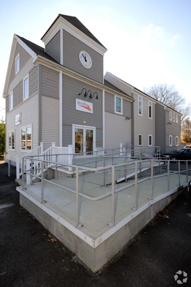
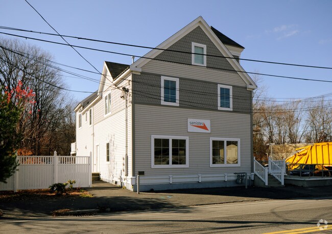
Property Record
20 A St, Framingham, MA 01701

Property Detail
20 A St
FRAM-000050-000032-008222
MIDDLESEX
Officebuilding
Massachusetts
B1
8222
AE The base floodplain where base flood elevations are provided. AE Zones are now used on new format FIRMs instead of A1-A30 Zones.
0.09 AC
2025
Framingham/Natick
2025
Boston
383700
Boston-Cambridge-Newton, MA-NH
3,540 SF
NEARBY LISTINGS FOR SALE OR LEASE
DEMOGRAPHICS near 20 A St
1 mile
3 mile
5 mile
2025 Total Population
9,939
69,736
150,937
2030 Population
10,277
72,423
157,199
Pop Growth 2025-2030
+ 3.40%
+ 3.85%
+ 4.15%
Average Age
43
42
41
2025 Total Households
3,992
26,911
57,209
HH Growth 2025-2030
+ 3.48%
+ 3.92%
+ 4.28%
Median Household Inc
$120,688
$115,766
$123,805
Avg Household Size
2.40
2.50
2.50
2025 Avg HH Vehicles
2.00
2.00
2.00
Median Home Value
$688,600
$732,271
$787,339
Median Year Built
1961
1962
1965
Nearby Places
Map Layers
Map Styles
 Street
 Aerial
Transit
 Traffic
 Biking
Places
Listings with unknown addresses are not visible on the map
- Restaurants
- Banks
- Shops
- Fitness
- Groceries
PUBLIC TRANSPORTATION
COMMUTER RAIL
Framingham (Framingham/Worcester Line - Massachusetts Bay Transportation Authority Commuter Rail (Purple Line))
Drive
Walk
Distance
Framingham (Framingham/Worcester Line - Massachusetts Bay Transportation Authority Commuter Rail (Purple Line))
8 min
3.5 mi
Drive
Walk
Distance
8 min
3.6 mi
AIRPORT
General Edward Lawrence Logan International
Drive
Walk
Distance
General Edward Lawrence Logan International
35 min
23.4 mi
Worcester Regional
Drive
Walk
Distance
Worcester Regional
47 min
27.2 mi
Freight Ports
Port of Boston
Drive
Walk
Distance
Port of Boston
33 min
21.7 mi
Nearby Properties
Address
Land Use
TOTAL SIZE
Lot Size
Zoning
Address
Land Use
TOTAL SIZE
Lot Size
Zoning
246,505 SF
6.48 AC
INII
Address
Land Use
TOTAL SIZE
Lot Size
Zoning
478,440 SF
11.97 AC
B
Address
Land Use
TOTAL SIZE
Lot Size
Zoning
396,002 SF
44.44 AC
R1
Address
Land Use
TOTAL SIZE
Lot Size
Zoning
509,007 SF
22.27 AC
HM-I
Address
Land Use
TOTAL SIZE
Lot Size
Zoning
304,444 SF
16.88 AC
INII
Address
Land Use
TOTAL SIZE
Lot Size
Zoning
94,545 SF
11.70 AC
RSA
Address
Land Use
TOTAL SIZE
Lot Size
Zoning
137,000 SF
18.96 AC
R1
Address
Land Use
TOTAL SIZE
Lot Size
Zoning
837,977 SF
18.57 AC
M1
Address
Land Use
TOTAL SIZE
Lot Size
Zoning
493,918 SF
28.90 AC
R1
Address
Land Use
TOTAL SIZE
Lot Size
Zoning
87,102 SF
8.26 AC
R40
Address
Land Use
TOTAL SIZE
Lot Size
Zoning
264,247 SF
6.09 AC
M1
Address
Land Use
TOTAL SIZE
Lot Size
Zoning
269,426 SF
HM-II
Address
Land Use
TOTAL SIZE
Lot Size
Zoning
136,919 SF
13.42 AC
M
Address
Land Use
TOTAL SIZE
Lot Size
Zoning
165,382 SF
12.46 AC
HPU
Address
Land Use
TOTAL SIZE
Lot Size
Zoning
122,748 SF
16.90 AC
HPU
Address
Land Use
TOTAL SIZE
Lot Size
Zoning
256,830 SF
12.61 AC
B
Address
Land Use
TOTAL SIZE
Lot Size
Zoning
51,524 SF
67.86 AC
R40
Address
Land Use
TOTAL SIZE
Lot Size
Zoning
207,522 SF
10.11 AC
B
Address
Land Use
TOTAL SIZE
Lot Size
Zoning
79.30 AC
RSA
Address
Land Use
TOTAL SIZE
Lot Size
Zoning
198,692 SF
2.60 AC
CII
Address
Land Use
TOTAL SIZE
Lot Size
Zoning
182,524 SF
3.60 AC
B2
Address
Land Use
TOTAL SIZE
Lot Size
Zoning
199,320 SF
16.65 AC
RSA
Address
Land Use
TOTAL SIZE
Lot Size
Zoning
231,897 SF
7.90 AC
B
Address
Land Use
TOTAL SIZE
Lot Size
Zoning
173,120 SF
15.29 AC
HM-I
Address
Land Use
TOTAL SIZE
Lot Size
Zoning
182,736 SF
7.30 AC
B2
Address
Land Use
TOTAL SIZE
Lot Size
Zoning
317,308 SF
10.04 AC
M
Address
Land Use
TOTAL SIZE
Lot Size
Zoning
139,397 SF
9.15 AC
M
Address
Land Use
TOTAL SIZE
Lot Size
Zoning
350,935 SF
25.51 AC
M
Address
Land Use
TOTAL SIZE
Lot Size
Zoning
73,257 SF
10.23 AC
RSA
Address
Land Use
TOTAL SIZE
Lot Size
Zoning
183,338 SF
4.85 AC
B2
The World's #1 Commercial Real Estate Marketplace
Connect with us
© 2026 CoStar Group
The information above has been obtained from sources believed reliable. While we do not doubt its accuracy we have not verified it and make no guarantee, warranty or representation about it. It is your responsibility to independently confirm its accuracy and completeness. Any projections, opinions, assumptions, or estimates used are for example only and do not represent the current or future performance of the property. The value of this transaction to you depends on tax and other factors which should be evaluated by your tax, financial, and legal advisors. You and your advisors should conduct a careful, independent investigation of the property to determine to your satisfaction the suitability of the property for your needs.