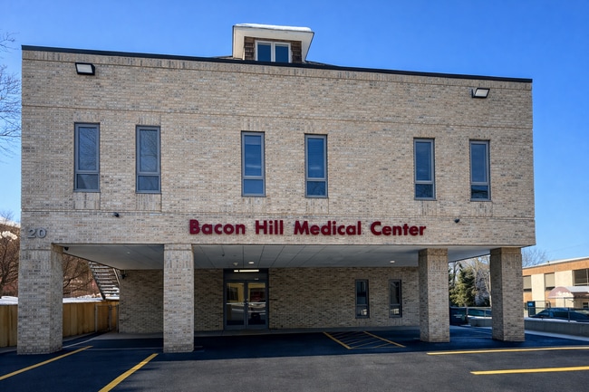
Property Record
20 Beacon Hill Dr, Dobbs Ferry, NY 10522


Current Lease Availabilities
NEARBY LISTINGS FOR SALE OR LEASE
Property Detail
20 Beacon Hill Dr
2603-003-090-00058-000-0003
Westchester
Professionalbldglegalinsurancerealestateetc
New York
X
3.000
36119C0263F
0.28 AC
2025
Southwest
2024
Westchester/So Connecticut
010500
New York-Jersey City-White Plains, NY-NJ
4,100 SF
DEMOGRAPHICS near 20 Beacon Hill Dr
1 Mile
3 Mile
5 Mile
2024 Total Population
11,835
54,644
247,876
2029 Population
11,524
53,581
243,255
Pop Growth 2024-2029
(2.63%)
(1.95%)
(1.86%)
Average Age
42
43
42
2024 Total Households
4,311
19,508
92,538
HH Growth 2024-2029
(2.83%)
(2.12%)
(1.97%)
Median Household Inc
$153,654
$168,165
$124,729
Avg Household Size
2.60
2.70
2.60
2024 Avg HH Vehicles
2.00
2.00
2.00
Median Home Value
$742,924
$777,533
$651,349
Median Year Built
1954
1957
1958
Nearby Places
Map Layers
Map Styles
 Street
 Aerial
- Restaurants
- Banks
- Shops
- Fitness
- Groceries
PUBLIC TRANSPORTATION
COMMUTER RAIL
Dobbs Ferry Station (Hudson Line - Metro-North Commuter Railroad Company (Metro-North))
DRIVE
WALK
Distance
Dobbs Ferry Station (Hudson Line - Metro-North Commuter Railroad Company (Metro-North))
3 min
19 min
1.0 mi
Ardsley-On-Hudson Station (Hudson Line - Metro-North Commuter Railroad Company (Metro-North))
DRIVE
WALK
Distance
Ardsley-On-Hudson Station (Hudson Line - Metro-North Commuter Railroad Company (Metro-North))
4 min
1.6 mi
AIRPORT
Westchester County
DRIVE
WALK
Distance
Westchester County
23 min
15.9 mi
LaGuardia
DRIVE
WALK
Distance
LaGuardia
34 min
21.9 mi
John F Kennedy International
DRIVE
WALK
Distance
John F Kennedy International
45 min
30.5 mi
Freight Ports
NY - Red Hook Container Terminal
DRIVE
WALK
Distance
NY - Red Hook Container Terminal
47 min
30.1 mi
Nearby Properties
Address
Land Use
TOTAL SIZE
Lot Size
Zoning
Address
Land Use
TOTAL SIZE
Lot Size
Zoning
88.45 AC
Address
Land Use
TOTAL SIZE
Lot Size
Zoning
229.55 AC
P
Address
Land Use
TOTAL SIZE
Lot Size
Zoning
63.48 AC
R-30
Address
Land Use
TOTAL SIZE
Lot Size
Zoning
2,736 SF
25.26 AC
Address
Land Use
TOTAL SIZE
Lot Size
Zoning
101.99 AC
Address
Land Use
TOTAL SIZE
Lot Size
Zoning
23.97 AC
Address
Land Use
TOTAL SIZE
Lot Size
Zoning
Address
Land Use
TOTAL SIZE
Lot Size
Zoning
13.22 AC
CA
Address
Land Use
TOTAL SIZE
Lot Size
Zoning
29.81 AC
Address
Land Use
TOTAL SIZE
Lot Size
Zoning
61.28 AC
Address
Land Use
TOTAL SIZE
Lot Size
Zoning
68,911 SF
16.31 AC
Address
Land Use
TOTAL SIZE
Lot Size
Zoning
97,600 SF
136.28 AC
R-40
Address
Land Use
TOTAL SIZE
Lot Size
Zoning
29.35 AC
Address
Land Use
TOTAL SIZE
Lot Size
Zoning
11.68 AC
Address
Land Use
TOTAL SIZE
Lot Size
Zoning
Address
Land Use
TOTAL SIZE
Lot Size
Zoning
Address
Land Use
TOTAL SIZE
Lot Size
Zoning
8.42 AC
Address
Land Use
TOTAL SIZE
Lot Size
Zoning
Address
Land Use
TOTAL SIZE
Lot Size
Zoning
26.50 AC
Address
Land Use
TOTAL SIZE
Lot Size
Zoning
14.92 AC
Address
Land Use
TOTAL SIZE
Lot Size
Zoning
1.65 AC
Address
Land Use
TOTAL SIZE
Lot Size
Zoning
11.18 AC
Address
Land Use
TOTAL SIZE
Lot Size
Zoning
220,000 SF
2.01 AC
Address
Land Use
TOTAL SIZE
Lot Size
Zoning
18.72 AC
Address
Land Use
TOTAL SIZE
Lot Size
Zoning
28.77 AC
Address
Land Use
TOTAL SIZE
Lot Size
Zoning
14.31 AC
Address
Land Use
TOTAL SIZE
Lot Size
Zoning
9.75 AC
Address
Land Use
TOTAL SIZE
Lot Size
Zoning
16.91 AC
Address
Land Use
TOTAL SIZE
Lot Size
Zoning
125,000 SF
1.62 AC
Address
Land Use
TOTAL SIZE
Lot Size
Zoning
1,823 SF
6.89 AC
The World's #1 Commercial Real Estate Marketplace
Connect with us
© 2026 CoStar Group
The information above has been obtained from sources believed reliable. While we do not doubt its accuracy we have not verified it and make no guarantee, warranty or representation about it. It is your responsibility to independently confirm its accuracy and completeness. Any projections, opinions, assumptions, or estimates used are for example only and do not represent the current or future performance of the property. The value of this transaction to you depends on tax and other factors which should be evaluated by your tax, financial, and legal advisors. You and your advisors should conduct a careful, independent investigation of the property to determine to your satisfaction the suitability of the property for your needs.