Property Record
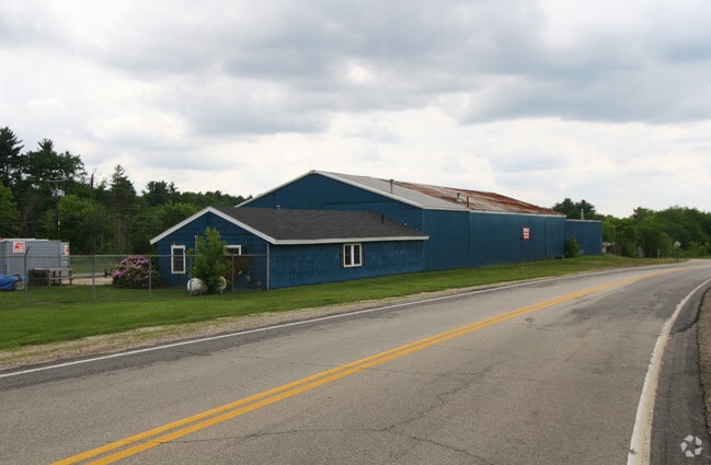
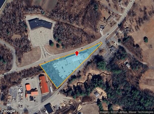
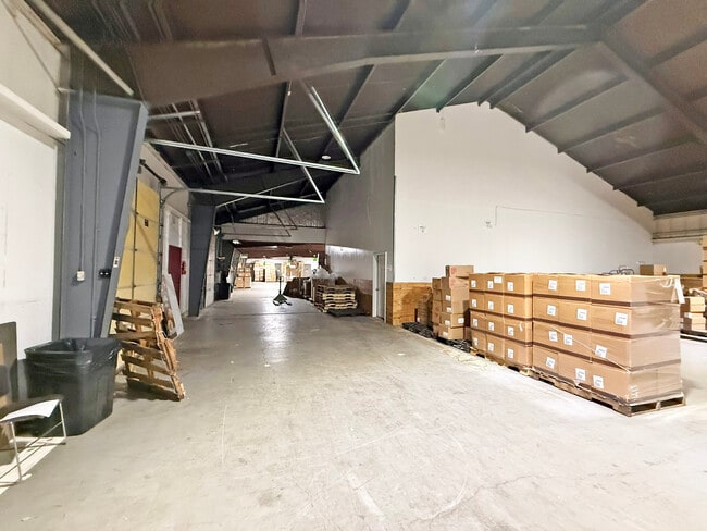
20 Colby Rd, Litchfield, NH 03052
Current Lease Availabilities
NEARBY LISTINGS FOR SALE OR LEASE
Property Detail
20 Colby Rd
LTCH-000021-000000-000002
Hillsborough
Industrialgeneral
New Hampshire
X
2
33011C0389D
2.80 AC
2024
Hillsborough
2024
Boston
013102
Manchester-Nashua, NH
12,745 SF
DEMOGRAPHICS near 20 Colby Rd
1 Mile
3 Mile
5 Mile
2024 Total Population
2,878
23,374
59,772
2029 Population
2,938
23,972
61,649
Pop Growth 2024-2029
+ 2.08%
+ 2.56%
+ 3.14%
Average Age
41
42
42
2024 Total Households
1,167
8,961
22,354
HH Growth 2024-2029
+ 2.14%
+ 2.57%
+ 3.18%
Median Household Inc
$93,276
$109,346
$118,319
Avg Household Size
2.40
2.60
2.60
2024 Avg HH Vehicles
2.00
2.00
2.00
Median Home Value
$325,087
$357,093
$393,212
Median Year Built
1983
1984
1985
Nearby Places
- Restaurants
- Banks
- Shops
- Fitness
- Groceries
PUBLIC TRANSPORTATION
AIRPORT
Manchester Boston Regional
DRIVE
WALK
Distance
Manchester Boston Regional
11 min
4.5 mi
Freight Ports
Port of Boston
DRIVE
WALK
Distance
Port of Boston
74 min
51.0 mi
Nearby Properties
Address
Land Use
TOTAL SIZE
Lot Size
Zoning
Address
Land Use
TOTAL SIZE
Lot Size
Zoning
768,020 SF
74.47 AC
I-II
Address
Land Use
TOTAL SIZE
Lot Size
Zoning
202,546 SF
55 AC
RESIDE
Address
Land Use
TOTAL SIZE
Lot Size
Zoning
603,357 SF
45.12 AC
GB
Address
Land Use
TOTAL SIZE
Lot Size
Zoning
56,997 SF
31.28 AC
INDUST
Address
Land Use
TOTAL SIZE
Lot Size
Zoning
42,228 SF
15.58 AC
PZ
Address
Land Use
TOTAL SIZE
Lot Size
Zoning
50.47 AC
GB
Address
Land Use
TOTAL SIZE
Lot Size
Zoning
151,002 SF
6.95 AC
PZ
Address
Land Use
TOTAL SIZE
Lot Size
Zoning
142,318 SF
26.13 AC
GB
Address
Land Use
TOTAL SIZE
Lot Size
Zoning
227,589 SF
GB
Address
Land Use
TOTAL SIZE
Lot Size
Zoning
244,637 SF
27.28 AC
IND-II
Address
Land Use
TOTAL SIZE
Lot Size
Zoning
13,395 SF
8.16 AC
PZ
Address
Land Use
TOTAL SIZE
Lot Size
Zoning
116.34 AC
IND-II
Address
Land Use
TOTAL SIZE
Lot Size
Zoning
24.20 AC
GB
Address
Land Use
TOTAL SIZE
Lot Size
Zoning
24,495 SF
13.05 AC
RESIDE
Address
Land Use
TOTAL SIZE
Lot Size
Zoning
5,894 SF
12.50 AC
RESIDE
Address
Land Use
TOTAL SIZE
Lot Size
Zoning
1.63 AC
RES
Address
Land Use
TOTAL SIZE
Lot Size
Zoning
Address
Land Use
TOTAL SIZE
Lot Size
Zoning
69,045 SF
35 AC
RESIDE
Address
Land Use
TOTAL SIZE
Lot Size
Zoning
107,615 SF
13.34 AC
PZ
Address
Land Use
TOTAL SIZE
Lot Size
Zoning
70,098 SF
7.69 AC
C2- GE
Address
Land Use
TOTAL SIZE
Lot Size
Zoning
Address
Land Use
TOTAL SIZE
Lot Size
Zoning
240,111 SF
21.18 AC
INDUST
Address
Land Use
TOTAL SIZE
Lot Size
Zoning
27,372 SF
28.89 AC
AR-I
Address
Land Use
TOTAL SIZE
Lot Size
Zoning
69,031 SF
62.01 AC
RES
Address
Land Use
TOTAL SIZE
Lot Size
Zoning
70,180 SF
10.34 AC
IND-II
Address
Land Use
TOTAL SIZE
Lot Size
Zoning
125,088 SF
8.94 AC
PZ
Address
Land Use
TOTAL SIZE
Lot Size
Zoning
50,963 SF
C2- GE
Address
Land Use
TOTAL SIZE
Lot Size
Zoning
142,740 SF
3.16 AC
INDUST
Address
Land Use
TOTAL SIZE
Lot Size
Zoning
57,842 SF
45.44 AC
INDUST
Address
Land Use
TOTAL SIZE
Lot Size
Zoning
65,234 SF
8.33 AC
C2- GE
The World's #1 Commercial Real Estate Marketplace
Connect with us
© 2025 CoStar Group
The information above has been obtained from sources believed reliable. While we do not doubt its accuracy we have not verified it and make no guarantee, warranty or representation about it. It is your responsibility to independently confirm its accuracy and completeness. Any projections, opinions, assumptions, or estimates used are for example only and do not represent the current or future performance of the property. The value of this transaction to you depends on tax and other factors which should be evaluated by your tax, financial, and legal advisors. You and your advisors should conduct a careful, independent investigation of the property to determine to your satisfaction the suitability of the property for your needs.