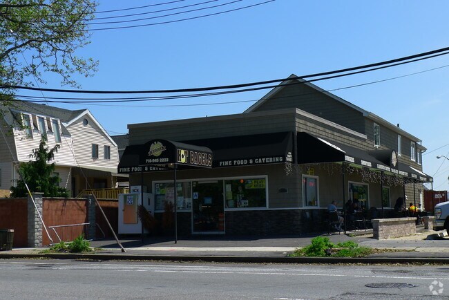
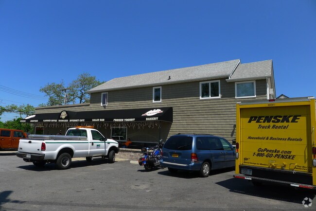
Property Record
20 Demerest Rd, Broad Channel, NY 11693
NEARBY LISTINGS FOR SALE OR LEASE
Property Detail
20 Demerest Rd
New York-Jersey City-White Plains, NY-NJ
Broad Channel Improv 6 S
15485-0013
Queens
Commercialnec
New York
AE
14
3604970377F
0.06 AC
2024
South Queens
2025
Long Island (New York)
107201
DEMOGRAPHICS near 20 Demerest Rd
1 Mile
3 Mile
5 Mile
2024 Total Population
10,191
66,870
224,871
2029 Population
9,633
62,822
210,493
Pop Growth 2024-2029
(5.48%)
(6.05%)
(6.39%)
Average Age
40
41
41
2024 Total Households
3,828
24,490
79,589
HH Growth 2024-2029
(5.88%)
(6.15%)
(6.53%)
Median Household Inc
$55,539
$59,867
$62,721
Avg Household Size
2.60
2.50
2.70
2024 Avg HH Vehicles
1.00
1.00
1.00
Median Home Value
$551,173
$617,473
$679,865
Median Year Built
1963
1966
1963
Nearby Places
- Restaurants
- Banks
- Shops
- Fitness
- Groceries
PUBLIC TRANSPORTATION
TRANSIT/SUBWAY
Broad Channel (A - New York MTA Subway (The Subway), Rockaway Park Shuttle - New York MTA Subway (The Subway))
DRIVE
WALK
Distance
Broad Channel (A - New York MTA Subway (The Subway), Rockaway Park Shuttle - New York MTA Subway (The Subway))
3 min
16 min
0.8 mi
COMMUTER RAIL
Far Rockaway Station (Far Rockaway Branch - Long Island Rail Road)
DRIVE
WALK
Distance
Far Rockaway Station (Far Rockaway Branch - Long Island Rail Road)
11 min
5.2 mi
Inwood Station (Far Rockaway Branch - Long Island Rail Road)
DRIVE
WALK
Distance
Inwood Station (Far Rockaway Branch - Long Island Rail Road)
11 min
6.5 mi
AIRPORT
John F Kennedy International
DRIVE
WALK
Distance
John F Kennedy International
19 min
9.8 mi
LaGuardia
DRIVE
WALK
Distance
LaGuardia
30 min
16.6 mi
Newark Liberty International
DRIVE
WALK
Distance
Newark Liberty International
54 min
27.2 mi
Freight Ports
NY - Red Hook Container Terminal
DRIVE
WALK
Distance
NY - Red Hook Container Terminal
33 min
16.1 mi
Nearby Properties
Address
Land Use
TOTAL SIZE
Lot Size
Zoning
Address
Land Use
TOTAL SIZE
Lot Size
Zoning
477.04 AC
PARKUS
Address
Land Use
TOTAL SIZE
Lot Size
Zoning
229.51 AC
PARKUS
Address
Land Use
TOTAL SIZE
Lot Size
Zoning
72,663 SF
264.48 AC
PARK
Address
Land Use
TOTAL SIZE
Lot Size
Zoning
200.83 AC
PARK
Address
Land Use
TOTAL SIZE
Lot Size
Zoning
42.84 AC
PARK
Address
Land Use
TOTAL SIZE
Lot Size
Zoning
60.84 AC
R4
Address
Land Use
TOTAL SIZE
Lot Size
Zoning
169.01 AC
PARK
Address
Land Use
TOTAL SIZE
Lot Size
Zoning
1,085,148 SF
13.53 AC
R6
Address
Land Use
TOTAL SIZE
Lot Size
Zoning
407,218 SF
34.48 AC
R4
Address
Land Use
TOTAL SIZE
Lot Size
Zoning
32.47 AC
PARK
Address
Land Use
TOTAL SIZE
Lot Size
Zoning
820,910 SF
21.03 AC
R4
Address
Land Use
TOTAL SIZE
Lot Size
Zoning
188.92 AC
PARK
Address
Land Use
TOTAL SIZE
Lot Size
Zoning
17.68 AC
PARK
Address
Land Use
TOTAL SIZE
Lot Size
Zoning
1,800 SF
65.66 AC
PARK
Address
Land Use
TOTAL SIZE
Lot Size
Zoning
587,170 SF
13.55 AC
R4
Address
Land Use
TOTAL SIZE
Lot Size
Zoning
14.91 AC
C4-4
Address
Land Use
TOTAL SIZE
Lot Size
Zoning
160,315 SF
0.66 AC
R7A
Address
Land Use
TOTAL SIZE
Lot Size
Zoning
72,148 SF
0.44 AC
R6A
Address
Land Use
TOTAL SIZE
Lot Size
Zoning
449,000 SF
5.15 AC
R6
Address
Land Use
TOTAL SIZE
Lot Size
Zoning
128,000 SF
2.52 AC
R5
Address
Land Use
TOTAL SIZE
Lot Size
Zoning
666,256 SF
14.16 AC
R6
Address
Land Use
TOTAL SIZE
Lot Size
Zoning
145,883 SF
1.29 AC
R6
Address
Land Use
TOTAL SIZE
Lot Size
Zoning
3,120 SF
20.62 AC
PARK
Address
Land Use
TOTAL SIZE
Lot Size
Zoning
120,994 SF
1.71 AC
R6
Address
Land Use
TOTAL SIZE
Lot Size
Zoning
358,140 SF
8.13 AC
R5
Address
Land Use
TOTAL SIZE
Lot Size
Zoning
16.49 AC
PARK
Address
Land Use
TOTAL SIZE
Lot Size
Zoning
334,586 SF
12.25 AC
R5
Address
Land Use
TOTAL SIZE
Lot Size
Zoning
14.26 AC
R3X
Address
Land Use
TOTAL SIZE
Lot Size
Zoning
253,000 SF
7.97 AC
R5
Address
Land Use
TOTAL SIZE
Lot Size
Zoning
129,955 SF
0.34 AC
R8
The World's #1 Commercial Real Estate Marketplace
Connect with us
© 2025 CoStar Group
The information above has been obtained from sources believed reliable. While we do not doubt its accuracy we have not verified it and make no guarantee, warranty or representation about it. It is your responsibility to independently confirm its accuracy and completeness. Any projections, opinions, assumptions, or estimates used are for example only and do not represent the current or future performance of the property. The value of this transaction to you depends on tax and other factors which should be evaluated by your tax, financial, and legal advisors. You and your advisors should conduct a careful, independent investigation of the property to determine to your satisfaction the suitability of the property for your needs.