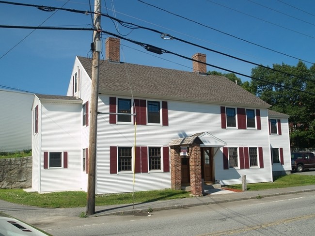
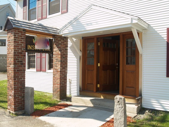
Property Record
20 Dunstable Rd, North Chelmsford, MA 01863
NEARBY LISTINGS FOR SALE OR LEASE
Property Detail
20 Dunstable Rd
CHEL-000013-000021-000010
Middlesex
Officebuilding
Massachusetts
X
10
25017C0119F
0.10 AC
2025
Lowell/Chelmsford
2025
Boston
317302
Boston-Cambridge-Newton, MA-NH
2,976 SF
DEMOGRAPHICS near 20 Dunstable Rd
1 Mile
3 Mile
5 Mile
2024 Total Population
8,239
66,517
185,043
2029 Population
8,108
65,547
182,377
Pop Growth 2024-2029
(1.59%)
(1.46%)
(1.44%)
Average Age
42
40
39
2024 Total Households
3,436
24,019
67,346
HH Growth 2024-2029
(1.80%)
(1.57%)
(1.49%)
Median Household Inc
$87,373
$93,700
$85,258
Avg Household Size
2.30
2.60
2.60
2024 Avg HH Vehicles
2.00
2.00
2.00
Median Home Value
$371,104
$443,837
$431,531
Median Year Built
1977
1968
1964
Nearby Places
Map Layers
Map Styles
 Street
 Aerial
- Restaurants
- Banks
- Shops
- Fitness
- Groceries
PUBLIC TRANSPORTATION
COMMUTER RAIL
Lowell (Lowell Line - Massachusetts Bay Transportation Authority Commuter Rail (Purple Line))
DRIVE
WALK
Distance
Lowell (Lowell Line - Massachusetts Bay Transportation Authority Commuter Rail (Purple Line))
8 min
4.1 mi
North Billerica (Lowell Line - Massachusetts Bay Transportation Authority Commuter Rail (Purple Line))
DRIVE
WALK
Distance
North Billerica (Lowell Line - Massachusetts Bay Transportation Authority Commuter Rail (Purple Line))
14 min
8.6 mi
AIRPORT
Manchester Boston Regional
DRIVE
WALK
Distance
Manchester Boston Regional
39 min
26.3 mi
General Edward Lawrence Logan International
DRIVE
WALK
Distance
General Edward Lawrence Logan International
51 min
37.9 mi
Freight Ports
Port of Boston
DRIVE
WALK
Distance
Port of Boston
52 min
37.6 mi
SALE & LEASE HISTORY
LISTING DATE
SALE/LEASE

Feb 13, 2017
For Lease
Nearby Properties
Address
Land Use
TOTAL SIZE
Lot Size
Zoning
Address
Land Use
TOTAL SIZE
Lot Size
Zoning
9.73 AC
INST
Address
Land Use
TOTAL SIZE
Lot Size
Zoning
23,251 SF
18.20 AC
SMF
Address
Land Use
TOTAL SIZE
Lot Size
Zoning
19.97 AC
SSF
Address
Land Use
TOTAL SIZE
Lot Size
Zoning
59.09 AC
SSF
Address
Land Use
TOTAL SIZE
Lot Size
Zoning
269,952 SF
18.11 AC
P
Address
Land Use
TOTAL SIZE
Lot Size
Zoning
68.15 AC
R1
Address
Land Use
TOTAL SIZE
Lot Size
Zoning
262,607 SF
4.33 AC
INST
Address
Land Use
TOTAL SIZE
Lot Size
Zoning
7.18 AC
SMF
Address
Land Use
TOTAL SIZE
Lot Size
Zoning
38.26 AC
P
Address
Land Use
TOTAL SIZE
Lot Size
Zoning
63,768 SF
8.83 AC
SMU
Address
Land Use
TOTAL SIZE
Lot Size
Zoning
33.01 AC
R3
Address
Land Use
TOTAL SIZE
Lot Size
Zoning
44.39 AC
SMU
Address
Land Use
TOTAL SIZE
Lot Size
Zoning
18.50 AC
CC
Address
Land Use
TOTAL SIZE
Lot Size
Zoning
199.97 AC
B2
Address
Land Use
TOTAL SIZE
Lot Size
Zoning
6.93 AC
SMU
Address
Land Use
TOTAL SIZE
Lot Size
Zoning
3.40 AC
INST
Address
Land Use
TOTAL SIZE
Lot Size
Zoning
3.85 AC
SMF
Address
Land Use
TOTAL SIZE
Lot Size
Zoning
4.67 AC
IA
Address
Land Use
TOTAL SIZE
Lot Size
Zoning
8.30 AC
B3
Address
Land Use
TOTAL SIZE
Lot Size
Zoning
73,965 SF
1.33 AC
TTF
Address
Land Use
TOTAL SIZE
Lot Size
Zoning
90,463 SF
8.56 AC
RA
Address
Land Use
TOTAL SIZE
Lot Size
Zoning
177.27 AC
R1
Address
Land Use
TOTAL SIZE
Lot Size
Zoning
10,240 SF
0.15 AC
SMU
Address
Land Use
TOTAL SIZE
Lot Size
Zoning
3.82 AC
TTF
Address
Land Use
TOTAL SIZE
Lot Size
Zoning
2.71 AC
SMF
Address
Land Use
TOTAL SIZE
Lot Size
Zoning
106,077 SF
1.80 AC
TSF
Address
Land Use
TOTAL SIZE
Lot Size
Zoning
12.26 AC
P
Address
Land Use
TOTAL SIZE
Lot Size
Zoning
68,907 SF
2.84 AC
TSF
Address
Land Use
TOTAL SIZE
Lot Size
Zoning
82,182 SF
13.86 AC
P
Address
Land Use
TOTAL SIZE
Lot Size
Zoning
31.92 AC
RB
The World's #1 Commercial Real Estate Marketplace
Connect with us
© 2025 CoStar Group
The information above has been obtained from sources believed reliable. While we do not doubt its accuracy we have not verified it and make no guarantee, warranty or representation about it. It is your responsibility to independently confirm its accuracy and completeness. Any projections, opinions, assumptions, or estimates used are for example only and do not represent the current or future performance of the property. The value of this transaction to you depends on tax and other factors which should be evaluated by your tax, financial, and legal advisors. You and your advisors should conduct a careful, independent investigation of the property to determine to your satisfaction the suitability of the property for your needs.