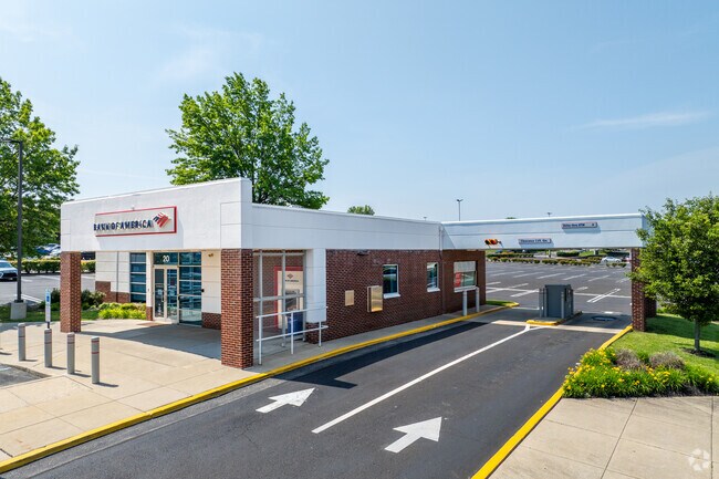
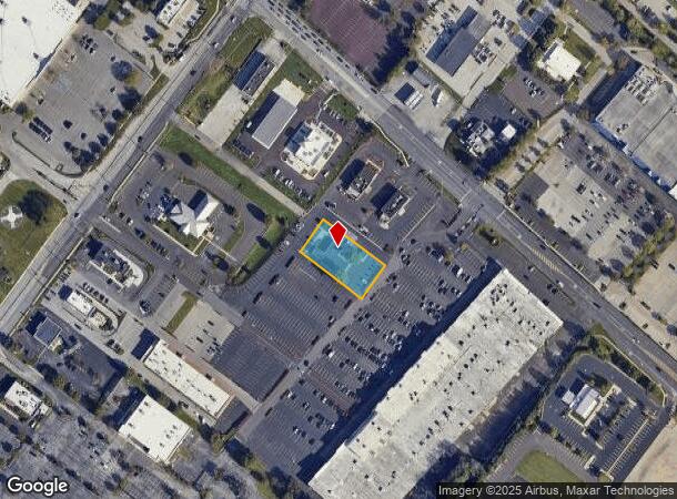
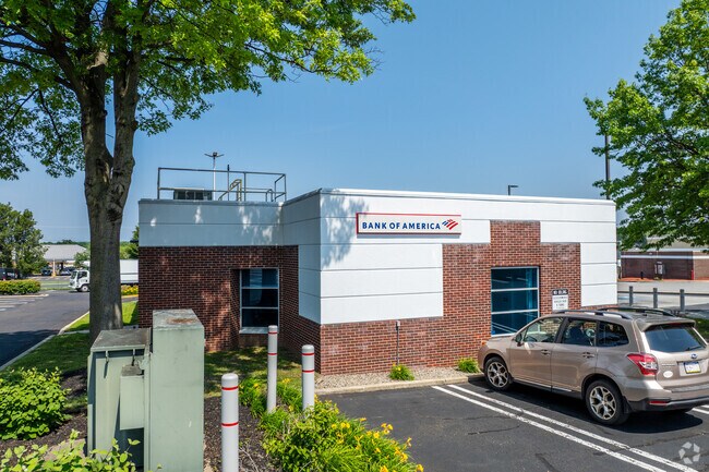
Property Record
20 E Germantown Pike, Norristown, PA 19401
NEARBY LISTINGS FOR SALE OR LEASE
Property Detail
20 E Germantown Pike
Philadelphia-Camden-Wilmington, PA-NJ-DE-MD
Dogwood Hills 04
33-00-03082-206
FIRST PENNSYLVANIA BANK PT U-6
Financialbuilding
Montgomery
X
Pennsylvania
42091C0270G
15
2024
0.85 AC
2025
Norristown/Valley Forge
203303
Philadelphia
3,314 SF
DEMOGRAPHICS near 20 E Germantown Pike
1 Mile
3 Mile
5 Mile
2024 Total Population
10,810
87,508
180,357
2029 Population
11,097
89,376
183,680
Pop Growth 2024-2029
+ 2.65%
+ 2.13%
+ 1.84%
Average Age
46
40
41
2024 Total Households
4,490
33,563
71,716
HH Growth 2024-2029
+ 2.76%
+ 2.19%
+ 1.90%
Median Household Inc
$98,810
$82,542
$97,389
Avg Household Size
2.30
2.50
2.40
2024 Avg HH Vehicles
2.00
2.00
2.00
Median Home Value
$302,829
$316,590
$373,369
Median Year Built
1969
1965
1968
Nearby Places
Map Layers
Map Styles
 Street
 Aerial
- Restaurants
- Banks
- Shops
- Fitness
- Groceries
PUBLIC TRANSPORTATION
COMMUTER RAIL
Elm Street (Norristown) (R6 - Southeastern Pennsylvania Transportation Authority Regional Rail (SEPTA Regional Rail))
DRIVE
WALK
Distance
Elm Street (Norristown) (R6 - Southeastern Pennsylvania Transportation Authority Regional Rail (SEPTA Regional Rail))
8 min
2.9 mi
Main Street (Norristown) (R6 - Southeastern Pennsylvania Transportation Authority Regional Rail (SEPTA Regional Rail))
DRIVE
WALK
Distance
Main Street (Norristown) (R6 - Southeastern Pennsylvania Transportation Authority Regional Rail (SEPTA Regional Rail))
8 min
3.2 mi
AIRPORT
Philadelphia International
DRIVE
WALK
Distance
Philadelphia International
44 min
28.6 mi
Trenton Mercer
DRIVE
WALK
Distance
Trenton Mercer
51 min
37.7 mi
Freight Ports
Port of Philadelphia
DRIVE
WALK
Distance
Port of Philadelphia
37 min
21.0 mi
Nearby Properties
Address
Land Use
TOTAL SIZE
Lot Size
Zoning
Address
Land Use
TOTAL SIZE
Lot Size
Zoning
1,807,465 SF
120.12 AC
R2
Address
Land Use
TOTAL SIZE
Lot Size
Zoning
365,348 SF
80.44 AC
IN
Address
Land Use
TOTAL SIZE
Lot Size
Zoning
469,066 SF
47 AC
MU
Address
Land Use
TOTAL SIZE
Lot Size
Zoning
476,392 SF
54.50 AC
I
Address
Land Use
TOTAL SIZE
Lot Size
Zoning
519,822 SF
19.53 AC
AR
Address
Land Use
TOTAL SIZE
Lot Size
Zoning
422,975 SF
92.05 AC
RA
Address
Land Use
TOTAL SIZE
Lot Size
Zoning
505,128 SF
12.11 AC
RE
Address
Land Use
TOTAL SIZE
Lot Size
Zoning
217,564 SF
12.64 AC
IN
Address
Land Use
TOTAL SIZE
Lot Size
Zoning
231,665 SF
26.34 AC
OSR
Address
Land Use
TOTAL SIZE
Lot Size
Zoning
381,496 SF
5.37 AC
EC
Address
Land Use
TOTAL SIZE
Lot Size
Zoning
452,740 SF
11.03 AC
C
Address
Land Use
TOTAL SIZE
Lot Size
Zoning
320,804 SF
30.85 AC
CR
Address
Land Use
TOTAL SIZE
Lot Size
Zoning
512,846 SF
9.50 AC
HRA
Address
Land Use
TOTAL SIZE
Lot Size
Zoning
311,142 SF
39.51 AC
R1
Address
Land Use
TOTAL SIZE
Lot Size
Zoning
53,368 SF
38.59 AC
R3
Address
Land Use
TOTAL SIZE
Lot Size
Zoning
213,070 SF
29.67 AC
RE
Address
Land Use
TOTAL SIZE
Lot Size
Zoning
320,737 SF
0.98 AC
TC
Address
Land Use
TOTAL SIZE
Lot Size
Zoning
416,392 SF
26.56 AC
HR
Address
Land Use
TOTAL SIZE
Lot Size
Zoning
227,948 SF
16 AC
AR
Address
Land Use
TOTAL SIZE
Lot Size
Zoning
208,144 SF
13.91 AC
AR
Address
Land Use
TOTAL SIZE
Lot Size
Zoning
186,736 SF
5.39 AC
AR
Address
Land Use
TOTAL SIZE
Lot Size
Zoning
205,344 SF
26.67 AC
RE
Address
Land Use
TOTAL SIZE
Lot Size
Zoning
747,448 SF
36.04 AC
SC
Address
Land Use
TOTAL SIZE
Lot Size
Zoning
153,544 SF
14.03 AC
I
Address
Land Use
TOTAL SIZE
Lot Size
Zoning
225,196 SF
14.87 AC
AR
Address
Land Use
TOTAL SIZE
Lot Size
Zoning
311,784 SF
21.82 AC
A
Address
Land Use
TOTAL SIZE
Lot Size
Zoning
136,637 SF
18 AC
OSR
Address
Land Use
TOTAL SIZE
Lot Size
Zoning
211,739 SF
14.14 AC
CR
Address
Land Use
TOTAL SIZE
Lot Size
Zoning
275,093 SF
10.79 AC
GA
Address
Land Use
TOTAL SIZE
Lot Size
Zoning
215,084 SF
12.96 AC
PO
The World's #1 Commercial Real Estate Marketplace
Connect with us
© 2025 CoStar Group
The information above has been obtained from sources believed reliable. While we do not doubt its accuracy we have not verified it and make no guarantee, warranty or representation about it. It is your responsibility to independently confirm its accuracy and completeness. Any projections, opinions, assumptions, or estimates used are for example only and do not represent the current or future performance of the property. The value of this transaction to you depends on tax and other factors which should be evaluated by your tax, financial, and legal advisors. You and your advisors should conduct a careful, independent investigation of the property to determine to your satisfaction the suitability of the property for your needs.