Property Record
20 Franklin Tpke, Mahwah, NJ 07430
Current Lease Availabilities
NEARBY LISTINGS FOR SALE OR LEASE
Property Detail
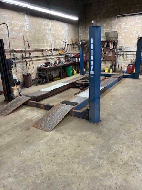
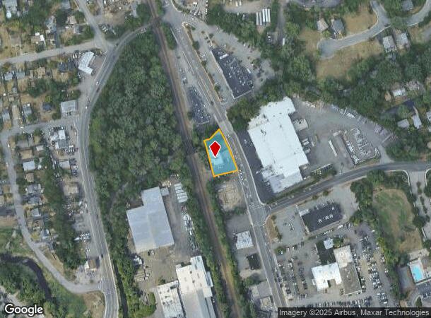
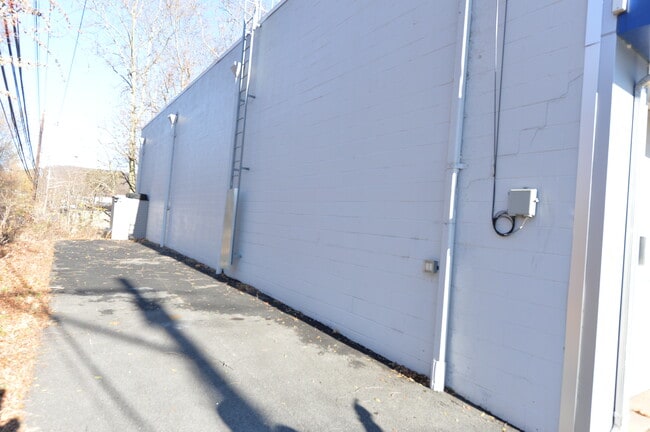
20 Franklin Tpke
New York-Jersey City-White Plains, NY-NJ
191X82
33-00068-0000-00003
Bergen
Commercialnec
New Jersey
AE
3
34003C0057H
0.36 AC
2024
Northwest Bergen
2025
Northern New Jersey
032202
DEMOGRAPHICS near 20 Franklin Tpke
1 Mile
3 Mile
5 Mile
2024 Total Population
13,164
49,806
139,264
2029 Population
13,527
51,529
143,925
Pop Growth 2024-2029
+ 2.76%
+ 3.46%
+ 3.35%
Average Age
42
43
36
2024 Total Households
5,122
19,178
42,376
HH Growth 2024-2029
+ 2.81%
+ 3.47%
+ 3.49%
Median Household Inc
$112,500
$111,979
$108,867
Avg Household Size
2.50
2.50
3.10
2024 Avg HH Vehicles
2.00
2.00
2.00
Median Home Value
$430,880
$548,679
$712,985
Median Year Built
1968
1978
1975
Nearby Places
- Restaurants
- Banks
- Shops
- Fitness
- Groceries
PUBLIC TRANSPORTATION
COMMUTER RAIL
Suffern (Bergen County/Port Jervis Line - NJ Transit Commuter Rail (NJ Transit), Main/Port Jervis Line - NJ Transit Commuter Rail (NJ Transit))
DRIVE
WALK
Distance
Suffern (Bergen County/Port Jervis Line - NJ Transit Commuter Rail (NJ Transit), Main/Port Jervis Line - NJ Transit Commuter Rail (NJ Transit))
2 min
14 min
0.7 mi
Mahwah (Bergen County/Port Jervis Line - NJ Transit Commuter Rail (NJ Transit), Main/Port Jervis Line - NJ Transit Commuter Rail (NJ Transit))
DRIVE
WALK
Distance
Mahwah (Bergen County/Port Jervis Line - NJ Transit Commuter Rail (NJ Transit), Main/Port Jervis Line - NJ Transit Commuter Rail (NJ Transit))
1 min
17 min
0.9 mi
AIRPORT
Westchester County
DRIVE
WALK
Distance
Westchester County
44 min
31.1 mi
LaGuardia
DRIVE
WALK
Distance
LaGuardia
50 min
33.0 mi
New York Stewart International
DRIVE
WALK
Distance
New York Stewart International
47 min
35.9 mi
Freight Ports
Port Newark Container Terminal
DRIVE
WALK
Distance
Port Newark Container Terminal
49 min
34.9 mi
Nearby Properties
Address
Land Use
TOTAL SIZE
Lot Size
Zoning
Address
Land Use
TOTAL SIZE
Lot Size
Zoning
284 AC
P40
Address
Land Use
TOTAL SIZE
Lot Size
Zoning
28.44 AC
Address
Land Use
TOTAL SIZE
Lot Size
Zoning
28.28 AC
GI80
Address
Land Use
TOTAL SIZE
Lot Size
Zoning
39.50 AC
Address
Land Use
TOTAL SIZE
Lot Size
Zoning
46.89 AC
IP120
Address
Land Use
TOTAL SIZE
Lot Size
Zoning
1,056 SF
99.35 AC
OP200
Address
Land Use
TOTAL SIZE
Lot Size
Zoning
61.37 AC
PED
Address
Land Use
TOTAL SIZE
Lot Size
Zoning
17.71 AC
B3
Address
Land Use
TOTAL SIZE
Lot Size
Zoning
7.11 AC
Address
Land Use
TOTAL SIZE
Lot Size
Zoning
23.32 AC
Address
Land Use
TOTAL SIZE
Lot Size
Zoning
10.38 AC
Address
Land Use
TOTAL SIZE
Lot Size
Zoning
6.52 AC
Address
Land Use
TOTAL SIZE
Lot Size
Zoning
17.90 AC
IP
Address
Land Use
TOTAL SIZE
Lot Size
Zoning
2.33 AC
B3
Address
Land Use
TOTAL SIZE
Lot Size
Zoning
20 AC
ORP200
Address
Land Use
TOTAL SIZE
Lot Size
Zoning
170,941 SF
10.04 AC
IP
Address
Land Use
TOTAL SIZE
Lot Size
Zoning
14.09 AC
B200
Address
Land Use
TOTAL SIZE
Lot Size
Zoning
106,836 SF
8.85 AC
LO
Address
Land Use
TOTAL SIZE
Lot Size
Zoning
Address
Land Use
TOTAL SIZE
Lot Size
Zoning
15.98 AC
Address
Land Use
TOTAL SIZE
Lot Size
Zoning
15.30 AC
R1
Address
Land Use
TOTAL SIZE
Lot Size
Zoning
133,140 SF
8.10 AC
B3
Address
Land Use
TOTAL SIZE
Lot Size
Zoning
68.78 AC
OP20
Address
Land Use
TOTAL SIZE
Lot Size
Zoning
146,442 SF
7.97 AC
LO
Address
Land Use
TOTAL SIZE
Lot Size
Zoning
92,851 SF
8.66 AC
Address
Land Use
TOTAL SIZE
Lot Size
Zoning
20.26 AC
Address
Land Use
TOTAL SIZE
Lot Size
Zoning
19.60 AC
OP200
Address
Land Use
TOTAL SIZE
Lot Size
Zoning
5.67 AC
Address
Land Use
TOTAL SIZE
Lot Size
Zoning
6.76 AC
IP120
Address
Land Use
TOTAL SIZE
Lot Size
Zoning
33.78 AC
CEDR40
The World's #1 Commercial Real Estate Marketplace
Connect with us
© 2025 CoStar Group
The information above has been obtained from sources believed reliable. While we do not doubt its accuracy we have not verified it and make no guarantee, warranty or representation about it. It is your responsibility to independently confirm its accuracy and completeness. Any projections, opinions, assumptions, or estimates used are for example only and do not represent the current or future performance of the property. The value of this transaction to you depends on tax and other factors which should be evaluated by your tax, financial, and legal advisors. You and your advisors should conduct a careful, independent investigation of the property to determine to your satisfaction the suitability of the property for your needs.