Property Record
20 Harder Rd, Hayward, CA 94544

Property Detail
20 Harder Rd
Oakland-Fremont-Berkeley, CA
LOT: 00004 BLK: 0074 AR: 0444 PAGE: 0069
444-0069-075-04
ALAMEDA
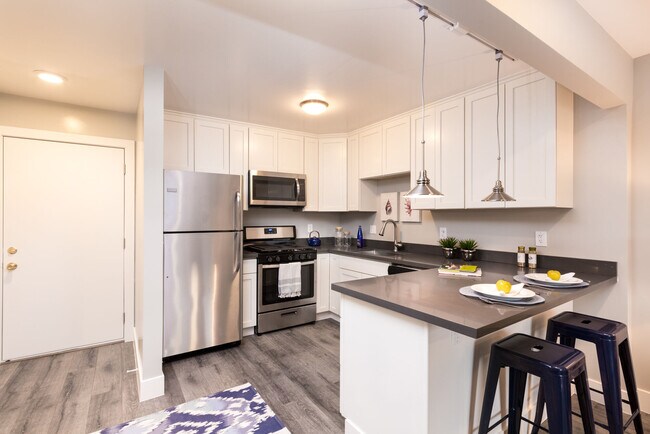
Multifamilydwelling
California
C and X Area of minimal flood hazard, usually depicted on FIRMs as above the 500-year flood level.
15-c
2024
1.53 AC
2025
Jackson Triangle
436602
East Bay/Oakland
41,700 SF
NEARBY LISTINGS FOR SALE OR LEASE
DEMOGRAPHICS near 20 Harder Rd
1 mile
3 mile
5 mile
2025 Total Population
37,772
191,249
365,851
2030 Population
37,777
190,875
364,365
Pop Growth 2025-2030
+ 0.01%
(0.20%)
(0.41%)
Average Age
37
40
41
2025 Total Households
10,850
59,836
115,180
HH Growth 2025-2030
(0.11%)
(0.26%)
(0.51%)
Median Household Inc
$99,205
$107,414
$111,526
Avg Household Size
3.30
3.00
3.10
2025 Avg HH Vehicles
2.00
2.00
2.00
Median Home Value
$764,094
$779,835
$849,418
Median Year Built
1968
1971
1970
Nearby Places
Map Layers
Map Styles
 Street
 Aerial
Layers
 Traffic
 Biking
Places
Listings with unknown addresses are not visible on the map
- Restaurants
- Banks
- Shops
- Fitness
- Groceries
PUBLIC TRANSPORTATION
COMMUTER RAIL
Hayward (Capitol Corridor - Capitol Corridor Joint Powers Authority)
Drive
Walk
Distance
Hayward (Capitol Corridor - Capitol Corridor Joint Powers Authority)
5 min
1.9 mi
Hayward Amtrak (Capitol Corridor - Amtrak)
Drive
Walk
Distance
Hayward Amtrak (Capitol Corridor - Amtrak)
5 min
1.9 mi
AIRPORT
Metro Oakland International
Drive
Walk
Distance
Metro Oakland International
17 min
11.8 mi
San Francisco International
Drive
Walk
Distance
San Francisco International
29 min
22.4 mi
Norman Y Mineta San Jose International
Drive
Walk
Distance
Norman Y Mineta San Jose International
34 min
27.0 mi
Freight Ports
Port of Redwood City
Drive
Walk
Distance
Port of Redwood City
30 min
22.8 mi
SALE & LEASE HISTORY
LISTING DATE
SALE/LEASE

Nov 03, 2023
For Sale
Nearby Properties
Address
Land Use
TOTAL SIZE
Lot Size
Zoning
Address
Land Use
TOTAL SIZE
Lot Size
Zoning
710,091 SF
50.34 AC
Address
Land Use
TOTAL SIZE
Lot Size
Zoning
367,398 SF
21.94 AC
Address
Land Use
TOTAL SIZE
Lot Size
Zoning
4.90 AC
Address
Land Use
TOTAL SIZE
Lot Size
Zoning
6.57 AC
Address
Land Use
TOTAL SIZE
Lot Size
Zoning
240,556 SF
11.63 AC
Address
Land Use
TOTAL SIZE
Lot Size
Zoning
2.48 AC
Address
Land Use
TOTAL SIZE
Lot Size
Zoning
312,244 SF
31.84 AC
Address
Land Use
TOTAL SIZE
Lot Size
Zoning
200,451 SF
11.22 AC
Address
Land Use
TOTAL SIZE
Lot Size
Zoning
236,976 SF
18.36 AC
Address
Land Use
TOTAL SIZE
Lot Size
Zoning
173,948 SF
6.10 AC
Address
Land Use
TOTAL SIZE
Lot Size
Zoning
10.64 AC
Address
Land Use
TOTAL SIZE
Lot Size
Zoning
333,302 SF
13.20 AC
Address
Land Use
TOTAL SIZE
Lot Size
Zoning
175,325 SF
2.91 AC
Address
Land Use
TOTAL SIZE
Lot Size
Zoning
470,929 SF
31.62 AC
Address
Land Use
TOTAL SIZE
Lot Size
Zoning
1.50 AC
Address
Land Use
TOTAL SIZE
Lot Size
Zoning
Address
Land Use
TOTAL SIZE
Lot Size
Zoning
150,856 SF
5.99 AC
Address
Land Use
TOTAL SIZE
Lot Size
Zoning
187,926 SF
1.19 AC
Address
Land Use
TOTAL SIZE
Lot Size
Zoning
300,507 SF
15.52 AC
Address
Land Use
TOTAL SIZE
Lot Size
Zoning
160,987 SF
7.20 AC
Address
Land Use
TOTAL SIZE
Lot Size
Zoning
297,592 SF
11.65 AC
Address
Land Use
TOTAL SIZE
Lot Size
Zoning
228,736 SF
5.95 AC
Address
Land Use
TOTAL SIZE
Lot Size
Zoning
169,371 SF
4.63 AC
Address
Land Use
TOTAL SIZE
Lot Size
Zoning
147,489 SF
9.90 AC
Address
Land Use
TOTAL SIZE
Lot Size
Zoning
146,599 SF
13.72 AC
Address
Land Use
TOTAL SIZE
Lot Size
Zoning
116,485 SF
1.81 AC
Address
Land Use
TOTAL SIZE
Lot Size
Zoning
137,889 SF
18.44 AC
Address
Land Use
TOTAL SIZE
Lot Size
Zoning
116,750 SF
4.72 AC
Address
Land Use
TOTAL SIZE
Lot Size
Zoning
154,113 SF
14.10 AC
Address
Land Use
TOTAL SIZE
Lot Size
Zoning
146,944 SF
4.21 AC
The World's #1 Commercial Real Estate Marketplace
Connect with us
© 2026 CoStar Group
The information above has been obtained from sources believed reliable. While we do not doubt its accuracy we have not verified it and make no guarantee, warranty or representation about it. It is your responsibility to independently confirm its accuracy and completeness. Any projections, opinions, assumptions, or estimates used are for example only and do not represent the current or future performance of the property. The value of this transaction to you depends on tax and other factors which should be evaluated by your tax, financial, and legal advisors. You and your advisors should conduct a careful, independent investigation of the property to determine to your satisfaction the suitability of the property for your needs.