Property Record
20 Lambert St, Staten Island, NY 10314


Save to a Folder
{{folder.Name}}
{{folder.ListingIds.length}} Properties
{{folder.ListingIds.length}} Property
Create a New Folder
Property Detail
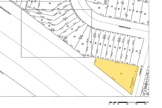
20 Lambert St
01641-0012
Richmond
Apartmenthouse5plusunits
New York
R3-2
12
B and X Area of moderate flood hazard, usually the area between the limits of the 100-year and 500-year floods.
0.34 AC
2025
Graniteville
2026
Long Island (New York)
030301
New York-Jersey City-White Plains, NY-NJ
11,480 SF
NEARBY LISTINGS FOR SALE OR LEASE
DEMOGRAPHICS near 20 Lambert St
1 mile
3 mile
5 mile
2025 Total Population
36,902
192,209
608,405
2030 Population
36,854
192,902
618,089
Pop Growth 2025-2030
(0.13%)
+ 0.36%
+ 1.59%
Average Age
40
40
40
2025 Total Households
12,204
64,774
211,772
HH Growth 2025-2030
(0.13%)
+ 0.43%
+ 1.74%
Median Household Inc
$103,795
$90,829
$84,018
Avg Household Size
2.90
2.90
2.80
2025 Avg HH Vehicles
2.00
1.00
1.00
Median Home Value
$664,583
$683,452
$664,256
Median Year Built
1976
1970
1967
Nearby Places
Map Layers
Map Styles
 Street
 Aerial
Layers
 Traffic
 Biking
Places
Listings with unknown addresses are not visible on the map
- Restaurants
- Banks
- Shops
- Fitness
- Groceries
PUBLIC TRANSPORTATION
COMMUTER RAIL
New Dorp (Staten Island Railway - New York MTA Subway (The Subway))
Drive
Walk
Distance
New Dorp (Staten Island Railway - New York MTA Subway (The Subway))
14 min
5.2 mi
Jefferson Avenue (Staten Island Railway - New York MTA Subway (The Subway))
Drive
Walk
Distance
Jefferson Avenue (Staten Island Railway - New York MTA Subway (The Subway))
15 min
6.2 mi
AIRPORT
Newark Liberty International
Drive
Walk
Distance
Newark Liberty International
19 min
11.4 mi
LaGuardia
Drive
Walk
Distance
LaGuardia
43 min
25.3 mi
John F Kennedy International
Drive
Walk
Distance
John F Kennedy International
46 min
27.7 mi
Freight Ports
New York Container Terminal
Drive
Walk
Distance
New York Container Terminal
4 min
2.0 mi
Nearby Properties
Address
Land Use
TOTAL SIZE
Lot Size
Zoning
Address
Land Use
TOTAL SIZE
Lot Size
Zoning
28.40 AC
Address
Land Use
TOTAL SIZE
Lot Size
Zoning
3,600 SF
731.18 AC
PARK
Address
Land Use
TOTAL SIZE
Lot Size
Zoning
633,280 SF
202.90 AC
R3-2
Address
Land Use
TOTAL SIZE
Lot Size
Zoning
738,600 SF
189.62 AC
R3-2
Address
Land Use
TOTAL SIZE
Lot Size
Zoning
2.21 AC
Address
Land Use
TOTAL SIZE
Lot Size
Zoning
1.01 AC
Address
Land Use
TOTAL SIZE
Lot Size
Zoning
1,258,042 SF
14.47 AC
C4-1
Address
Land Use
TOTAL SIZE
Lot Size
Zoning
91,760 SF
210.43 AC
M3-1
Address
Land Use
TOTAL SIZE
Lot Size
Zoning
Address
Land Use
TOTAL SIZE
Lot Size
Zoning
39.64 AC
Address
Land Use
TOTAL SIZE
Lot Size
Zoning
566,000 SF
103.31 AC
R3-2
Address
Land Use
TOTAL SIZE
Lot Size
Zoning
11.14 AC
Address
Land Use
TOTAL SIZE
Lot Size
Zoning
855,000 SF
48.74 AC
M3-1
Address
Land Use
TOTAL SIZE
Lot Size
Zoning
10 SF
9.18 AC
Address
Land Use
TOTAL SIZE
Lot Size
Zoning
24.19 AC
Address
Land Use
TOTAL SIZE
Lot Size
Zoning
131.25 AC
PARK
Address
Land Use
TOTAL SIZE
Lot Size
Zoning
494,840 SF
34.77 AC
R3-2
Address
Land Use
TOTAL SIZE
Lot Size
Zoning
970,000 SF
55.25 AC
M3-1
Address
Land Use
TOTAL SIZE
Lot Size
Zoning
195,395 SF
12.04 AC
R3-2
Address
Land Use
TOTAL SIZE
Lot Size
Zoning
975,000 SF
58.52 AC
M3-1
Address
Land Use
TOTAL SIZE
Lot Size
Zoning
418,012 SF
6.74 AC
R3-1
Address
Land Use
TOTAL SIZE
Lot Size
Zoning
104.30 AC
PARK
Address
Land Use
TOTAL SIZE
Lot Size
Zoning
111,000 SF
186.03 AC
PARK
Address
Land Use
TOTAL SIZE
Lot Size
Zoning
Address
Land Use
TOTAL SIZE
Lot Size
Zoning
16.30 AC
Address
Land Use
TOTAL SIZE
Lot Size
Zoning
10.76 AC
Address
Land Use
TOTAL SIZE
Lot Size
Zoning
450,000 SF
33.26 AC
M3-1
Address
Land Use
TOTAL SIZE
Lot Size
Zoning
6,188,000 SF
8.18 AC
Address
Land Use
TOTAL SIZE
Lot Size
Zoning
Address
Land Use
TOTAL SIZE
Lot Size
Zoning
1.94 AC
The World's #1 Commercial Real Estate Marketplace
Connect with us
© 2026 CoStar Group
The information above has been obtained from sources believed reliable. While we do not doubt its accuracy we have not verified it and make no guarantee, warranty or representation about it. It is your responsibility to independently confirm its accuracy and completeness. Any projections, opinions, assumptions, or estimates used are for example only and do not represent the current or future performance of the property. The value of this transaction to you depends on tax and other factors which should be evaluated by your tax, financial, and legal advisors. You and your advisors should conduct a careful, independent investigation of the property to determine to your satisfaction the suitability of the property for your needs.