Property Record
20 Lenox Pointe Ne, Atlanta, GA 30324

NEARBY LISTINGS FOR SALE OR LEASE
Property Detail
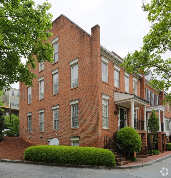
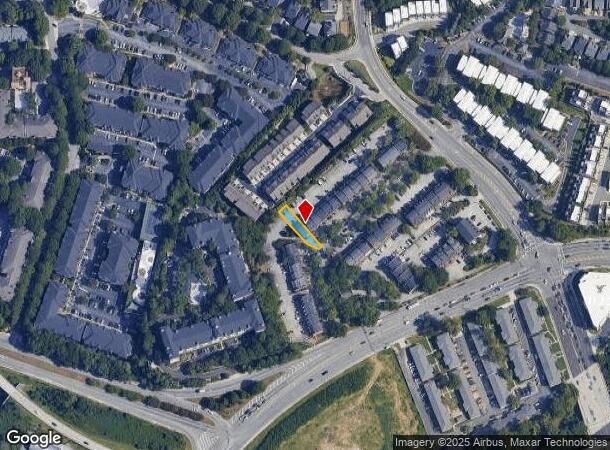
20 Lenox Pointe Ne
Atlanta-Sandy Springs-Roswell, GA
Lenox Pointe
17-0006-0004-018-6
KA LENOX POINTE AN BLDG 20, LEVELS B,1 & 2 SALES VALIDATED 12/11/23; FLD CK REQ FLD CK 2/9/24; ** PARCEL UPDATED
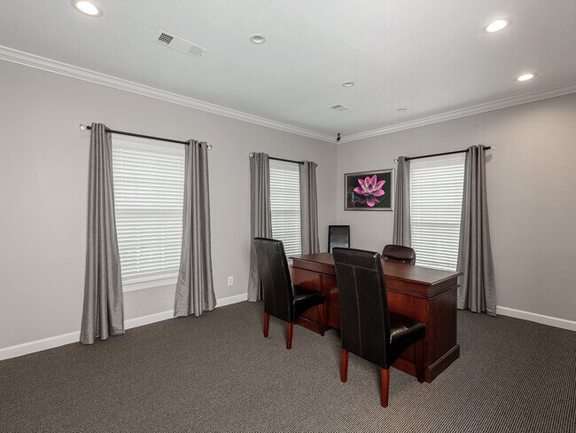
Officecondo
Fulton
X
Georgia
13089C0053K
20
2024
0.08 AC
2025
Upper Buckhead
009407
Atlanta
3,600 SF
DEMOGRAPHICS near 20 Lenox Pointe Ne
1 Mile
3 Mile
5 Mile
2024 Total Population
21,801
156,928
393,925
2029 Population
22,261
160,557
401,857
Pop Growth 2024-2029
+ 2.11%
+ 2.31%
+ 2.01%
Average Age
37
38
37
2024 Total Households
12,083
79,366
191,534
HH Growth 2024-2029
+ 2.21%
+ 2.63%
+ 2.38%
Median Household Inc
$87,550
$98,299
$103,778
Avg Household Size
1.80
1.90
1.90
2024 Avg HH Vehicles
1.00
1.00
1.00
Median Home Value
$513,213
$664,155
$622,333
Median Year Built
1995
1992
1992
Nearby Places
Map Layers
Map Styles
 Street
 Aerial
- Restaurants
- Banks
- Shops
- Fitness
- Groceries
PUBLIC TRANSPORTATION
COMMUTER RAIL
DRIVE
WALK
Distance
6 min
3.2 mi
AIRPORT
Hartsfield - Jackson Atlanta International
DRIVE
WALK
Distance
Hartsfield - Jackson Atlanta International
25 min
16.0 mi
SALE & LEASE HISTORY
LISTING DATE
SALE/LEASE

Mar 17, 2022
For Sale
Nearby Properties
Address
Land Use
TOTAL SIZE
Lot Size
Zoning
Address
Land Use
TOTAL SIZE
Lot Size
Zoning
11,126,925 SF
43.33 AC
C3
Address
Land Use
TOTAL SIZE
Lot Size
Zoning
179.40 AC
R4
Address
Land Use
TOTAL SIZE
Lot Size
Zoning
3,356,268 SF
14.72 AC
C3
Address
Land Use
TOTAL SIZE
Lot Size
Zoning
1,572,131 SF
25.12 AC
RG3
Address
Land Use
TOTAL SIZE
Lot Size
Zoning
2,044,200 SF
9.16 AC
C3
Address
Land Use
TOTAL SIZE
Lot Size
Zoning
903,671 SF
1 AC
C3
Address
Land Use
TOTAL SIZE
Lot Size
Zoning
654,394 SF
2.27 AC
C1C
Address
Land Use
TOTAL SIZE
Lot Size
Zoning
345,125 SF
7.73 AC
C1
Address
Land Use
TOTAL SIZE
Lot Size
Zoning
844,000 SF
2.33 AC
PDMU
Address
Land Use
TOTAL SIZE
Lot Size
Zoning
628,608 SF
0.39 AC
SPI4
Address
Land Use
TOTAL SIZE
Lot Size
Zoning
702,901 SF
3.72 AC
PDOC
Address
Land Use
TOTAL SIZE
Lot Size
Zoning
169,435 SF
76.18 AC
M
Address
Land Use
TOTAL SIZE
Lot Size
Zoning
1,242,520 SF
3.38 AC
PDMU
Address
Land Use
TOTAL SIZE
Lot Size
Zoning
1,233,815 SF
2.18 AC
PDMU
Address
Land Use
TOTAL SIZE
Lot Size
Zoning
687,016 SF
4.21 AC
R4
Address
Land Use
TOTAL SIZE
Lot Size
Zoning
1,021,058 SF
2.89 AC
C3
Address
Land Use
TOTAL SIZE
Lot Size
Zoning
598,962 SF
4.50 AC
PDOC
Address
Land Use
TOTAL SIZE
Lot Size
Zoning
835,636 SF
5.63 AC
PDOC
Address
Land Use
TOTAL SIZE
Lot Size
Zoning
899,673 SF
2.15 AC
PDMU
Address
Land Use
TOTAL SIZE
Lot Size
Zoning
188,648 SF
4.39 AC
X
Address
Land Use
TOTAL SIZE
Lot Size
Zoning
1,006,124 SF
2.97 AC
RG4C
Address
Land Use
TOTAL SIZE
Lot Size
Zoning
658,880 SF
1.52 AC
C4
Address
Land Use
TOTAL SIZE
Lot Size
Zoning
589,761 SF
22.67 AC
RM-HD
Address
Land Use
TOTAL SIZE
Lot Size
Zoning
32.79 AC
R3
Address
Land Use
TOTAL SIZE
Lot Size
Zoning
12.97 AC
C3
Address
Land Use
TOTAL SIZE
Lot Size
Zoning
2,820,296 SF
9.58 AC
RG5
Address
Land Use
TOTAL SIZE
Lot Size
Zoning
458,822 SF
2.86 AC
RG2
Address
Land Use
TOTAL SIZE
Lot Size
Zoning
863,826 SF
3.79 AC
C4
Address
Land Use
TOTAL SIZE
Lot Size
Zoning
1,092,973 SF
4.11 AC
C1C
Address
Land Use
TOTAL SIZE
Lot Size
Zoning
664,442 SF
4.76 AC
RG3
The World's #1 Commercial Real Estate Marketplace
Connect with us
© 2025 CoStar Group
The information above has been obtained from sources believed reliable. While we do not doubt its accuracy we have not verified it and make no guarantee, warranty or representation about it. It is your responsibility to independently confirm its accuracy and completeness. Any projections, opinions, assumptions, or estimates used are for example only and do not represent the current or future performance of the property. The value of this transaction to you depends on tax and other factors which should be evaluated by your tax, financial, and legal advisors. You and your advisors should conduct a careful, independent investigation of the property to determine to your satisfaction the suitability of the property for your needs.