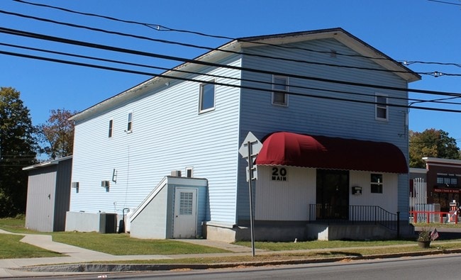
Property Record
20 Main St, Camden, NY 13316

Property Detail
20 Main St
147-005-0002-016-000-0000
N ATLANTIC R E M ST S CRIST W FISH CR
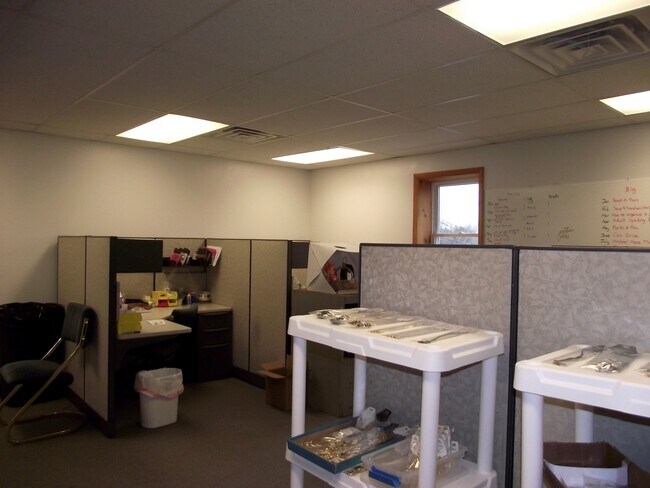
Professionalbldglegalinsurancerealestateetc
Oneida
01 - NOT Z
New York
AE The base floodplain where base flood elevations are provided. AE Zones are now used on new format FIRMs instead of A1-A30 Zones.
16.000
2025
0.67 AC
2025
Outlying Oneida County
024500
Utica/Rome
7,664 SF
Utica-Rome, NY
NEARBY LISTINGS FOR SALE OR LEASE
DEMOGRAPHICS near 20 Main St
1 mile
3 mile
5 mile
2025 Total Population
2,197
3,687
5,631
2030 Population
2,166
3,653
5,625
Pop Growth 2025-2030
(1.41%)
(0.92%)
(0.11%)
Average Age
41
43
43
2025 Total Households
915
1,514
2,236
HH Growth 2025-2030
(1.53%)
(0.99%)
(0.22%)
Median Household Inc
$62,024
$61,265
$62,321
Avg Household Size
2.30
2.40
2.40
2025 Avg HH Vehicles
2.00
2.00
2.00
Median Home Value
$180,310
$195,372
$182,474
Median Year Built
1947
1949
1957
Nearby Places
Map Layers
Map Styles
 Street
 Aerial
Layers
 Traffic
 Biking
Places
Listings with unknown addresses are not visible on the map
- Restaurants
- Banks
- Shops
- Fitness
- Groceries
PUBLIC TRANSPORTATION
AIRPORT
Syracuse Hancock International
Drive
Walk
Distance
Syracuse Hancock International
60 min
42.8 mi
SALE & LEASE HISTORY
LISTING DATE
SALE/LEASE

Sep 24, 2016
For Sale
Jan 27, 2017
For Sale
Dec 20, 2019
For Sale
Nearby Properties
Address
Land Use
TOTAL SIZE
Lot Size
Zoning
Address
Land Use
TOTAL SIZE
Lot Size
Zoning
98,254 SF
27.30 AC
01 - NOT Z
Address
Land Use
TOTAL SIZE
Lot Size
Zoning
73,938 SF
26.60 AC
01 - NOT Z
Address
Land Use
TOTAL SIZE
Lot Size
Zoning
67,247 SF
11.50 AC
01 - NOT Z
Address
Land Use
TOTAL SIZE
Lot Size
Zoning
1,968 SF
5.64 AC
RR3
Address
Land Use
TOTAL SIZE
Lot Size
Zoning
Address
Land Use
TOTAL SIZE
Lot Size
Zoning
32,459 SF
4.30 AC
01 - NOT Z
Address
Land Use
TOTAL SIZE
Lot Size
Zoning
316,724 SF
22.90 AC
01 - NOT Z
Address
Land Use
TOTAL SIZE
Lot Size
Zoning
Address
Land Use
TOTAL SIZE
Lot Size
Zoning
147,880 SF
4.74 AC
01 - NOT Z
Address
Land Use
TOTAL SIZE
Lot Size
Zoning
28 AC
01 - NOT Z
Address
Land Use
TOTAL SIZE
Lot Size
Zoning
80 AC
01 - NOT Z
Address
Land Use
TOTAL SIZE
Lot Size
Zoning
11,284 SF
7.80 AC
01 - NOT Z
Address
Land Use
TOTAL SIZE
Lot Size
Zoning
1,568 SF
1.55 AC
01 - NOT Z
Address
Land Use
TOTAL SIZE
Lot Size
Zoning
9,430 SF
1.40 AC
01 - NOT Z
Address
Land Use
TOTAL SIZE
Lot Size
Zoning
32,682 SF
11.89 AC
01 - NOT Z
Address
Land Use
TOTAL SIZE
Lot Size
Zoning
12 AC
01 - NOT Z
Address
Land Use
TOTAL SIZE
Lot Size
Zoning
Address
Land Use
TOTAL SIZE
Lot Size
Zoning
17,960 SF
1.70 AC
01 - NOT Z
Address
Land Use
TOTAL SIZE
Lot Size
Zoning
0.75 AC
01 - NOT Z
Address
Land Use
TOTAL SIZE
Lot Size
Zoning
71.70 AC
RR3
Address
Land Use
TOTAL SIZE
Lot Size
Zoning
1,920 SF
0.13 AC
Address
Land Use
TOTAL SIZE
Lot Size
Zoning
99.90 AC
RR3
Address
Land Use
TOTAL SIZE
Lot Size
Zoning
1,720 SF
5.23 AC
01 - NOT Z
Address
Land Use
TOTAL SIZE
Lot Size
Zoning
67.80 AC
RR3
Address
Land Use
TOTAL SIZE
Lot Size
Zoning
33.10 AC
RR3
Address
Land Use
TOTAL SIZE
Lot Size
Zoning
Address
Land Use
TOTAL SIZE
Lot Size
Zoning
4,187 SF
1.84 AC
01 - NOT Z
Address
Land Use
TOTAL SIZE
Lot Size
Zoning
36,000 SF
4.30 AC
01 - NOT Z
Address
Land Use
TOTAL SIZE
Lot Size
Zoning
29.60 AC
Address
Land Use
TOTAL SIZE
Lot Size
Zoning
15,435 SF
1.60 AC
01 - NOT Z
The World's #1 Commercial Real Estate Marketplace
Connect with us
© 2026 CoStar Group
The information above has been obtained from sources believed reliable. While we do not doubt its accuracy we have not verified it and make no guarantee, warranty or representation about it. It is your responsibility to independently confirm its accuracy and completeness. Any projections, opinions, assumptions, or estimates used are for example only and do not represent the current or future performance of the property. The value of this transaction to you depends on tax and other factors which should be evaluated by your tax, financial, and legal advisors. You and your advisors should conduct a careful, independent investigation of the property to determine to your satisfaction the suitability of the property for your needs.